EDITING
EDITING. How to make your own!. Manuscript Maps. Paper maps drawn by a cartographer Generalization is a problem Scale is the key to map accuracy 1/24,000 scale accuracy is ± ~40’ (.0076 mile) 1/50,000 scale accuracy is ± ~80’ (.015 mile) 1/100k scale accuracy is ± ~160’ (.03 mile)

EDITING
E N D
Presentation Transcript
EDITING How to make your own!
Manuscript Maps • Paper maps drawn by a cartographer • Generalization is a problem • Scale is the key to map accuracy • 1/24,000 scale accuracy is ± ~40’ (.0076 mile) • 1/50,000 scale accuracy is ± ~80’ (.015 mile) • 1/100k scale accuracy is ± ~160’ (.03 mile) • 1/500k scale accuracy is ± ~800’ (.34 mile) • 1/1,000,000 scale is ~ ± 160,000’ (30 miles) esf Laboratory for Applied GIS
The generalized stream is not as accurate a representation of the stream as the original And if you try to mix data of different scale common lines are NOT going to match Original Generalized Accuracy & Generalization Error! esf Laboratory for Applied GIS
Green is County boundary Yellow is soils layer (NRCS) This is called the “Coincident Line” problem Orthophoto background esf Laboratory for Applied GIS
Errors • From manuscript maps you have data drawn at different scales with different levels of generalization • From digital data you have differences due to the ways the data was produced and • they are just different (could be scale) esf Laboratory for Applied GIS
So • Use the metadata to determine, if possible, how the data was created • and what the scale of the original manuscript map was if it was generated that way • And what the accuracy of the orthophoto was if the vector data was created by heads up digitizing esf Laboratory for Applied GIS
Shape files FC Coverages ArcINFO format PC ArcInfo format Rasters of various kinds TINs (Triangulated Irregular Networks) Networks Can edit Can edit Cannot edit in ArcMap Can’t even open in ArcMap* nope Yup Yup File types * Open in ArcView 3.3 & save as a shapefile esf Laboratory for Applied GIS
Creating empty Shapefiles & FCs Been there, done that! esf Laboratory for Applied GIS
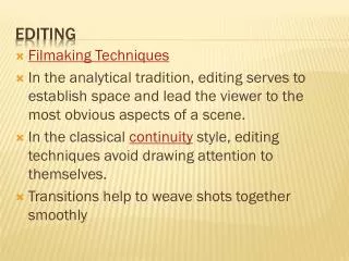
Editing esf Laboratory for Applied GIS
Editing Steps • Load only the data needed for editing into ArcMap • Click on the “Selection” tab at the bottom of the TOC (demo) • Make sure only the layer to be edited is selected • This gets around the Booby Trap of having the wrong layer in the Target window! D esf Laboratory for Applied GIS
Set Snapping • Snapping environment • Select “snapping” from Edit dropdown • Priority of snappingis the order of thelayers (drag ‘em’). • In this case the mills will be snapped to the road’s edges. • Set snapping Tolerance (how close for jump) • Edit/options D esf Laboratory for Applied GIS
Setting Snapping Stuff Pixels or map units No, No, No Distance between vertices Number of vertices to be deleted when you screw up – and you will when using stream mode! Tip says what you are snapped to esf Laboratory for Applied GIS
Tricks • Snap poly corner to the corner of another poly… • Move poly’s selection anchor… what? • In edit mode when a poly is selected a “X” wil appear in the center of the poly • That’s the selection anchor • Drag it to the corner you want to snap from • Move the poly towards its new location until it snaps. esf Laboratory for Applied GIS
Snapping tricks • Press “T” will show you what the current snapping tolerance is… • If you need to change the snapping tolerance often then load the interactive snap tolerance toll to any tool bar • Rt clk blank spot on menu bar, scroll down to the bottome of the list that appears and click cutomize. Click the Command tab and then Edit and scroll down to the tool • Drag it to any tool bar (Edit, perhaps) • Clicking on the tool allows you to draw a circle that is the snapping tolerance you need. D esf Laboratory for Applied GIS
Sketch Construction Tools: Sketch tool Use the Sketch tool to create point features and digitize the vertices of line or polygon features. After you finish the sketch, ArcMap adds the final segment, and the sketch turns into a feature. esf Laboratory for Applied GIS
Sketch Construction Tools: ArcTool The Arc tool helps you create a segment that is a parametric (true) curve. Instead of being made of numerous vertices, a parametric curve has only two vertices as endpoints. esf Laboratory for Applied GIS
Sketch Construction Tools - midpoint The Midpoint tool lets you define the location of the next vertex by clicking two points; the new vertex is placed at the midpoint of the line between these points. esf Laboratory for Applied GIS
Midpoint tool? D esf Laboratory for Applied GIS
Sketch Construction Tools The Trace tool helps you create segments that Follow along parallel to an existing segment. esf Laboratory for Applied GIS
Traces along an existing line features (instead of typing the angle and length of each segment.) select the parcel features before you can start tracing the road casing feature. The Trace tool only follows selected features. Trace tool D esf Laboratory for Applied GIS
These 2vertices put in automatically Autocomplete • Another very handy trick for creating polygons. • Set the task to autocomplete (under topology tasks) #3 #2 Dbl click #1 esf Laboratory for Applied GIS
Streaming • As you move the cursor along a path vertices are placed at the “stream tolerance” you have specified. • Good for things like meandering streams • But is tricky – don’t sneeze! • Turned on and off by right click on the sketch tool click “streaming” or press F8. esf Laboratory for Applied GIS
Split Poly Tool • Use the “Cut Polygon Features” task • Why • Makes a perfect match between polys when Split – every time and… • Select poly to split with the Edit Tool • Use pencil tool to draw a line through the poly where you want it split • Rt click anywhere to finish the job D esf Laboratory for Applied GIS
Advanced editing • This is just the tip of the editing abilities. • The advanced tools let you do things like… • Extend a line to touch another line • Traverse tool – use COGO data to add to the edit sketch • Explode tool – Splits a multipart feature into its component features • Circle tool – draws a circle • Rectangle tool – guess what • Trim tool – trims dangles esf Laboratory for Applied GIS
Tricks • Use arrow keys to pan while editing esf Laboratory for Applied GIS