Download
1 / 17
170 likes | 366 Views
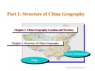
Part 1: Structure of China Geography. Chapter 1. China Geography Location and Territory. Chapter 2. Structure of China Geography. Remote Sensing Image. Map. Understanding Process—. Chapter 2.Structure of China Geography. Understanding Process. Understanding Process —Flow Chart.

E N D
Part 1: Structure of China Geography Chapter 1. China Geography Location and Territory Chapter 2. Structure of China Geography Remote Sensing Image Map Understanding Process—
Chapter 2.Structure of China Geography Understanding Process Understanding Process—Flow Chart
Part 1—Structure of China Geography (Foundation) Part 1 China Geography Location and Territory Homework 1 Latitude and Longitude Coordinates Chinese Landscape Optical Models China in the world Map Network GovernanceArea Network Part 2 Structure of China Geography CAI Homework 2 Geography Structure of Three Zones Geography Structure Basis Physiognomy Physiognomy Structure Upheaval of Tibetan Plateau Hydro – Thermal Structure Differentiate of Three Natural Zones Map Differentia Climate Population Distribution Pattern Land Cover Physical Structure Human Activity Geography Landscape Pattern Water System Structure Vegetation Soil Structure Transportation Pattern Land Use Structure of Big Agriculture Urban Cluster(Industrial Structure) Hu Population Line Biology Structure Population Density,Agriculture,Politics,Industrialization and Urbanilization Field Investigation RS Landscape Optical Models of China Typical Regions 章结构—
Chapter 2. Structure of China Geography 1.Basis of Chinese Geographic Pattern 2.Uplift of Tibetan Plateau and Chinese Climate Disparity 3.Chinese Population Density Distribution and Hu Huanyong Population Line 4.Chinese Land Use and Cover Change Teaching Material Structure—
1. Basis of Chinese Geographic Pattern ——Geomorphologic Structure 1.1 Chinese Macro Geomorphologic Structure 1.2 Formation of Chinese Macro Geomorphologic Structure 1.3 Chinese Geomorphologic Material and Regional Differences of Climatic Geomorphology (CAI disk)
1.1 Chinese Macro Geomorphologic Structure Macro Geomorphologic Structure: Normal landforms taking the internal agency mainly, the up and down in the vertical direction and configuration combinations in the horizontal direction. • (1) Hypsography Pattern • Basic Features:East-low and West-high, a ladder- shaped distribution;high hypsography, great highness; big surface gurgitation; the geographic significance of hypsography (CAI disk)
(2) Combination Structure of Relief Forms Quantity Structure of Relief Types Mountainous Regions Constructing Relief Framework Plains and Lowland Concentrated in the Eastern China Major Axis Direction of Basin Nearly East-west
1.2 Formation of Chinese Macro Geomorphologic Structure ——Explanation of Plate Theory Justify: Theory of Land Circle Mechanism
(1) Basic Points of Plate Theory A Resource Mechanism of Crustal Movement Hot mantle convection, driving the movement of lithosphere plates Various stresses engendered by Plate Crustal movement was in the horizontal direction A B C D Special Phenomenon(Evidence) Special Materials:ophiolite and mixed accumulation Special Relief:Boundary is mountainous region and valley B
Split C Hai-gou Subduction Four Kinds of Contacting Relationship of Plates Transform Fault Terra Seam Type
D Understanding of Chinese Plates Relationship American Plate Eurasian Plate Three Plates and Movement Direction Eurasian plate sliding southward Terra Seam TypeIndia plate sliding north Hai-gou Subduction Pacific plate down to northwest African plate Pacific Plate India Plate Western is Eurasian and India plates impacting zone Impacting zoneEastern is Eurasian and Pacific plates impacting zone Central is the three plates compound affected districts
(2) Explanation of Big Relief Type and Stretching Direction Mountain-Valley to Contact with Plate for Geotectonic Activities Belt Evidence:Ophiolite and mixed accumulation in diving belt Asymmetry of Mountain slope (majority) Eastern Mountain : East slope steep, West slope soft Western Mountain : South slope soft, North slope steep Plateau, Basins, Plains are in Plate, Construction Stable Regions Four Axes of Mountainous Regions Pattern:North-east, North- west,East-west, South-north Two Geotectonic Areas(Boundary: Helan Line)
(3) Explanation of Big Relief Spatial-temporal Change Horizontal Direction East:island-arc and back-arc basin land wave—upheaval and sedimentation belts West:accordion Land Wave—Mountainous regions and Basin and Altiplano( terra seam type) Vertical Direction Block and block cracked,producing highest hypsography (Tibetan Plateau ) Considerations of the impact of external agency:The latest collision region has the relatively highest topography Eastern : Taiwan mountains; Western : Himalaya Mountains
Siberian Plate Tarim Sino-Korean plate Yangze Plate India Plate Plate Boundary Temporal Change Eastern Region—west early and east late Western Region—north early and south late Subduction Belt Cenozoic Eopaleozoic Late Mesozoic Proterozoic Archean-Eoproterozoic Eomesozoic Late Paleozoic
1.3 Regional Difference of Chinese Relief Material and Climate Geomorphology Relief Material Relief Material Regionalization of China Red Rock Sequence Red Weathering Crust Red Layer Marine Sediment Limestone Carbonate Karst Landform Loose sediment of quaternary period Sandy Material Loess Material Red Bed Landform Volcanic Rock Volcanic Landform Loose Sediment Blank is other lithology
GeomorphologicExternal Agency and Climate Geomorphology 400mm of Precipitation Line 0°C Isotherm Critical Value of Wind of Raising Sand Glacier Landform Loess Landform Sandstorm Landform Karst Landform (CAI Disk)