Understanding GIS: Terminology, File Formats, and Data Structures
190 likes | 310 Views
This entry introduces Geographic Information Systems (GIS), covering fundamental concepts and terminology, including the differences between shapefiles, grids, vector, and raster data. It explains digital elevation models (DEM) and triangulated irregular networks (TIN), highlighting their applications in representing terrain. Additionally, it covers coordinate systems and their classifications, essential for spatial data analysis. Whether you're a beginner or looking to refresh your knowledge, this overview provides a foundational understanding of GIS components and file formats crucial for geographic analysis.

Understanding GIS: Terminology, File Formats, and Data Structures
E N D
Presentation Transcript
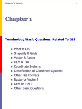
Chapter 1 Terminology/Basic Questions Related To GIS • What is GIS • Shapefile & Grids • Vector & Raster • DEM & TIN • Coordinate Systems • Classification of Coordinate Systems • Other File Formats • Raster or Vector ? • DEM or TIN ? • Other Basic Questions
1.1.What is GIS ? S H A P E F I L E File formats G R I D F I L E Layers representing specific informations GIS : A geographic information system (GIS), also known as a geographical information system, is an information system for capturing, storing, analyzing, managing and presenting data which are spatially referenced (linked to location).
1.2.Shape file & Grids Coverage : In geographic information systems, a coverage is a mapping of one aspect of data in space. It represents a "domain" (the universe of extent) in terms of characteristics expressing a range of values. Aerial photography, land cover data, and digital elevation models are all considered coverage data. Below are two types of coverage which are used in GIS for representation of informations. Shapefile : A "shapefile" is commonly refers to a collection of files with ".shp", ".shx", ".dbf", and other extensions on a common prefix name (e.g., "lakes.*"). The actual shapefile relates specifically to files with the ".shp" extension, however this file alone is incomplete for distribution, as the other supporting files are required. Shapefiles spatially describe geometries: points, polylines, and polygons. These, for example, could represent water wells, rivers, and lakes, respectively. Each item may also have attributes that describe the items, such as the name or temperature. Grids : In cartography, any network of parallel and perpendicular lines superimposed on a map and used for reference is collectively called as grid. These grids are usually referred to by the map projection or coordinate system they represent.
1.3.DEM & TIN DEM : A digital elevation model (DEM) is a digital representation of ground surface topography or terrain. It is also widely known as a digital terrain model (DTM). A DEM can be represented as a raster (a grid of squares) or as a triangular irregular network. DEMs are commonly built using remote sensing techniques, however, they may also be built from land surveying TIN : A triangulated irregular network (TIN) is a digital data structure used in a geographic information system (GIS) for the representation of a surface. A TIN is a vector based representation of the physical land surface or sea bottom, made up of irregularly distributed nodes and lines with three dimensional coordinates (x,y, and z) that are arranged in a network of non-overlapping triangles. TINs are often derived from the elevation data of a rasterized digital elevation model (DEM). An advantage of using a TIN over a DEM in mapping and analysis is that the points of a TIN are distributed variably based on an algorithm that determines which points are most necessary to an accurate representation of the terrain. Data input is therefore flexible and fewer points need to be stored than in a DEM with regularly distributed points. While a TIN may be less suited than a DEM raster for certain kinds of GIS applications, such as analysis of a surface's slope and aspect, but it have the advantage of being able to portray terrain in three dimensions. Three-dimensional visualizations are readily created by rendering of the triangular facets. In regions where there is little variation in surface height, the points may be widely spaced whereas in areas of more intense variation in height the point density is increased.
1.4.Vector & Raster VECTOR : In a GIS, geographical features are often expressed as vectors, by considering those features as geometrical shapes. RASTER : A raster data type is, in essence, any type of digital image. Anyone who is familiar with digital photography will recognize the pixel as the smallest individual unit of an image. A combination of these pixels will create an image, distinct from the commonly used scalable vector graphics which are the basis of the vector model. While a digital image is concerned with the output as representation of reality, in a photograph or art transferred to computer, the raster data type will reflect an abstraction of reality. Raster data type consists of rows and columns of cells, with each cell storing a single value. Raster data can be images (raster images) with each pixel (or cell) containing a color value. Additional values recorded for each cell may be a discrete value, such as land use, a continuous value, such as temperature, or a null value if no data is available. Vector Raster A Vector Image Comparison A Raster Image
1.5.Coordinate System 1.5.1.GEOGRAPHIC COORDINATE SYSTEM Map information in a GIS must be manipulated so that it registers, or fits, with information gathered from other maps. Before the digital data can be analyzed, they must undergone manipulations like projection and coordinate conversions that in turn will integrate them into a GIS. The earth can be represented by various models, (collectively known as Geographic Coordinate System), each of which may provide a different set of coordinates (e.g., latitude, longitude, elevation) for any given point on the earth's surface. The simplest model is to assume the earth as a perfect sphere. Projection is a fundamental component of map making. A projection is a mathematical means of transferring information from a model of the Earth, which represents a three-dimensional curved surface, to a two-dimensional medium—paper or a computer screen. Different projections are used for different types of maps because each projection particularly suits certain uses. For example, a projection that accurately represents the shapes of the continents will distort their relative sizes. Since much of the information in a GIS comes from existing maps, a GIS uses the processing power of the computer to transform digital information, gathered from sources with different projections and/or different coordinate systems, to a common projection and coordinate system. For images, this process is called rectification.
1.5.Coordinate System 1.5.2.PROJECTED COORDINATE SYSTEM A projected coordinate system is a flat, two-dimensional representation of the Earth. It is based on a sphere or spheroid geographic coordinate system, but it uses linear units of measure for coordinates, so that calculations of distance and area are easily done in terms of those same units. The latitude and longitude coordinates are converted to x, y coordinates on the flat projection. The x coordinate is usually the eastward direction of a point, and the y coordinate is usually the northward direction of a point. The center line that runs east and west is referred to as the x axis, and the center line that runs north and south is referred to as the y axis. The intersection of the x and y axes is the origin and usually has a coordinate of (0,0). The values above the x axis are positive, and the values below the x axis are negative. The lines parallel to the x axis are equidistant from each other. The values to the right of the y axis are positive, and the values to the left of the y axis are negative. The lines parallel to the y axis are equidistant. Mathematical formulas are used to convert a three-dimensional geographic coordinate system to a two-dimensional flat projected coordinate system. The transformation is referred to as a map projection. Map projections usually are classified by the projection surface used, such as conic, cylindrical, and planar surfaces. Depending on the projection used, different spatial properties will appear distorted. Projections are designed to minimize the distortion of one or two of the data's characteristics, yet the distance, area, shape, direction, or a combination of these properties might not be accurate representations of the data that is being modeled. There are several types of projections available. While most map projections attempt to preserve some accuracy of the spatial properties, there are others that attempt to minimize overall distortion instead, such as the Robinson projection. The most common types of map projections include: (SeePage 12)
1.7.Other File Formats GPX : The Global Positioning System (GPS) is a satellite-based navigation system made up of a network of 24 satellites placed into orbit by the U.S. Department of Defense. GPS was originally intended for military applications, but in the 1980s, the government made the system available for civilian use. GPS works in any weather conditions, anywhere in the world, 24 hours a day. There are no subscription fees or setup charges to use GPS. GPS satellites circle the earth twice a day in a very precise orbit and transmit signal information to earth. GPS receivers take this information and use triangulation to calculate the user's exact location. Essentially, the GPS receiver compares the time a signal was transmitted by a satellite with the time it was received. The time difference tells the GPS receiver how far away the satellite is. Now, with distance measurements from a few more satellites, the receiver can determine the user's position and display it on the unit's electronic map. GPS readings can be retrieved as GPX file. .shp — shape format; the feature geometry itself .shx — shape index format; a positional index of the feature geometry to allow seeking forwards and backwards quickly .dbf — attribute format; columnar attributes for each shape, in dBase III format In each of the .shp, .shx, and .dbf files, the shapes in each file correspond to each other in sequence. That is, the first record in the .shp file corresponds to the first record in the .shx and .dbf files, and so on. Geodatabase:A geo-database represents geographic features and attributes that are stored inside a Relational Database Management System (RDMS). There are two types of geodatabases - Personal and Enterprise. The personal geodatabase in fact is in the format of Microsoft ACCESS (.mdb); Enterprise geodatabases are hosted in server-based DBMS such as SQL Server, Oracle, or IBM DB2. KML : KML is a file format used to display geographic data in an Earth browser, such as Google Earth, Google Maps, and Google Maps for mobile. KML uses a tag-based structure with nested elements and attributes and is based on the XML standard.
1.8.RASTER or VECTOR ? • Raster data sets record a value for all points in the area covered which may require more storage space than representing data in a vector format that can store data only where needed. • Raster data also allows easy implementation of overlay operations, which are more difficult with vector data. • Vector data can be displayed as vector graphics used on traditional maps, whereas raster data will appear as an image that, depending on the resolution of the raster file, may have a blocky appearance for object boundaries. • Vector data can be easier to register, scale, and re-project. This can simplify combining vector layers from different sources. Vector data are more compatible with relational database environment. They can be part of a relational table as a normal column and processes using a multitude of operators. • The file size for vector data is usually much smaller for storage and sharing than raster data. Image or raster data can be 10 to 100 times larger than vector data depending on the resolution. • Another advantage of vector data is it can be easily updated and maintained. For example, a new highway is added. The raster image will have to be completely reproduced, but the vector data, "roads," can be easily updated by adding the missing road segment. Same differences remain when you compare shapefile with gridfiles. Remember, shape file is a vector and grid file is a raster. My Tip :Use vector data for representing cities, rivers, villages, forest etc. where precision is important and when precision is not important use raster ( example :classification, contours, bathymetry maps etc.)
1.9.DEM or TIN ? A triangulated irregular network (TIN) is a digital data structure used in a geographic information system (GIS) for the representation of a surface. A TIN is a vector based representation of the physical land surface or sea bottom, made up of irregularly distributed nodes and lines with three dimensional coordinates (x,y, and z) that are arranged in a network of nonoverlapping triangles. A digital elevation model (DEM) is a digital representation of ground surface topography or terrain. It is also widely known as a digital terrain model (DTM). A DEM can be represented as a raster (a grid of squares) or as a triangular irregular network. DEMs are commonly built using remote sensing techniques, however, they may also be built from land surveying. TINs are often derived from the elevation data of a rasterized digital elevation model (DEM). TIN are distributed variably based on an algorithm that determines which points are most necessary to an accurate representation of the terrain and hence they are light. DEM are distributed regularly and hence they are heavy DEM are more suitable than TIN for analysis of a surface’s slope and aspect. TINs are suitable in portraying terrain in three dimensions. My Tip :To represent elevation use DEM and to represent Surface Topography (terrains) use TIN
1.10.Other Basic Questions 1.What is the importance of having a GIS? GIS is the resource for gathering and presenting information on geographical data, such as natural resources, bodies of water, roads, etc., in order to benefit the planning and development of cities, counties, industries, and various government entities. GIS can benefit business industry and economy by aiding employers in finding the perfect geographical location for their company or industry, thus bringing new jobs to that area and to the state. GIS can also assist emergency management teams in locating correct addresses, as well as determining how many residential structures are within a fire district. The possibilities of GIS are endless. Source : Learon Dalby &Richard Chaney ‘s Article Published in http://www.gis.state.ar.us
1.10.Basic Questions 2.What is the difference between GIS and a map ? "GIS is the application that compares the tabular data and illustrates the spatial relationships. It allows for selective analysis and informed decisions. The end results of the various analyses are usually illustrated as 'maps.' However, the layman mistakes GIS as simply mapmaking." "A map is generally static and might be thought of as a cartographic output. Once created, the map does not provide any additional information. Conversely, GIS is an integrated system that enables a user to ask numerous questions of a database and visualize the answers." 3.What are some non-map generation uses of GIS ? "GIS can be used to create charts and graphs of databases to verify the quality of the database. These processes can also be performed in standard spreadsheet packages. Ordinarily, GIS is used to map the database so one can visualize the location of events. Generally speaking, answers acquired from map analysis performed in a GIS could be concluded through standard database queries. However, the answers may not be as easy to interpret."
1.10.1.Data Formats 4.What is a geoTIFF? "The geoTIFF file format embeds image registration information directly into the raster file. GeoTIFF is an industry-neutral raster file format widely used and recognized by all of the major GIS software vendors.“ 5.What is datum? "A datum is a mathematical model used to determine overall height of continental land masses like North America. A common datum is the North American Datum of 1983, more commonly known as NAD83." 6.Give examples of Raster files ? Arc Digitized Raster Graphics (ADRG). Band Interleaved by Line (BIL) Digital Elevation Model (DEM). PC Paintbrush Exchange (PCX). Spatial Data Transfer Standard (SDTS). Tagged Image File Format (TIFF). Source : http://data.geocomm.com
1.10.1.Data Formats 7.What is Arc Digitized Raster Graphics (ADRG) ? ADRG is a format used by the US military to store raster images of paper maps. 8.What is Band Interleaved by Line (BIL) ? Band Interleaved by Pixel (BIP), and Band Sequential (BSQ). BIL, BIP, and BSQ are formats produced by remote-sensing systems. The primary difference among them is the technique used to store brightness values captured simultaneously in each of several colors or spectral bands. 9.What is Digital Elevation Model (DEM) ? DEM is a raster format used by the USGS to record elevation information. Unlike other raster file formats, DEM cells do not represent color brightness values, but rather the elevations of points on the earth’s surface. 10.What is PC Paintbrush Exchange (PCX) ? PCX is a common raster format produced by most scanners and personal computer (PC) drawing programs.
1.10.1.Data Formats 11.What is Spatial Data Transfer Standard (SDTS) ? SDTS is a general-purpose format designed to transfer geographic information. One SDTS variant is the raster profile, designed as a standard format for transferring raster data. However, this protocol has not as yet been finalized. 12.What is Tagged Image File Format (TIFF) ? Like PCX, TIFF is a common raster format produced by PC drawing programs and scanners. 13.Give examples of Vector files ? ARC/INFO Coverages Autodesk’s Data Interchange File (DXF) AutoCAD" Drawing Files (DWG) PC Digital Line Graphs (DLG) Spatial Data Transfer System (SDTS) Topologically Integrated Geographic Encoding and Referencing Files (TIGER). Vector Product Format (VPF)
1.10.1.Data Formats 14.What is ARC/INFO Coverage ? An ARC/INFO "coverage" is a set of internal binary files used by ARC/INFO, a GIS program. This file format is proprietary and not readily usable by other programs. 15.What is Autodesk’s Data Interchange File (DXF) Format ? DXF is probably the most widely used vector data transfer format, and a file in DXF format offers some very strong advantages. It contains very complete display information, and almost every graphics program can read it. However, there are several different ways to store attribute information in DXF and to link DXF entities to external attributes. Because there are no attribute standards, many programs that claim to read DXF files still do not import attribute information properly. 16.What is AutoCAD" Drawing Files (DWG) ? DWG is the internal, proprietary format used in AutoCAD® software, which is a computer-aided design/drafting (CAD) program. Despite its proprietary nature, AutoCAD can convert any DWG file to a DXF file (described below) without loss of graphic information. As with DXF files, there are a number of ways to store attribute information in DWG files. The emerging standard is one that uses Extended Entity Data (EED) to link attributes, but many others are possible. However, the lack of one standard for linking attributes can cause problems when data is transferred between systems.
1.10.1.Data Formats 17.What is Digital Line Graphs (DLG) ? DLG, a transfer format used by the US Geological Survey (USGS), depicts vector information portrayed on printed paper maps. It carries very accurate coordinate information and sophisticated feature-classification information but no other attribute data. The DLG standard is significant because the USGS and other US government agencies have used it to publish large numbers of digital maps. 18.What is Spatial Data Transfer System (SDTS) ? SDTS, a new transfer format developed by the US government, was designed to handle all types of geographic data. SDTS can be either binary or ASCII but is generally binary. Virtually all geographic concepts can be encoded in SDTS, including coordinate information, complex attribute information, and display information. This versatility causes a corresponding increase in complexity. To simplify things, several standard subsets of SDTS have been adopted. The first of these, the Topological Vector Profile (TVP), is used to store certain types of vector maps. SDTS can also be used for raster information. Not much data is available in SDTS format at this time, nor do many software systems support it.
1.10.1.Data Formats 19.What is Topologically Integrated Geographic Encoding and Referencing Files (TIGER) ? TIGER is an ASCII transfer format used by the US Census Bureau to store the street maps constructed for the 1990 census. It contains complete geographic coordinates and is line, not polygon, based (although polygons can be constructed from its attribute information). The most important attributes include street name and address information. TIGER does not contain display information. Maps of the entire US are available in TIGER format. 20.What is Vector Product Format (VPF) ? VPF is a binary format used by the US Defense Mapping Agency. It is well documented and can be used as an internal format and as a transfer format. It carries geographic and attribute information but no display data. VPF files are sometimes referred to as VMAP products. The Digital Chart of the World (DCW) is published in this format.