Download
1 / 33
340 likes | 448 Views
Explore the variables and factors affecting climate including temperature, altitude, water bodies, and winds. Learn about ocean currents, mountain barriers, and the orographic effect on climate patterns. Discover how latitude and elevation influence weather conditions over time.

E N D
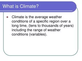
What is Climate? • Climate is the average weather conditions of a specific region over a long time, (tens to thousands of years) including the range of weather conditions (variables).
1) Temperature 2) Air Pressure 3) Humidity (moisture content) 4) Wind 5) Cloud Cover 6) Precipitation 7) Storms What are the Variables of Weather?
Climate is Based on • The Water Cycle
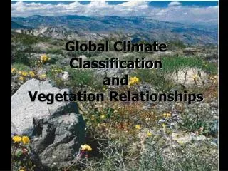
Factors that Affect Climate Latitude Altitude (elevation) Proximity to Large Bodies of Water Ocean Currents Mountain Barriers Prevailing Winds
Latitude • The duration of insolation at low latitude is pretty much constant, temperature variance is small. The angle of insolation is always quite high. Therfore, the temperature is high as well. • At high altitudes, temperatures vary but remain relatively low because of the generally low angle of insolation.
Important to Remember As the duration of insolation increases, so does the temperature. As latitude increases, the average yearly temperature decreases but annual temperature range increases. Lines of Latitude Lines of Latitude
Elevation • The elevation, (altitude) affects the moisture and temperature patterns of a region. The effects of elevation are similar to latitude. • Lower elevations are more stable in temperature and moisture while high elevations have more variation. • As altitude increases the average yearly temperature decreases and the precipitation generally increases.
Large Bodies of Water • Refer to the following website: http://www.uwmc.uwc.edu/geography/100/koppen_web/koppen_map.htm Large bodies of water (large lakes and oceans), ocean currents, and prevailing winds modify the latitudinal climate patterns of their shoreline areas.
Large Bodies of Water (continued) • The slow heating and cooling of large bodies of water cause the land masses near them to have modified temperatures. • Can anyone tell us why?
Large Bodies of Water (continued) • Maritime Climate Areas on the North (West & East) coast of the US are characterized by cooler summers and warmer winters than would normally be expected for that latitude. Areas of maritime climate have small temperature ranges.
Large Bodies of Water (continued) • Continental Climate Inland regions (not surrounded by water) are not directly affected by large bodies of water. They have continental climates. These climates are characterized by hot summers and cold winters.
Ocean Currents (p. 4 of your reference table) • Ocean Currents Maps of global winds and ocean currents look similar. This is because the winds blowing over the water create a frictional drag resulting in surface currents. The Coriolis effect (caused by earth’s rotation) results in surface currents being deflected to the right in the Northern Hemisphere and to the left in the Southern Hemisphere.
Ocean Currents • Surface currents may either be warm or cold depending upon the temperature of the water through which they are passing and their direction. • Warm currents flow away from the equator and cold currents flow towards the equator. (Please write this on p. 4 of your reference table)
Ocean Currents • As warm water flows away from the equator it helps to distribute the solar energy it has absorbed from the low latitudes to the higher latitudes. • Land closer to warm ocean currents tend to be warmer than would be expected at that latitude. Cold ocean currents have the effect of making nearby land cooler than would normally be expected.
Mountain (Orographic Barriers) • The overall effect on climate patterns is called the orographic effect. • The latitudinal climate patterns are modified by mountains that act as barriers to local weather systems by interrupting the normal path of a prevailing wind.
Mountain (Orographic Barriers) • The windward side, is the side facing the prevailing wind. As the wind hits the windward side of the mountain the air is forced upward and cools by expansion until the dew point is reached. • Condensation then occurs and cooling slows. These conditions cause the water in the air to condense forming clouds and precipitation on the windward side.
Mountain (Orographic Barriers) • The leeward side, will be drier and warmer than the windward side. It is said to be in the rain shadow. • As the air rises over the mountain and begins to descend on the leeward side, it warms because of the compression increasing its ability to hold moisture.
Windward Side (the side that receives the wind) Moist Air Rises Air Expands Air is Cooled Moist Air Condenses and forms clouds. Leeward Side (the side that does not receive the wind) Dry Air Sinks Air is Compressed Air is Warmed Air is very dry (the rain shadow effect) What do we see in the orographic effect?
Prevailing Winds • The planetary winds and pressure belts affect moisture and temperature patterns. • If the prevailing wind first crosses a large body of water before coming on land, it will bring moisture to the land. • If the prevailing wind crosses a large land mass, the effect would be arid (dry).
Prevailing Winds • Prevailing Winds from the tropics (equator) including warm ocean currents, will bring warm moist air. • Prevailing Winds from the polar regions (north and south) will bring cool dry air.
What is an El Niño an La Nina?? El Niño is characterized by unusually warm ocean temperatures in the Equatorial Pacific, as opposed to La Niña, which characterized by unusually cold ocean temperatures in the Equatorial Pacific. El Niño is an oscillation of the ocean-atmosphere system in the tropical Pacific having important consequences for weather around the globe.
What are El Nino and La Nina? El Nino - (El Nee-nyo) is the warming of water in the Pacific Ocean. La Nina - (Lah Nee-Nyah) is the cooling of water in the Pacific Ocean.
Comparison of El Nino to La Nina El Nino Weather La Nina Weather Rain and flooding along the Pacific coast Warm water disrupts food chain of fish, birds, and sea mammals Tornadoes and thunderstorms in southern US Fewer than normal hurricanes in the Atlantic Snow and rain on the west coast Unusually cold weather in Alaska Unusually warm weather in the rest of the USA Drought in the southwest Higher than normal number of hurricanes in the Atlantic
How does El Nino and La Nina Form? http://esminfo.prenhall.com/science/geoanimations/animations/26_NinoNina.html
Interesting Facts El Nino was first discovered hundreds of years ago by fishermen off the coast of Peru. El Nino means "Little Boy" and was named after the Christ child, because it usually starts around Christmas. El Nino is officially called ENSO - El Nino Southern Oscillation. La Nina means "Little Girl." It is also called El Viejo, which means "old man," or an ENSO cold event. La Nina occurs roughly half as often as El Nino El Nino and La Nina are the most powerful phenomenon on the earth and alter the climate across more than half the planet. El Nino may be caused by underwater volcanoes in the Pacific.
Lab Activity #10: Climates of an Imaginary Continent • Please complete lab activity #10: Climates of an Imaginary Continent.
HW #10, July 26, 2010 • Please read pages 160-163. make a summary on the factors that affect infiltration and the factors that affect runoff and stream discharge. • For homework tonight please complete questions 26-49 on pages 172173.