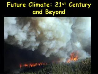
Understanding Climate: Factors, Types, and the Role of Wind and Storms
Climate refers to the long-term average patterns of temperature, humidity, and atmospheric phenomena in a region, distinguished from short-term weather conditions. It is affected by latitude, altitude, terrain, and nearby water bodies. Classifications like the Köppen system help in understanding various climate types. Wind, driven by atmospheric pressure differences and influenced by the Earth's rotation, plays a crucial role in weather and climate dynamics. Learn about climate change, its causes, and the impact of storms and cyclones on our environment.

Understanding Climate: Factors, Types, and the Role of Wind and Storms
E N D
Presentation Transcript
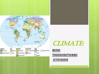
CLIMATE: WIND THUNDERSTORMS CYCLONES
What is CLIMATE? • Climate is a measure of the average pattern of variation in temperature, humidity, atmospheric pressure, wind, precipitation, atmospheric particle count and other meteorological variables in a given region over long periods of time. Climate is different from weather, in that weather only describes the short-term conditions of these variables in a given region. • A region's climate is generated by the climate system, which has five components: atmosphere, hydrosphere,cry sphere, land surface, and biosphere.[1]
Climate (from Ancient Greekklima, meaning inclination) is commonly defined as the weather averaged over a long period.[3] The standard averaging period is 30 years,[4] but other periods may be used depending on the purpose. Climate also includes statistics other than the average, such as the magnitudes of day-to-day or year-to-year variations.
FACTORS OF CLIMATE: • The climate of a location is affected by its latitude, terrain, and altitude, as well as nearby water bodies and their currents. • Climates can be classified according to the average and the typical ranges of different variables, most commonly temperature and precipitation. • The most commonly used classification scheme was originally developed by Wladimir Köppen. The Thornthwaite system,[2] in use since 1948, incorporates evapotranspiration along with temperature and precipitation information and is used in studying animal species diversity and potential effects of climate changes. The Bergeron and Spatial Synoptic Classification systems focus on the origin of air masses that define the climate of a region.
Difference between climate and weather- • The difference between climate and weather is usefully summarized by the popular phrase "Climate is what you expect, weather is what you get.” • The day to day conditions of the atmosphere at a place with respect to the temperature, humidity, rainfall, wind-speed, etc., is called the weather at that place. • The weather is generally not the same on any two days and week after week. • The average weather pattern taken over a long time, say 25 years, is called the climate of the place.
Climate classification • There are several ways to classify climates into similar regimes. Originally, climes were defined in Ancient Greece to describe the weather depending upon a location's latitude. Modern climate classification methods can be broadly divided into genetic methods, which focus on the causes of climate, and empiric methods, which focus on the effects of climate. Examples of genetic classification include methods based on the relative frequency of different air mass types or locations within synoptic weather disturbances. Examples of empiric classifications include climate zones defined by planthardiness,[10] evapotranspiration,[11] or more generally the Köppen climate classification which was originally designed to identify the climates associated with certain biomes. A common shortcoming of these classification schemes isthat they produce distinct boundaries between the zones they define, rather than the gradual transition of climate properties more common in nature.
Climate change • Climate change is the variation in global or regional climates over time. It reflects changes in the variability or average state of the atmosphere over time scales ranging from decades to millions of years. These changes can be caused by processes internal to the Earth, external forces (e.g. variations in sunlight intensity) or, more recently, human activities.[42] Variations in CO2, temperature and dust from the Rostock ice core over the past 450,000 years
WIND Moving air is called WIND. In meteorology the term is usually applied to the natural horizontal motion of the atmosphere; motion in a vertical, or nearly vertical, direction is called a current. Winds are produced by differences in atmospheric pressure, which are primarily attributable to differences in temperature. Variations in the distribution of pressure and temperature are caused largely by unequal distribution of heat from the Sun, together with differences in the thermal properties of land and ocean surfaces. When the temperatures of adjacent regions become unequal, the warmer air tends to rise and flow over the colder, heavier air. Winds initiated in this way are usually greatly modified by the Earth's rotation. Winds may be classified into four major types: the prevailing winds, the seasonal winds, the local winds, and the cyclonic and anticyclone winds, including cyclones, hurricanes, and tornadoes.
Anemometer Anemometer (Greek, anemos, “wind”; metron,”measure”), an instrument that measures wind speed. The most common kind of anemometer consists of three or four cups attached to short rods that are connected at right angles to a vertical shaft. As the wind blows, it pushes the cups, which turn the shaft. The number of turns per minute is translated into wind speed by a system of gears similar to those in the speedometer of a motor vehicle. Wind velocity is also measured by the pressure of the air blowing into a Pitot tube (an L-shaped tube, one end open towards the flow of air and the other end connected to a pressure-measuring device), or electrically by the cooling effect of the wind on a heated wire, which causes the electrical resistance of the wire to change.
Thunder Storm A flash of lightning rips through the night sky. Lightning is the visible electric discharge that occurs between rain clouds or between a rain cloud and the earth.
All thunderstorms are dangerous. Every thunderstorm produces lightning. While lightning fatalities have decreased over the past 30 years, lightning continues to be one of the top three storm-related killers in the United States. In 2010 there were 29 fatalities and 182 injuries from lightning. Although most lightning victims survive, people struck by lightning often report a variety of long-term, debilitating symptoms. Other associated dangers of thunderstorms includetornadoes, strong winds, hail andflash flooding. Flash flooding is responsible for more fatalities – more than 140 annually – than any other thunderstorm-associated hazard. Dry thunderstorms that do not produce rain that reaches the ground are most prevalent in the western United States. Falling raindrops evaporate, but lightning can still reach the ground and can startwildfires.
Before Thunderstorm and Lightning • To begin preparing, you should build an emergency kit and make a family communications plan. • Remove dead or rotting trees and branches that could fall and cause injury or damage during a severe thunderstorm. • Postpone outdoor activities. • Remember the 30/30 Lightning Safety Rule: Go indoors if, after seeing lightning, you cannot count to 30 before hearing thunder. Stay indoors for 30 minutes after hearing the last clap of thunder. • Secure outdoor objects that could blow away or cause damage.
Get inside a home, building, or hard top automobile (not a convertible). Although you may be injured if lightning strikes your car, you are much safer inside a vehicle than outside. • Remember, rubber-soled shoes and rubber tires provide NO protection from lightning. However, the steel frame of a hard-topped vehicle provides increased protection if you are not touching metal. • Shutter windows and secure outside doors. If shutters are not available, close window blinds, shades or curtains. • Unplug any electronic equipment well before the storm arrives.
According to the National Oceanic and Atmospheric Administration (NOAA) National Weather Service, approximately 1,800 thunderstorms are occurring at any given time, resulting in about 16-million thunderstorms each year. Most thunderstorms last about 30 minutes and are typically about 15 miles (24 km) in diameter. Thunderstorms thrive under certain conditions. The two most basic elements that cause a thunderstorm to develop are: • Moisture • Rapidly rising warm air Because moisture and warmth are crucial to thunderstorms, it makes sense that they would occur more often in the spring and summer, particularly in humid areas. The high humidity, in conjunction with warm temperatures, creates massive amounts of warm, moist air rising into the atmosphere, where it can easily form a thunderstorm.
Where does the thunder (and lightning) come from? • The basic idea is that thunder clouds can become giant Van de Graff generators and create huge charge separations within the cloud. Let's look at how it works. • Clouds contain millions and millions of water droplets and ice particles suspended in the air. As the process of evaporation and condensation occurs, these droplets collide with other moisture that is condensing as it rises. The importance of these collisions is that electrons are knocked off of the rising moisture, creating a charge separation. The newly knocked-off electrons gather at the lower portion of the cloud, giving it a negative charge. The rising moisture that has lost an electron carries a positive charge to the top of the cloud.
As the rising moisture encounters colder temperatures in the upper cloud regions and begins to freeze, the frozen portion becomes negatively charged and the unfrozen droplets become positively charged. At this point, rising air currents have the ability to remove the positively charged droplets from the ice and carry them to the top of the cloud. The remaining frozen portion either falls to the lower portion of the cloud or continues on to the ground. • The charge separation has an electric field associated with it. Like the cloud, this field is negative in the lower region and positive in the upper region. The strength or intensity of the electric field is directly related to the amount of charge build-up in the cloud. As the collisions and freezing continue to occur, and the charges at the top and bottom of the cloud increase, the electric field becomes more and more intense -- so intense, in fact, that the electrons at the Earth's surface are repelled deeper into the Earth by the negative charge at the lower portion of the cloud. This repulsion of electrons causes the Earth's surface to acquire a strong positive charge.
All that is needed now is a conductive path so the negative cloud bottom can conduct its electricity to the positive Earth surface. The strong electric field creates this path through the air, resulting in lightning. The lightning is a high-voltage, high-current surge of electrons, and the temperature at the core of a lightning bolt is incredibly hot. For example, when lightning strikes a sand dune, it can instantly melt the sand into glass. The combination of the rapid heating of the air by the lightning and the subsequent rapid cooling creates sound waves. These sound waves are what we call thunder. There can never be thunder without lightning.
In meteorology, a cyclone is an area of closed, circular fluid motion rotating in the same direction as the Earth. This is usually characterized by inward spiralingwinds that rotate anti-clockwise in the Northern Hemisphere and clockwise in the Southern Hemisphere of the Earth. Most large-scale cyclonic circulations are centered on areas of low atmospheric pressure.[3][4] The largest low-pressure systems are cold-core polar cyclones and extra-tropical cyclones which lie on the synoptic scale
According to the NHC glossary, warm-core cyclones such as tropical and subtropical cyclones also lie within the synoptic scale.Mesocyclones, tornadoes and dust devils lie within the smaller mesoscale. Upper level cyclones can exist without the presence of a surface low, and can pinch off from the base of the Tropical Upper Tropospheric Trough during the summer months in the Northern Hemisphere. Cyclones have also been seen on extraterrestrial planets, such as Mars and Neptune. Cyclogenesis describes the process of cyclone formation and intensification. Tropical cyclones form due to latent heat driven by significant thunderstorm activity, and are warm core. Cyclones can transition between extra-tropical, subtropical, and tropical phases under the right conditions. In the Atlantic basin, a tropical cyclone is generally referred to as a HURRICANE (from the name of the ancient Central American deity of wind, Huracan), CYCLONE in the Indian Ocean and parts of the Pacific TYPHOON in the Northwest Pacific region
Stages of Front Formation • Fronts are associated with cyclones, or areas of low pressure, and occur when cold air masses meet warm ones . The circulation of the Earth’s atmosphere causes the cold air to move eastwards and equator wards and the warm air to move eastwards and pole wards in a wedge shape called the warm sector . This movement causes the front to buckle , with a warm front to the east, where the leading edge of the warm sector is replacing cold air, and a cold front to the west . Because cold air moves faster than warm air, the warm sector is gradually squeezed and the front occludes and decays.
SYNOPTIC SCALE A fictitious synoptic chart of an extra-tropical cyclone affecting the UK and Ireland. The blue arrows between isobarsindicate the direction of the wind, while the "L" symbol denotes the center of the "low". Note the occluded, cold and warm frontal boundaries.
Surface-based types - There are three main types surface-based cyclones: Extra-tropical cyclones Subtropical cyclones Tropical cyclones
Extra-tropical cyclone • An extra-tropical cyclone is a synoptic scalelow-pressure weather system that does not have tropical characteristics, being connected with fronts and horizontal gradients in temperature and dew point otherwise known as "baroclinic zones". • The descriptor "extra-tropical" refers to the fact that this type of cyclone generally occurs outside of the tropics, in the middle latitudes of the planet. These systems may also be described as "mid-latitude cyclones" due to their area of formation, or "post-tropical cyclones" where extra-tropical transition has occurred, and are often described as "depressions" or "lows" by weather forecasters and the general public. These are the everyday phenomena which along with anti-cyclones, drive the weather over much of the Earth.
An extra-tropical cyclone can transform into a subtropical storm, and from there into a tropical cyclone, if it dwells over warm waters and develops central convection, which warms its core.
Subtropical Cyclones- Subtropical Storm Andrea in 2007 A subtropical cyclone is a weather system that has some characteristics of a tropical cyclone and some characteristics of an extratropical cyclone. They can form between the equator and the 50th parallel.
Tropical Cyclones - 2013Atlantic hurricane season summary map A tropical cyclone is a storm system characterized by a low-pressure center and numerous thunderstorms that produce strong winds and floodingrain. A tropical cyclone feeds on heat released when moist air rises, resulting incondensation of water vapour contained in the moist air. They are fueled by a different heat mechanism than other cyclonic windstorms such as nor'easters, European windstorms, and polar lows, leading to their classification as "warm core" storm systems.[
Cyclone Catharina, a rareSouth Atlantic tropical cycloneviewed from theInternational Space Stationon March 26, 2004
Effects of Tropical Cyclones • While tropical cyclones can produce extremely powerful winds and torrential rain, they are also able to produce high waves and damaging stormsurge. • They develop over large bodies of warm water, and lose their strength if they move over land. This is the reason coastal regions can receive significant damage from a tropical cyclone, while inland regions are relatively safe from receiving strong winds. • Heavy rains, however, can produce significant flooding inland, and storm surges can produce extensive coastal flooding up to 40 km.(25 mi) from the coastline. • Although their effects on human populations can be devastating, tropical cyclones can also relieve droughtconditions. • They also carry heat and energy away from the tropics and transport it toward temperate latitudes, which makes them an important part of the global atmospheric circulation mechanism. As a result, tropical cyclones help to maintain equilibrium in the Earth's troposphere.
Polar low- Polar low over theBarents Seaon February 27, 1987 A polar low is a small-scale, short-lived atmospheric low-pressure system(depression) that is found over the ocean areas pole ward of the main polar front in both the Northern and Southern Hemispheres. Polar lows are cold-core so they can be considered as a subset of extra tropical cyclones
What is barometer ? Barometer is a instrument for measuring atmospheric pressure, the force exerted on a surface of unit area caused by the Earth’s gravitational attraction on the air vertically above that area. Pressure is transmitted equally in all directions within a fluid such as air and may be measured using a variety of techniques.
ANEROID BAROMETER In an aneroid barometer, a partially evacuated metal drum expands or contracts in response to changes in air pressure. A series of levers and springs translates the up-and-down movement of the drum top into the circular motion of the pointers over the aneroid barometer's face.
A Torricelli Barometer • In 1643 the Italian physicist Evangelista Torricelli invented a barometer—an instrument for measuring atmospheric pressure. He filled a glass tube (sealed at one end) with mercury and placed it with the open end down into a container of mercury. He observed that the mercury level in the tube settled at 76 cm up the tube, and explained this as caused by the pressure of the air on the mercury in the container forcing it up the tube. The level that the mercury reached in the tube varied according to different weather conditions, indicating variations in atmospheric pressure. Atmospheric pressure is measured in millibars.
What does it mean when a barometer is rising or falling? A barometer measures air pressure: A "rising" barometer indicates increasing air pressure; a "falling" barometer indicates decreasing air pressure. In space, there is a nearly complete vacuum so the air pressure is zero. On Earth, because there are many miles of air molecules stacked up and exerting pressure due to the force of gravity, the pressure is about 14.7 pounds per square inch at sea level The interesting thing about air pressure is that it is different at different points on the planet and it changes over time. Why might that be? Hot air is less dense (lighter) than cooler air. Therefore, on any given day you would expect the air over a desert to have a lower pressure than the air over an ice cap. These same sort of pressure differences occur all over the planet for various reasons. These pressure differences have a big effect on the weather. As a very loose rule, a high-pressure area will be clear, and a low-pressure area will be cloudy and rainy.