Download

1 / 21
220 likes | 448 Views
LANDSAT: The L ongest S atellite D ata R ecord of the Earth’s Land Surface. Sensors. LANDSAT – 40 years of continuous data. Landsat 1 - July 23, 1972 (MSS ) Landsat 2 - January 22, 1975 (MSS ) Landsat 3 - March 5, 1978 (MSS) Landsat 4 - July 16, 1982 (TM)

E N D
LANDSAT: The Longest Satellite Data Record of the Earth’s Land Surface
Sensors LANDSAT – 40 years of continuous data Landsat 1 - July 23, 1972 (MSS) Landsat 2 - January 22, 1975 (MSS) Landsat 3 - March 5, 1978 (MSS) Landsat 4 - July 16, 1982 (TM) Landsat 5 - March 1, 1984 (TM, MSS) Landsat 6 - October 5, 1993, but never reached orbit Landsat 7 - April 15, 1999, May 2003 SLC-Off (ETM+) Landsat 8 - February 11, 2013 (OLI, TIRS) Launch date:
Multi Spectral Scanner (MSS) • 4 bands • Green, red, near infra-red (x2) • Across-track scanner • 6 bit data format • Spatial resolution (Instantaneous Field of View): • 79m x 79m
Landsat Thematic Mapper (TM) • 7 bands • Blue, green, red, near-IR, mid-IR (x2), thermal • Across-track scanner • 8 bit data format • Spatial resolution (IFOV): • 30m (non-thermal bands) • 120m for thermal band (b6) • Large improvement over MSS. “twice as much information exists in the TM data.” – Solomson 1984
Enhanced Thematic Mapper Plus ETM+ • 8 bands: B, G, R, NIR, MIR (2), thermal, panchromatic • Across-track scanner • Spatial resolution (IFOV): • 30m for Bands 1 to 7 • 15m for panchromatic band • 60m for thermal band • Can collect in two gain settings (high or low) for increased radiometric sensitivity and dynamic range • Vastly improved internal calibration • 8 bit data format
Landsat 8: Operational Land Imager (OLI) and Thermal Infrared Sensor (TIRS) Landsat 8 now operational L5 decommissioned and L7 with scan-line corrector issues, best platform to use Many enhancements over previous Landsat platforms
Landsat 8: Operational Land Imager (OLI) and Thermal Infrared Sensor (TIRS) 11 bands: coastal aerosol, cirrus cloud and 2nd thermal band added
Landsat 8 Operational Land Imager (OLI) and Thermal Infrared Sensor (TIRS) • Spatial resolution • 30m bands 1 to 7 and 9 • 15m panchromatic • 100m for thermal (resampled to 30m) • Band 1 (ultra-blue) is useful for coastal and aerosol studies. • Band 9 is useful for cirrus cloud detectionand quality control when conducting image analysis studies • 12 bit data format
Improvements with Landsat 8 Explanation of Differences Cirrus Band added to detect cirrus contamination in other channels Coastal Band added at request of ocean color investigators requiring higher resolution of coastal waters relative to MODIS and SEAWifs Bandwidth refinements made in all bands to avoid atmospheric absorption features Panchromatic band narrowed to avoid crossing vegetation reflectance transition From Jim Irons
Improvements with Landsat 8 • 12 bit vs. 8 bit (4096 potential grey levels vs. 256) • 5x improvement in signal to noise ratios • Greater number of detectors • Pushbroom (along-track) vs. whiskbroom (across-track) scanner (no moving mirror) • Addition of a 2nd thermal infrared channel improves temperature measurements • Coastal aerosol band enables detection of additional water column constituents
Improvements with Landsat 8 (quality control measures) • Cirrus cloud band added for quality control • Addition of a Quality Assessment (QA) band • Each pixel in the QA band contains a decimal value that represents bit-packed combinations of surface, atmosphere, and sensor conditions that can affect the overall usefulness of a given pixel. • Codes: • Bit 0 = 1 = fill • Bit 1 = 0 = no cloud • Bit 2 = 0 = land • Bit 3 = 0 = no snow • QA bits improve the integrity of science investigations by indicating which pixels might be affected by instrument artifacts or subject to cloud contamination.
Sensor Architecture Evolution Whiskbroom (Landsat 1-7) Pushbroom (LDCM) Push broom Whisk broom
LANDSAT Data Continuity Mission Landsat 8 continues the Landsat mission of collecting data about the Earth’s surface
LANDSAT Data Continuity Mission Landsat has created the longest and most comprehensive record of the Earth’s condition ever assembled. • In addition to collecting data, dissemination of that data is critical. • USGS began offering all Landsat data free of charge in 2008! • USGS is also working with other countries to “repatriate” historic Landsat imagery. • This will provide a safe repository for those data and will also continue to improve the data with updated ground processing techniques
LANDSAT distribution • All Landsat images are available to anyone at no cost. • Almost 3 million images are distributed to users in over 180 nations and territories each year.
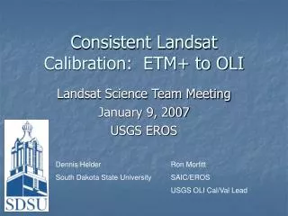
Landsat Data Continuity Mission (LCDM) Data consistency is important across platforms L8 calibrated to L7 for consistency in long-term analyses • Performed 2 day underflight of L7 and L8 to calibrate
Landsat Data Continuity Mission (LCDM) • All images reprocessed using updated methodology Standard format for all products: Pixel size: 15m/30m/30m Media type: FTP Product type: Level-1T (precision, terrain correction) Output format: GeoTIFF Map projection: UTM (Polar Stereographic for Antarctica) Datum: WGS84 Orientation: North up Resampling: Cubic convolution Accuracy: OLI 12m circular error, 90% confidence TIRS 41m circular error, 90% confidence
Landsat Global Archive Consolidation • All imagery housed at Earth Resources Observation and Science (EROS) Data Center in South Dakota, USA • With offsite backup • Imagery processed upon request • New OLI acquisitions should be available within one day • As repatriated data are successfully ingested, the Landsat scenes will become immediately available for download at no charge from EarthExplorer (http://earthexplorer.usgs.gov) or GloVis (http://glovis.usgs.gov).