Download
1 / 16
160 likes | 250 Views
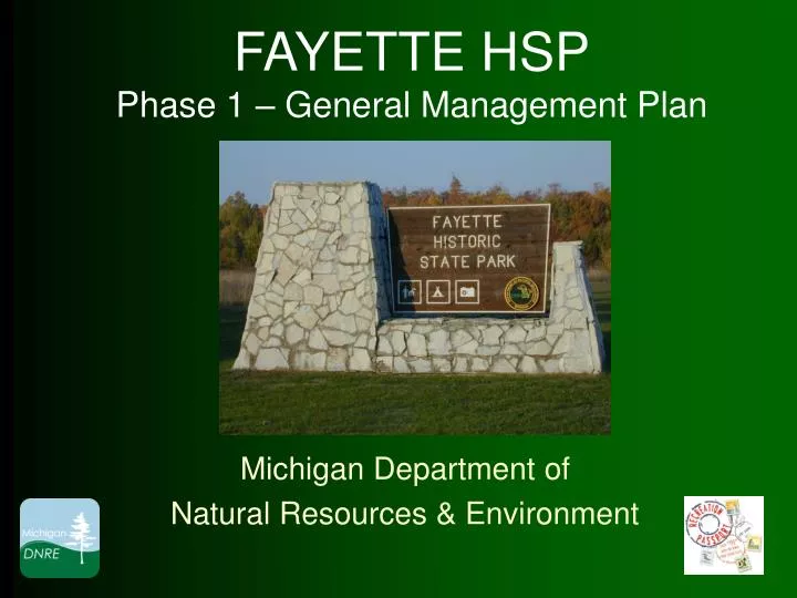
FAYETTE HSP Phase 1 – General Management Plan. Michigan Department of Natural Resources & Environment. Location. Base Features. First Bullet First indent Second indent Third indent. Aerial Image. First Bullet First indent Second indent Third indent.

E N D
FAYETTE HSPPhase 1 – General Management Plan Michigan Department of Natural Resources & Environment
Base Features First Bullet First indent Second indent Third indent
Aerial Image First Bullet First indent Second indent Third indent
Park Significance(quotes from the ‘Cultural Resource Management Plan’ by SSOE, Inc.) “Fayette is the most intact, post Civil War-era, charcoal iron-smelting company town in the United States.” - excellent opportunities for historic research and education - Archaeology has significantly affected the way Fayette is interpreted, the way it looks, and the way it is managed. The limestone cliffs protecting Snail Shell Harbor provide the habitat for old-growth cedar (in excess of 1,000 years old), the rare slender cliff-brake fern, and three rare land snails. Snail Shell Harbor surrounded by brilliant white cliffs offers a memorable visual image…
Cultural Landscape Zone (overlay) This zone identifies known cultural resources within Fayette HSP and encompasses the entire park, or approximately 721 acres. It is considered an “overlay” of all other zones in the park.
Ecologically Sensitive Zone Totaling approximately 21 acres (3%), this designation protects three species of globally significant land snails, and cedar trees found on the limestone cliffs along Lake Michigan that date to over 1,000 years of age. Public entry into this zone location will not be allowed to protect these resources. Limestone cliffs - home to rare land snailsand ancient cedars
Natural Resource Recreation Zone This zone is approximately 583 acres (81%) of land that applies to the majority of the park. The land is characterized by fairly flat terrain, with moderate slopes and change in elevation as it approaches the west. Its land cover is scattered woods and open areas. In this zone, more active recreation takes place with trail use, hunting, and snowmobile use in the winter.
History Education Zone This zone designation applies to two locations, and totals approximately 88 acres (12%) of the park. The largest is the historic Town Site of Fayette. The Town Site is under active restoration and educational programming. The second location is at the south end of the park and defines the St. Peter’s Church Cemetery that is home to original settlers of the town.
Scenic Zone (overlay) Two areas in the park are designated in this zone. One is the top of the limestone cliffs (along the trail), which offers sweeping panoramic views of the Town Site and Lake Michigan, and the second is the view of these same cliffs from the Town Site.
Developed Recreation Zone This 25 acre zone (3%) is located along the Lake Michigan shoreline. It incorporates the semi-modern campground, day-use area, boat launch, and the mooring dock in Snail Shell Harbor.
Visitor Services Zone This zone is located just outside the ‘Town Site’ and takes in the headquarters, shop, contact station, and storage area. It totals just over eight acres (1%) of land. Additional land immediately north of the current office/shop area has been included in this zone for purposes of future expansion or relocation.
Land Funding Sources and Hunting Safety Zone A new Hunting Safety Zone is defined to match the land funding source (State Game Funds). This will require a Director’s Order. Hunting Safety Zone
Planning Overview MEETINGS • 9/11/2003 Start-up Meeting • 10/09/2003 Planning Meeting • 12/09/2003 Stakeholder Meeting • 9/16/2004 Public Meeting PLAN REVIEWS • 5/25/2010 RD Section Chiefs • 6/9/2010 RD Management Team • 4/19/2010 EUP Ecoteam • 8/9/2010 Statewide Council • 8/23/2010 MSPAC – Stewardship & Operations Subcommittee • (date) MSPAC (Michigan State Parks Advisory Committee)
Thank You Questions?