Download
1 / 20
210 likes | 656 Views
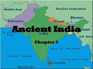
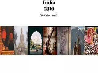
Ancient India: Geography . Ms. Berry Social Studies 6 th grade . India . India, Bangladesh, and Pakistan are located in southern Asia. Together they create the Indian subcontinent . A large area of land that is separated by geography from the rest of the continent . . Land of India .

E N D
Ancient India: Geography Ms. Berry Social Studies 6th grade
India • India, Bangladesh, and Pakistan are located in southern Asia. • Together they create the Indian subcontinent. • A large area of land that is separated by geography from the rest of the continent.
Land of India • Two major rivers: • Indus River and Ganges River • Both begin in the snowy Himalaya Mountains • Indus River (1,800 miles long) empties into the Arabian Sea. • Ganges River flows east (1,560 miles long) and empties into the Bay of Bengal.
Northern India • Covered by wide river plains • Indus plain is called the Punjab or “Five Rivers” • Ganges flows east through the large Ganges Plain
Deccan Plateau • Rugged hilly land located in south-central India • Travel is very difficult • Fewer, smaller streams; not used for travel
Sacred Rivers • “Waters, you are the ones who bring us the life force. Help us to find nourishment so that we may look upon great joy.” • See rivers as holy; will wash away their sins
Monsoons • The season when moist winds blow from the Indian ocean toward the subcontinent and almost all of India’s rain falls; four months long • This affects crops; too much can cause destruction and if too little rain falls then that can lead to famine • Even wars were stopped during the monsoon season because roads got so muddy.
Deforestation • The widespread cutting down of trees which has lead to larger floods than in ancient times. • The worst flooding happens in Ganges Plain. • In the last 50 years many of the forests have been cleared and the roots of the trees used to help soak up the water and now it rushes more quickly and causes damaging flooding.
Farming in Ancient India • They depend on monsoons and rain for crops • Grow cotton, sesame seeds, tea, wheat, and barley • Cotton plant is native to India • Raise livestock such as cattle, sheep, and goats
Mountains • Western Ghats • Eastern Ghats Two mountain ranges that are located in southern India on either coast. Western Ghats are higher in elevation. Both are wet and contain thick wooded forests.
Hindu Kush • Mountain range located in north-western Afghanistan • 500 miles from East to West • Mostly uninhabitable • Khyber Pass- 28 miles long; ancient trade route
Thar Desert • Located on the border between India and Pakistan • 500 miles long; 250 miles wide • Little to no Vegetation • Pronounced Tar
Critical Thinking Questions • Deccan Plateau • Eastern & Western Ghats (Mountains) • Ganges River • Hindu Kush Mountains • Indus River • Thar Desert *Looking at your map and your notes about each geographical location to answer the questions. Give details to support your answers.