Download
1 / 15
180 likes | 479 Views
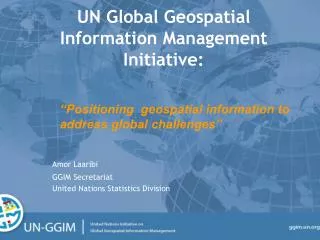
UN Global Geospatial Information Management Initiative:. Amor Laaribi. “Positioning geospatial information to address global challenges”. GGIM Secretariat United Nations Statistics Division. Outline:. 1. Location matters

E N D
UNGlobal Geospatial Information Management Initiative: Amor Laaribi “Positioning geospatial information to address global challenges” GGIM Secretariat United Nations Statistics Division
Outline: 1. Location matters 2. Need of a global inter-governmental mechanism: UN- GGIM and its work 3. Data Access and Confidentiality Issues 4. Geospatial Information is support of Sustainable Development (Post-2015 Development Agenda) 5. Conclusion “Positioning geospatial information to address global challenges”
Why a global mechanism? • Significant gap in the recognition and management of geospatial information base • Lack of a global consultative and decision-making mechanism among Member States in: • setting global norms on geospatial information; • developing common tools; and • bringing geospatial information to bear on global policy issues • Governments have the mandate and accountability to create and maintain the national geospatial information base and related policy • This gap is increasingly being filled by non-governmental actors, reducing the role and influence of Governments and creating a proliferation of data providers (e.g. official/authoritative data)
UN Committee of Experts on GGIM (UN-GGIM): An Inter-governmental Coordination Mechanism “Positioning geospatial information to address global challenges”
UN-GGIM: An inter-governmental mechanism Formal inter-governmental Committee of Experts on GGIM, established by ECOSOC in July 2011 to (mandate): • Discuss, enhance and coordinate Global Geospatial Information Management activities by involving Member States at the highest level as key participants • Make joint decisions and set directions on the use of geospatial information within national and global policy frameworks • Work with Governments to improve policy, institutional arrangements, and legal frameworks • Address global issues and contribute collective knowledge as a community with shared interests and concerns • Develop effective strategies to build geospatial capacity in developing countries
GGIM Meetings I. UN-GGIM: (Committee of Experts on GGIM) (Formal UN meetings - Annual session) • Inaugural session in Seoul, Republic of Korea, 26 October 2011 • Second session in New York, 13-15 August 2012 • Third Session in Cambridge, UK, 24-26 July 2013 • Fourth Session to be held in New York, 4-6 August 2014 II. High-Level Forums on GGIM: (Hosted by countries: less formal and more inclusive with all stakeholders involved - ministerial segments and business sector forums) • First High-Level Forum on GGIM, Seoul, Rep. of Korea, 24-26 October 2011 • Second High-Level Forum on GGIM, Doha, Qatar, 4-6 February 2013 • Third High-level Forum on GGIM, Beijing, China, December 2014
UN-GGIMRegional - Global Architecture “Positioning geospatial information to address global challenges”
Regional Committee of UN-GGIM for Asia-Pacific (formerly PCGIAP) created November 2012 UN-GGIM for the Americas (formerly PC-IDEA) created August 2013 UN-GGIM for Arab States initiated February 2013 UN-GGIM for Europe has had a number of preparatory meetings and will be formally established in August 2014 Committee on Development Information, Science & Technology Sub-committee on Geo-information (CODIST-Geo), UNECA – UN-GGIM for Africa (2014 ?) JB-GIS – major voice for relevant international GI organizations Members of the Bureau of the Committee Creation of a Regional-Global architecture for UN-GGIM
Data: National to global framework datasets Positioning (Geodetic) Address (Buildings) Cadastre (Tenure) Names (Gazetteer) Water(Hydrology) Administrative Boundaries Transport Bathymetry (Hydrography) Land cover (Vegetation) Elevation Geographical names Cadastre, Topographic, Natural Resources and Climate Data Land, Island and Submarine Relief Coastal, International, State and Municipal Limits Imagery (Satellite & Photo) Geodetic Reference Frame
Integrating Geospatial, Environmental and Socio-Economic Data:Confidentiality issues “Positioning geospatial information to address global challenges”
The importance of geospatial information • “I am also pleased to see that the importance of reliable, trusted geographic information is now recognised. The United Nations has now established a Committee of Experts of Member States, which the UK co-chairs, to move this agenda forward” • Rt Hon Nick Clegg MP, Deputy Prime Minister, United Kingdom Government
The Future We Want: 19th June 2012 “Positioning geospatial information to address global challenges”
UN-GGIM: Summary • UN-GGIM is the global inter-governmental and apex entity for the geospatial information requirements of the post-2015 development agenda • Reliable and authoritative data • Data Access and related confidentiality issues • Contribution of geospatial information to sustainable development, and the post-2015 development agenda
Future trends in geospatial information management: the five to ten year vision “Positioning geospatial information to address global challenges”