Download
1 / 30
300 likes | 441 Views
Development of Vegetation Products for U.S. GOES-R Satellite Mission. Yunyue Yu, Mitch Goldberg, NOAA/NESDIS/StAR Peter Romanov, University of Maryland Hui Xu, Yuhong Tian, I. M. Systems Group, Inc. Outlines. GOES-R Mission AWG Land Team Vegetation Products Accomplishments Summary.

E N D
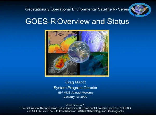
Development of Vegetation Products for U.S. GOES-R Satellite Mission Yunyue Yu, Mitch Goldberg, NOAA/NESDIS/StAR Peter Romanov, University of Maryland Hui Xu, Yuhong Tian, I. M. Systems Group, Inc.
Outlines • GOES-R Mission • AWG Land Team • Vegetation Products • Accomplishments • Summary
GOES-R Mission US GOES Imager Coverage 135 W 75 W
GOES-R Overview GOES Satellite Mission • National operational environmental observations for 24-hour of weather and Earth’s environment • The GOES-R system provides an observation system that produces reliable data on atmosphere, terrestrial, fresh water, and ocean ecosystems data and will be one of the primary U.S. systems networked into the Global Observing System led by the World Meteorological Organization and that was set as a goal at the Earth Observation Summit (July 2003) • Support storm-scale weather forecasting and numerical modelers • To meet requirements, GOES continuously maintains operational satellites at two locations (75º West and 135º West) • On-orbit spare ready in case of failure • currently operational : GOES-10 (K), -11(L), -12(M), -13(N) • Under Development: GOES-O, -P (N series) • GOES-R Series is the follow-on continuity program to GOES-N Series (New Generation GOES Satellites)
GOES-R Mission GOES-R AWG program is a government-led effort to • broker algorithms between government, academic and commercial sources; • support the prototyping and demonstration of algorithm performance including algorithm/product metadata generation techniques, standards, and formats; • provide algorithm software, test data sets, and benchmarks as potential solutions for the product generation functions, and • review and assess applicable GOES Incident Reports (GIRs).
ABI Sensor -- Scan Mode ABI scans about 5 times faster than the current GOES imager CONUS Full Disk “Franklin” N. Hemisphere Mesoscale There are two anticipated scan modes for the ABI: • Full disk images every 15 minutes + 5 min CONUS images + mesoscale • Or, Full disk every 5 minutes
GOES-R Overview GOES-R Algorithm WorkingGroup
AWG Land Team and Products • Normalized Difference Vegetation Index • Peter Romanov (Lead) • Hui Xu • Dan Tarpley • Bob Yu • Kevin Gallo • Felix Kogan • Wei Guo • Land Surface Temperature • Bob Yu (Lead) • Dan Tarpley • Hui Xu • Ming Chen • Konstantin Vinnikov • Kevin Gallo AWG Land Team Chair : Yunyue (Bob) Yu • Flood/Standing Water • Donglian Sun (Lead) • Bob Yu • Sanmei Li • Hui Xu • Albedo/Reflectance • Shunlin Liang (Lead) • Kaicun Wang • Bob Yu • Tao He • Hongyi Wu • Green Vegetation Fraction • Peter Romanov (Lead) • Felix Kogan (co-Lead) • Yuhong Tian (co-Lead) • Bob Yu • Dan Tarpley • Hui Xu • Fire/Hot Spot Characterization • Chris Schmidt (Lead) • Ivan Csiszer • Wilfrid Schroeder • Bob Yu • Hui Xu • Clear Sky Radiance* • Peter Romanov (Lead) • Hui Xu • Dan Tarpley Software Development • Hui Xu (Lead) • Shuang Qiu • Ming Chen • Wei Guo *Activities on this product are not described in this review
03/2009 03/2010 03/2011 03/2012 Product Priority • Release 1 and 2 required for GOES-R launch readiness • Products are grouped into four Product Generation capability releases; releases 3 & 4 are options • Prioritization methodology: user prioritization, product precedence trees (MIT/LL, STAR), heavy hitters from latency requirements, and LIRD/MRD Prioritization Tiers
GOES-R NDVI and GVF Schedules Development Schedule for GOES-R Veg Products
NDVI CDR Requirements C – CONUS Full Disk: Request for change of requirement has been submitted
GVF ADR Requirements C – CONUS
NDVI Algorithm NDVI = ( Rnir- Rvis ) / ( Rnir + Rvis ) Rnir: Near IR reflectance (0.86 µm, ch.3) Rvis: Visible reflectance (0.64 µm, ch.2) Both reflectances are top of the atmosphere values • First introduced by Rouse, et al (1973) • Widely used in vegetation/climate monitoring since then, e.g., Tucker (1979), Holben, (1986), Myneni et al. (1997), Kogan (2001)
NDVI start Initialize variables/LUTs Read ABI Data Read Ancillary Data Process ABI data to calculate NDVI NDVI Data Formatting, Metadata End NDVI NDVI Algorithm Flowchart and Input/output High Level Flowchart of NDVI Output of ABI NDVI product
NDVI Algorithm Output-- SEVIRI as Proxy False color composite and the derived NDVI map ofSEVIRI full disk image for April 9, 2008, 12:15 UTC
Test Outputs – Instantaneous, NDVI Products The instantaneous NDVI taken at 12:15 UTC (below), and at 12:45 UTC (right) Presented at GOES-R 2008 Annual Conference, Madison, WI 53706, 23-26 June 2008.
Test Outputs –Daily and Weekly NDVI Products The NDVI dailycomposite (June 15, 2008) (below), and weekly composite (June 9-15, 2008) (right) Presented at GOES-R 2008 Annual Conference, Madison, WI 53706, 23-26 June 2008.
NDVI Test Plan– Offline Validation: Test Results Fraction of cases with over 0.05 NDVI diurnal change MSG SEVIRI full disk data, 1145UTC “All data” : No cloud mask applied, Ɵsat < 700, Ɵsol < 700 “Simple cloud mask”: T9>285K, R1<60%, NDVI>0.05 “Added dR1 threshold”: Cloud mask consisting of “Simple cloud mask” and 10% max daily change in R1
GVF Background Green Vegetation Fraction (GVF): fraction of the area within the instrument footprint occupied by photosynthetically active green vegetation 1.Datasets based on observations from polar-orbiting satellite data NESDIS/STAR Operational Monthly:Monthly 0.144-deg (~16km) global climatology of GVF from 5 years of AVHRR data. (Gutman & Ignatov, 1998). NESDIS/STAR New Weekly GVF:28 years (1982~present)AVHRR-based near real-time weekly global 0.144-deg (~16km) GVF (Jiang et al., 2009). Includes weekly GVF climatology. 2.Datasets based on observations from Geostationary satellite data EUMETSAT/MSG SEVIRI Product:Daily since 2005,3km resolution, covers land area within Meteosat domain.
GOES-R GVF Algorithm GOES-R ABI is expected to characterize GVF at higher spatial and temporal resolution as compared to available AVHRR-based datasets NDVI-based GVF Algorithm GVF = (NDVImax - NDVI) / (NDVImax - NDVImin) NDVI : Observed NDVI NDVImax : Maximum NDVI corresponding to 100% vegetation cover NDVImin : Minimum NDVI corresponding to 0% vegetation cover NDVImaxandNDVIminare global parameters independent of location or land cover type
GVF Challenges • Global NDVImaxandNDVImin have to be established • NDVI angular anisotropy has to be accounted for - NDVI, NDVImaxandNDVImin should be brought to the same geometry of observations - NDVI angular anisotropy is neglected In current GVF algorithms
MSG NDVI Angular Anisotropy Effect of solar zenith angle • Up to 0.4 change in NDVI due to the change in solar zenith angle • NDVI angular anisotropy is the strongest for scenes with high NDVI value Mixed Forest Lat=47.48N Lon=13.98E Cropland Lat=48.15N Lon=33.10E Bare Ground Lat=24.96N Lon=0.25W Examples of NDVI daily (July) change MSG-SEVIRI cloud-clear data
Lat=16.2S Lon=51.6W Lat=42.7N Lon=3.6W Lat=8.7N Lon=22.7E Forward Scatter Forward Scatter Backscatter Backscatter Backscatter FS FS NDVI Angular Anisotropy (2) Effect of solar-satellite relative azimuth angle • Relative azimuth may cause about 0.1 change in NDVI • Changing relative azimuth may cause asymmetry of NDVI daily change MSG
NDVI Angular Model Empirical approach • Follow techniques for angular correction of reflectance to develop NDVI angular model (Roujean et al., 1992; Wanner et al., 1999; Lucht et al., 2000) • Generate a comprehensive dataset of clear-sky observations • Test different analytical parameterizations for NDVI anisotropy - Solar-satellite angle reciprocity will be used • Determine the parameterization providing the best characterization of the observed NDVI daily change
NDVImin and NDVImax NDVImax and NDVImindefined after Sellers et al. (1996) NDVImax = 5th upper percentile of global NDVI values corrected for angular anisotropy NDVImin = 5th lower percentile of global NDVI values after cloud filtering We expect that processing of 1-2 month of SEVIRI data for two seasons would be enough to make reliable estimates of NDVImax andNDVImin
Algorithm Development Strategy • Adopt NDVI-based GVF formulation • Use MSG SEVIRI as GOES-R prototype • Develop an analytical model to correct NDVI for angular anisotropy • Determine global NDVImax and NDVImin • Apply the new GVF algorithm to MSG SEVIRI data • Evaluate the algorithm performance
GVF Algorithm Processing Outline Flow Chart of GVF GVF start Acquire satellite data (NDVI, angle values) Declare & Initialize variables Acquire model data (NDVImin, NDVImax, NDVI angular model parameters) Read Data Apply cloud mask, water mask Acquire ancillary data (cloud mask, land/water mask) Bring NDVI to the reference geometry Calculate GVF Write files GVF end
Summary • GOES-R NDVI will be calculated from TOA reflectances • GOES-R GVF will be derived from NDVI product after angular correction • Empirical approach will be used in the development of NDVI angular correction algorithm and in estimating NDVImax and NDVImin • Tailored products such as daily and weekly products and mostly cloud-free NDVI and GVF products will be developed