Download
1 / 23
230 likes | 381 Views
Results from the Central Region Demonstration of the GOES-R Fog and Low Stratus Algorithm Applied to Current Real-time GOES Imagery and Data. Chad Gravelle GOES-R Satellite Liaison CIMSS, University of Wisconsin-Madison / NWS Operations Proving Ground Brian Motta

E N D
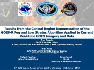
Results from the Central Region Demonstration of the GOES-R Fog and Low Stratus Algorithm Applied to Current Real-time GOES Imagery and Data Chad Gravelle GOES-R Satellite Liaison CIMSS, University of Wisconsin-Madison / NWS Operations Proving Ground Brian Motta DOC/NOAA/NWS/OCWWS Training DivisionForecast Decision Training Branch 2nd NWS Eastern Region Virtual Satellite Workshop – 25 February 2013 Michael Pavolonis NOAA/NESDIS/STAR Corey Calvert CIMSS University of Wisconsin-Madison
Fog and Low Stratus Demonstration Overview • GOES-R demonstration of the official GOES-R Fog and Low Stratus algorithm that uses today’s GOES imagery. • 1 August – 31 December 2012 • GOES-R Fog and Low Stratus (FLS) Products • IFR Probabilities • LIFR Probabilities • Cloud Thickness • Participating Central Region Offices: DMX, EAX, IND, JKL, LMK, LSX, MQT, RIW • Improve products “today” before GOES-R is launched “tomorrow”.
GOES-R Fog and Low Stratus Overview • GOES-R Fog and Low Stratus products are a fused suite of products that provide forecaster and tactical decision aids for NWS forecasters when identifying the presence and location of fog and low stratus. • Mike Pavolonis(NOAA/NESDIS) and Corey Calvert (CIMSS) • Products: • Probability of MVFR, IFR, and LIFR Conditions • Cloud Thickness Example from Calvert and Pavolonis (2012)
GOES-R Fog and Low Stratus Training • FLS training session was developed/given by the FLS product developer, Mike Pavolonis, to WFOs via GoToMeeting. • Session was recorded and made available to each office. • Training was similar to the session that is currently available on the VISIT webpage.
GOES-R Fog and Low Stratus Training • During the evaluation, offices could also utilize “real-time” training and product examples on the GOES-R Fused Fog Blog. http://fusedfog.blogspot.com/
Feedback to the GOES-R Proving Ground • One of the goals of the GOES-R Proving Ground is to create an environment where feedback between users and developers can occur. • Forecaster Surveys – 2 Approaches • Quantitative: Participants are asked questions to determine the frequency and percentage of their responses. • Qualitative: Participants are asked to respond to general questions, and their responses are explored to identify and define peoples' perceptions, opinions, and feelings. • Area Forecast Discussions • Science Operations Officer and Office Satellite Focal Point • Facebook Posts • Informal Emails
Feedback - Survey Results (based on 45 responses) How many years have you been a forecaster at your current WFO? What is your current position?
Feedback - Survey Results What was the FLS problem of the day? How were the GOES-R FLS products utilized? • FLS thickness product was also utilized for fog and low stratus dissipation.
Feedback - Survey Results How did the GOES-R FLS products perform when compared to surface observations? • Mostly very good, although the IFR/LIFR probabilities were very low at KCMX when visibilities were M1/4. • Lower probability IFR matched up pretty well with MVFR cigs.
Feedback - Survey Results How did the GOES-R FLS products perform when compared to legacy fog products? Did you use both the GOES-R FLS and legacy fog (e.g., 10.35-3.9 µm band difference) products? • FLS products identified the areas better than the legacy visible/fog imagery, but felt IFR/LIFR probabilities were too low considering the areal coverage and uniformity of LIFR conditions, likely due to high clouds moving across the state.
Feedback - Survey Results Did these probability trends give confidence for the formation or dissipation of FLS? Did you notice increases or decreases in the GOES-R FLS probabilities? • On this morning, the GOES-R datasets gave increased confidence that fog/low clouds were developing near KSAW, despite having high clouds initially over the site.
Feedback - Survey Results How useful was the GOES-R cloud thickness product in assisting with estimating fog dissipation? Did you use the GOES-R cloud thickness product assist with estimating fog dissipation? • Used to gauge the depth of the stratus deck moving in from Minnesota. • Currently trying to use data to create our own scatter chart. We’ve noticed significant differences on timing of dissipation based on the orientation of the valleys.
Feedback - Survey Results How likely are you to use the GOES-R FLS Products again when diagnosing FLS? Overall, how useful did you find the GOES-R FLS Products? • A good additional tool. I'm sure our interpretive skill will improve as we use it more. • We are becoming increasingly confident of using this information for TAFs, etc. and it gives us confirmation of what we normally think should be going on.
Feedback - Survey Results Summary • Although only 9% of survey respondents used the MODIS-based products, the majority found them to be useful. • “FLS products identified the areas better than the legacy visible/fog imagery, but felt IFR/LIFR probabilities were too low considering the areal coverage and uniformity of LIFR conditions, likely due to high clouds moving across the state.” • “Mostly good, although the IFR/LIFR probabilities were very low at times when vsbys were M1/4.” • “On this morning, the GOES-R datasets gave increased confidence that fog/low clouds were developing near KSAW, despite having high clouds initially over the site.” • “A good additional tool. I'm sure our interpretive skill will improve as we use it more.” • “We are becoming increasingly confident of using this information for TAFs, etc. and it gives us confirmation of what we normally think should be going on.”
Feedback - Area Forecast Discussion Example 1 • 8 AFDs during the evaluation mentioned the FLS products. • 5 Probability Products • 3 Cloud Thickness Product FXUS63 KLSX 101039AFDLSXAREA FORECAST DISCUSSION...UPDATED AVIATIONNATIONAL WEATHER SERVICE ST LOUIS MO539 AM CDT FRI AUG 10 2012.AVIATION...ISSUED AT 511 AM CDT FRI AUG 10 2012MVFR CONDITIONS NOW COVERING MOST OF THE AREA NORTHEAST OF KCOU TO KSAR LINE...INCLUDING ALL TAF SITES EXCEPT FOR KCOU...WHERE BKN012 IS EXPECTED BY AROUND 11Z. CIGS HAVE BEEN HOVERING JUST ABOVE IFR STATUS EXCEPT FOR KUIN WHERE CIGS HAVE BRIEFLY DIPPED TO 003 AT TIMES. HAVE USED THE GOES-R FOG AND LOW STRATUS PRODUCTS THIS MORNING TO DETERMINE PROBABILITIES OF IFR CONDITIONS...AND THEY HAVE GIVEN CONFIDENCE IN HOLDING CIGS JUST ABOVE IFR STATUS AT ALL TAF SITES EXCEPT KUIN...WHERE SATELLITE PRODUCTS SHOW A HIGHER PROBABILITY OF IFR CIGS UPSTREAM. LOW STRATUS SHOULD BREAK UP BY AROUND 14Z TO 15Z...GIVING WAY TO SCT CU FIELD THIS AFTERNOON. NNW WINDS AT 10 TO 15 KTS EXPECTED. REMAINING CU SHOULD DISSIPATE RAPIDLY AFTER SUNSET LEAVING CLEAR SKIES OVERNIGHT. STEAM FOG OFF THE MISSOURI RIVER IS LIKELY LATE TONIGHT AND WILL LIKELY AFFECT KSUS TAF SITE.&&.LSX WATCHES/WARNINGS/ADVISORIES...MO...NONE.IL...NONE.&&$$
Feedback - Area Forecast Discussion Example 2 FXUS63 KLSX 211549AFDLSXAREA FORECAST DISCUSSION...UPDATEDNATIONAL WEATHER SERVICE ST LOUIS MO949 AM CST WED NOV 21 2012 .UPDATE...ISSUED AT 943 AM CST WED NOV 21 2012STARTING TO SEE IMPROVEMENT IN LOW VISIBILITIES/CEILINGS ASSOCIATED WITH DENSE FOG. PORTIONS OF CENTRAL MISSOURI HAVE IMPROVED FAIRLY RAPIDLY OVER THE PAST COUPLE OF HOURS WHERE FOG NOW IS CONFINED TO LOWER ELEVATIONS/RIVER VALLEYS EXCLUSIVELY. THUS...HAVE ELECTED TO BEGIN TRIMMING THE DENSE FOG ADVISORY OVER THE FAR WESTERN CWFA AND BELIEVE THIS TREND WILL CONTINUE OVER THE NEXT COUPLE OF HOURS. ALONG THE MISSISSIPPI RIVER AND POINTS EASTWARD...IF YESTERDAY IS ANY INDICATION...BELIEVE THIS AREA WILL BE SOCKED IN FOR AT LEAST A FEW MORE HOURS...IF NOT LONGER. GOES-E CLOUD THICKNESSES OF 1000-1200 FEET SUGGEST THE RADIATION FOG TO LAST 4-5 HOURS AFTER SUNRISE OR 11 AM TO NOON. HOWEVER...GIVEN WEAK SUN ANGLE/TIME OF YEAR AND LITTLE MIXING ESPECIALLY OVER THE EASTERN CWA...LIKE YESTERDAY BELIEVE THIS IF ANYTHING MAY BE UNDERESTIMATED. WILL CONTINUE TO MONITOR SITUATION AND SEE IF DENSE FOG ADVISORY MAY NEED TO BE EXTENDED OVER THOSE AFOREMENTIONED AREAS.&&.LSX WATCHES/WARNINGS/ADVISORIES...MO...DENSE FOG ADVISORY UNTIL NOON CST TODAY FOR CALLAWAY MO-COLE MO-CRAWFORD MO- FRANKLIN MO-GASCONADE MO-IRON MO-JEFFERSON MO-LEWIS MO-LINCOLN MO-MADISON MO- MARION MO-MONTGOMERY MO-OSAGE MO-PIKE MO-RALLS MO-REYNOLDS MO-ST. CHARLES MO-ST. FRANCOIS MO-ST. LOUIS CITY MO-ST. LOUIS MO-STE. GENEVIEVE MO-WARREN MO-WASHINGTON MO.IL...DENSE FOG ADVISORY UNTIL NOON CST TODAY FOR ADAMS IL-BOND IL-BROWN IL-CALHOUN IL- CLINTON IL-FAYETTE IL-GREENE IL-JERSEY IL-MACOUPIN IL-MADISON IL-MARION IL-MONROE IL- MONTGOMERY IL-PIKE IL-RANDOLPH IL-ST. CLAIR IL-WASHINGTON IL.&&$$
Demonstration Final Thoughts • GOES-R products are “demonstration” products and they demonstrate what is possible with the next-generation satellite. • Although all the WFOs had at least one representative on the FLS training, certain aspects need to be emphasized. • Differences (and how to identify them) in FLS probabilities between Satellite-Model and Model only predictors. • FLS products based on MODIS imagery should be used although data is infrequent. • The GOES-R products should be compared to legacy products when possible.
Upcoming with GOES-R Fog and Low Stratus • AWIPS 2 compatibility • VISIT live teletraining sessions calendar: http://rammb.cira.colostate.edu/training/visit/calendar.asp • GOES-R fog blog: http://fusedfog.blogspot.com/ • GOES-R Fog and Low Stratus Demonstrations in 2013 • Alaska Region – MODIS and Suomi NPP • Western Region – GOES-13 and MODIS • Southern Region – GOES-13/15 and MODIS
Questions Questions or comments? chad.gravelle@noaa.gov or brian.motta@noaa.gov