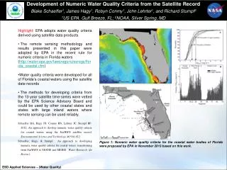
Download
1 / 10
100 likes | 323 Views
Aviation Products Derived from GOES Satellite Data. Gary P. Ellrod Office of Research and Applications (NOAA/NESDIS) Camp Springs, MD. Aviation Hazards Low clouds / Fog Aircraft Icing Volcanic Ash Microburst Winds Related projects High Density Winds Clouds above 12 kft

E N D
Aviation Products Derived from GOES Satellite Data Gary P. Ellrod Office of Research and Applications (NOAA/NESDIS) Camp Springs, MD
Aviation Hazards Low clouds / Fog Aircraft Icing Volcanic Ash Microburst Winds Related projects High Density Winds Clouds above 12 kft Convective instability CAT climatology Resources 0.7 FTE (G. Ellrod) 1 contractor as of June ‘00 (Raytheon) 3 HP-755 workstations Funding GOES I-M Product Assurance Plan (NESDIS) Product Development Areas
Experimental Satellite Products • GOES Data Required: • Imager: Multi-spectral data (5 bands) • Sounder: Temperature / moisture profiles • Means of Display: Internet (Hourly) • http://orbit-net.nesdis.noaa.gov/arad/fpdt/ • Evaluators: • NWS (WFOs and AWC), DoD, airlines, etc. • In-house Validation Uses: • Pilot reports, surface observations, upper air data, other satellite data
Improved Depiction of Low Clouds / Fog • GOES Enhanced Low Cloud Product • Uses GOES IR (10.7 - 3.9 mm) image, and IR - surface temperature difference • Thresholds set based on statistical analysis • Red indicates IFR ceilings (<1000 ft) likely • Validation based on >500 METAR reports: • Probability of Detection (POD) ~74% • False Alarm Ratio (FAR) ~ 14% • Possible upgrades: • Reduce under-detection of IFR conditions
In-flight Icing Detection • GOES Aircraft Icing Product • Uses 3 IR (3.9, 10.7, 12 mm), + Visible • Icing shown in blue • Validation: • POD ~ 80% • FAR ~10% • Needed upgrade: • Height information
Improved Volcanic Ash Detection • GOES 3-Band IR Ash Product • Uses 3.9 mm, along with 10 & 12 mm IR • Improves on “split window” technique • In use at Washington VAAC • Develop strategies for loss of 12 mm IR Columbia Equador
GOES Microburst Products • Wind Index, Wet & Dry Microburst Indices • Use GOES Sounder temp. / moisture profiles • Validation: • Wind Index mean error ~ 3 knots • Wet Microburst Index correlates highly with microburst occurrence at Cape Canaveral (Fla. Institute Of Technology) • Possible upgrades: • Improve Wind Index at night, reduce area of dry microburst risk, provide site-specific products • Microburst Indices planned for NWS AWIPS
Summary and Conclusions • Experimental GOES products have been developed in following aviation hazard areas: • Low ceilings / fog • In-flight icing • Convective wind gusts • Volcanic ash • Validation shows good product quality • Improvements planned, but resources limited • Products can also be derived with data from polar spacecraft (NOAA, METOP, etc)