Download
1 / 21
210 likes | 375 Views
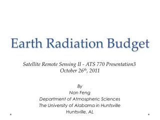
On the Development of GOES-R Longwave Earth Radiation Budget Products. Hai-Tien Lee (1) & Istvan Laszlo (2) (1) CICS/ESSIC-NOAA, University of Maryland (2) NOAA/NESDIS/STAR.

E N D
On the Development of GOES-R Longwave Earth Radiation Budget Products Hai-Tien Lee(1) & Istvan Laszlo(2) (1)CICS/ESSIC-NOAA, University of Maryland (2)NOAA/NESDIS/STAR Acknowledgments: Nicolas Clerbaux, Steven Dewitte (RMI, Belgium), Jacqueline Russell (Imperial College, UK), GERB and SEVIRI Teams, Fred Rose & CERES Team, and NASA Langley Data Center. GOES-R Risk Reduction and AWG Projects. GOES-R 2007 Annual Meeting Lansdowne, VA, May 15-18, 2007
LW Earth Radiation Budget Parameters • Top of the atmosphere Outgoing Longwave Radiation (OLR) - Physical-based multi-spectral regression model • Surface Downward Longwave Radiation (DLW) - Physical-based multi-spectral non-linear regression model, physical-based statistical parameterization • Surface Upward Longwave Radiation (ULW) - physical method
HIRS Multi-spectral OLR Algorithm Ni= channel i radiance = local zenith angle ai = regression coefficient HIRS OLR Validation (Ellingson et al., 1994) HIRS OLR Climate Data Record 1979 - 2003 (Lee et al., 2007) Tropical Mean HIRS OLR is Operational since 1998. HIRS OLR Climate Data Record in excellent agreement with broadband measurements.
OLR Validation Reference CERES SSF OLR Nighttime Daytime June 2004
June 2004 SEVIRI-CERES OLR Differences Negative Differences Positive Differences Highly variable cloud, e.g., ITCZ, is a scene that the measurements were typically “mismatched” - producing both large positive and negative random errors. Day Night
Space and Time Collocation • Observation Time in 15 min. window • View zenith angle matched (azimuth is not!) • Spatial Homogeneity SEVIRI radiances averaged for a 3x3-pixel target (red, 9km at nadir) collocates with a CERES footprint (yellow, 20km at nadir).
How do the observation time differences and the varying spatial homogeneity affect the validation results? Collocated, VZA-matched SEVIRI and CERES OLR June 2004 Night-time Mean OLR Diff Std OLR Diff Threshold of Time diff (sec) Threshold of Time diff (sec) Homogeneity Index Bins Homogeneity Index Bins
Threshold and Absolute Homogeneity Range Limit Statistics for points < threshold Statistics for points for index bins
SEVIRI Model Comparison SEVIRI OLR Model A Channels 6, 9, 11 SEVIRI OLR Model B Channels 5, 6, 7, 11 • June 21-27 and Dec. 11-17, 2004 Meteosat8 full disk domain • CERES SSF FM1/2 (Ed2b), FM3/4 (Ed1b) • View zenith angle matched (<1°), homogeneous scenes (index<0.01), both day & night
Effects of Upper Tropospheric Humidity SEVIRI OLR Limb Darkening Biases Day/Night, Homog<0.01, vza matched, No Desert Model A: Ch 6, 9, 11 UTH variation is important in determining LW broadband radiance angular variation. Inclusion of 6.2 m channel (Ch5) significantly reduced the limb darkening biases. Y=-12.21+16.16*X Model B: Ch 5, 6, 7, 11 Y=-6.66+6.17*X
GERB - CERES OLR Empirical correction for limb darkening errors: Dewitte et al., 2006
0 3 6 Wm-2 -6 -3 3 6 Wm-2 SEVIRI-CERES Mean Diff Std Diff Model B 1°x1° • June 21-27 and Dec. 11-17, 2004 Meteosat8 full disk domain • CERES SSF FM1/2 (Ed2b), FM3/4 (Ed1b) • View zenith angle matched (<1°), homogeneous scenes (index<0.01), both day & night
Summary • Preliminary SEVIRI/ABI OLR algorithms were validated against CERES SSF data. The full-disk domain mean OLR difference is within 1%, with rms differences of about 5 Wm-2 and nearly one-to-one relationship. • Angular dependence and Regional biases • Empirical correction possible, but not desired! • New OLR model accounted for UTH variation, producing much better limb darkening property, but erred for desert (need to devise different regression technique) • GERB OLR validation showed similar limb darkening problems - thin cirrus identification problems. • Scene identification may improve regional accuracy - particularly for extreme conditions (desert) and semi-transparent cirrus scenes. • Adaptation of CERES LW ADM is under evaluation.
Validation Summary • June 21-27 and Dec. 11-17, 2004 • Validated with CERES SSF FM1/2 (Ed2b), FM3/4 (Ed1b) • For zenith angle matched, homogeneous scenes (index<0.01), day & night: SEVIRI OLR Model A: Channels 6, 9, 11 SEVIRI OLR Model B: Channels 5, 6, 7, 11