Download
1 / 34
340 likes | 443 Views
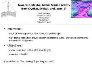
Towards 1 MilliGal Global Marine Gravity from CryoSat , Envisat , and Jason- 1* David Sandwell Emmanuel Garcia Khalid Soofi Paul Wessel Walter H. F. Smith. motivation: much of the deep ocean floor is uncharted by ships

E N D
Towards1 MilliGal Global Marine GravityfromCryoSat, Envisat, and Jason-1*David Sandwell Emmanuel GarciaKhalid SoofiPaul WesselWalter H. F. Smith • motivation: • much of the deep ocean floor is uncharted by ships • high spatial resolution gravity can reveal tectonic fabric, uncharted seamounts, and seafloor roughness • objectives: • spatial resolution < 6 km (1/2 wavelength) • accuracy < 2 mGal • (* published in: The Leading Edge, August, 2013)
Towards 1 MilliGal Global Marine Gravity from CryoSat, Envisat, and Jason-1 • higher accuracy = improved range precision + improved coverage • why retracking is essential for optimal gravity accuracy • retracking improves range precision by 1.5 times and reduces “spectral hump” • current gravity accuracy (V22.1 grid) • some tectonic examples
Towards 1 MilliGal Global Marine Gravity from CryoSat, Envisat, and Jason-1 • higher accuracy = improved range precision + improved coverage • why retracking is essential for optimal gravity accuracy • retracking improves range precision by 1.5 times and reduces “spectral hump” • current gravity accuracy (V22.1 grid) • some tectonic examples
2-pass retracking to improve range precision • retrack waveforms with standard 3-parameter model • smooth wave height and amplitude over 40-km • retrack waveforms with 2-parameter model • Note: this assumes wave height varies smoothly along track. [Sandwell and Smith, GJI, 2005]
20 Hz range precision of all altimeters 3-parameter 2-parameter
Towards 1 MilliGal Global Marine Gravity from CryoSat, Envisat, and Jason-1 • higher accuracy = improved range precision + improved coverage • why retracking is essential for optimal gravity accuracy • retracking improves range precision by 1.5 times and reduces “spectral hump” • current gravity accuracy (V22.1 grid) • some tectonic examples
comparisons in the Gulf of Mexico satellite gravity with CryoSat LRM, Envisat and Jason-1 ship gravity source: EDCON 5 mGal contour interval
GPS Navigated Gravity survey of Alaminos Canyon (Alan Herring, personal communication, Dec. 2011.)
spatial comparisons in the Gulf of Mexico V22 CryoSat-2 Jason-1 Envisat Geosat ERS-1 V18 Geosat ERS-1 Noise contribution from the EDCON data is 0.51 mGal.
current gravity accuracy accuracy ~1.6 mGal latitudes < 66˚ accuracy ~3.5 mGal in Arctic
Towards 1 MilliGal Global Marine Gravity from CryoSat, Envisat, and Jason-1 • higher accuracy = improved range precision + improved coverage • why retracking is essential for optimal gravity accuracy • retracking improves range precision by 1.5 times and reduces “spectral hump” • current gravity accuracy (V22.1 grid) • some tectonic examples
vertical gravity gradient old V18
vertical gravity gradient new V22
vertical gravity gradient new V22
Conclusions • “newer” altimeters have 1.4 times better range precision and 2 times better coverage. • 2-pass waveform retracking provides 1.5 times range precision for all altimeters and reduces “spectral hump”. • Marine gravity accuracy is currently 1.6 – 3.5 mGal with most improvement in the 13 – 40 km wavelength band. • Most academic fleet ship gravity is less accurate than altimeter gravity. • The new V22 gravity has less filtering but lower noise so subtle tectonic features are now apparent. • We have not performed any long-wavelength corrections to the data so some corrections may improve areas of high mesoscale variability.
actual gravity improvement V22 – CryoSat-2, Jason-1, Envisat, ERS-1, Geosat V18 – ERS-1, Geosat total improvement What is the contribution from each altimeter? Do we still need ERS-1 and Geosat?
CryoSat-2 provides significant noise reduction over all latitude bands. improvement Jason-1 mainly improves east component between +/- 66. improvement
Envisat provides greatest noise reduction in Arctic and Antarctic. improvement Geosat improves east component at low latitudes and east component in 66-72 latitude band improvement
First attempt at comparing all academic fleet ship gravity (1500 cruises) with V21.1 satellite gravity courtesy of Paul Wessel. • The median absolute deviation between academic fleet gravity and satellite gravity is 2.75 mGal. • Most academic fleet cruises are less accurate than the satellite gravity.