Download
1 / 53
530 likes | 1.1k Views
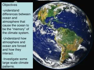
Objectives understand differences between ocean and atmosphere that cause the ocean to be the “memory” of the climate system. Understand how atmosphere and ocean are forced and how they interact. Investigate some large scale climate patterns. Outline:

E N D
Objectives • understand differences between ocean and atmosphere that cause the ocean to be the “memory” of the climate system. • Understand how atmosphere and ocean are forced and how they interact. • Investigate some large scale climate patterns.
Outline: • Differences between ocean and atmosphere. • Density-timescales • Forcing • Equations of motion. • F=ma • Purpose of each term • How do ocean and atmosphere interact? • Heat • Momentum • Weather patterns • Short term • Decadal
12 km 6.3 km 6300 km Relative thicknesses of earth, ocean and troposphere (lower atmosphere). Consequence: Ocean and atmosphere motions are mostly 2-dimensional.
How do ocean and atmosphere differ? - density and energy content Energy = mass x heat capacity x temperature (broadly) Heat capacity of air ~ 1000 J/kg deg K Density of air ~ 1.2 kg/m3 at sea level Heat capacity of water ~ 4000 J/kg deg K Density of water is 1000 kg/m3 So, 1 meter of water has roughly as much stored energy as the whole lower atmosphere (troposphere) Consequences: -ocean slower, more massive, has longer timescales (more “memory”).
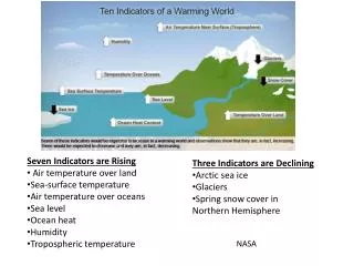
Solar radiation is greatest at the equator, and smaller at the poles. Blue dashed line is outgoing radiation, red line is incoming radiation. So why aren’t tropics getting steadily hotter and poles steadily colder? Consequence: Ocean and atmosphere motions are driven by thermal gradient (difference between Tequator and Tpole).
Key Point: little incoming radiation absorbed by atmosphere. Consequence: Ocean is heated from above, Atmosphere is heated from below. Ocean is more stable than the atmosphere.
Sources of energy to ocean and atmosphere. Heat from: sun (shortwave), evaporation and precipitation (latent), conduction (sensible), emission (longwave) Freshwater: precipitation and evaporation Momentum: winds
Consequences: The only external input here is solar radiation. Otherwise, the interaction between ocean and atmosphere occurs as a system. What is lost by one component is gained by the other (or by the land surface or cryosphere).
Outline: • Differences between ocean and atmosphere. • Density-timescales • Forcing • Equations of motion. • F=ma • Purpose of each term • How do ocean and atmosphere interact? • Heat • Momentum • Weather patterns • Short term • Decadal • Long term
How do we predict motions in the ocean and atmosphere? From F=ma Or a=F/m
a F/m Pressure from earth’s rotation and unequal heating F/m Wind F/m Friction Conservation of mass
Outline: • Differences between ocean and atmosphere. • Density-timescales • Forcing • Equations of motion. • F=ma • Purpose of each term • How do ocean and atmosphere interact? • Momentum • Heat • Weather patterns • Short term • Decadal • Long term
Easterlies Surface winds Westerlies Trades
Wind - Driven circulation Consequences: In a perfect stable world, oceans would only carry heat within the gyres, not between them.
Consequences: What we observe rarely looks like the “mean” picture described. Ocean and atmosphere are turbulent and hard to predict.
Buoyancy/Stratification: (Thermal and freshwater forcing) Ideal gas law PV=nRT… And density = mass/volume if you keep all constant then, T -> V but P -> T Also, as S -> So warm water rises, cold water sinks And fresh water rises, salty water sinks,
Density (or temperature) from South to North - pycnocline or thermocline = maximum upper ocean density or temperature gradient.
Consequences: Cold water made at poles encircles the globe, gradually upwelling to the surface. This also occurs at mid-latitudes. (Storing surface conditions for ~ 500 years)
Outline: • Differences between ocean and atmosphere. • Density-timescales • Forcing • Equations of motion. • F=ma • Purpose of each term • How do ocean and atmosphere interact? • Momentum • Heat • Weather patterns • Short term • Decadal • Long term
http://www.thecoolroom.org/education/upwelling.htm Coastal upwelling Consequence: Relatively short changes in wind (several days), drive large ocean changes that affect ecosystems down to physics. Feedbacks!
Maximum Tuna Catch 1995 1994 1993 >29C 29C 1992 <29C 1991 1990 1989 1988 120E 160E 160W 120W 29C (84F) Surface water A11.008 STAAC2
Sea Surface Chlorophyl La Niña Oct., 1983 El Niño Oct., 1997
North American climate anomalies during warm phase PDO October-March air temperature anomalies Above average winter and spring Temperatures in Northwestern North America, below average temperatures In the southeastern US. Above average winter and spring Rainfall in the southern US and Northern Mexico, below average Precipitation in the interior Pacific Northwest and Great lake regions. DJF Precipitation Anomalies
Table 1: summary of North American climate anomalies associated with extreme phases of the PDO. climate anomalies Warm Phase PDO Cool Phase PDO Ocean surface temperatures in the northeastern and tropical Pacific Above average Below average October-March northwestern North American air temperatures above average Below average October-March Southeastern US air temperatures below average Above average October-March southern US/Northern Mexico precipitation Above average Below average October-March Northwestern North America and Great Lakes precipitation Below average Above average Northwestern North American spring time snow pack below average Above average Winter and spring time flood risk in the Pacific Northwest Below average Above average
Beginning of a cold PDO phase in 1999 TOPEX/Poseidon satellite measures the sea surface height. The image shows a horsehoe of higher than (warm) water in the western Pacific (red and white) and lower than average (cool) blue and purple water in the eastern Pacific.
Impact of PDO on west-coast ecosystem productivity Warm PDO phase: enhanced coastal ocean productivity in Alaska but inhibited productivity in Washington and Oregon. Cold PDO phase: reversed fortune. Quotes from News: August/September 1972 (Pacific Fisherman) “Bristol Bay (Alaska) salmon run a disaster” “Gillnetters in the lower Columbia received an unexpected bonus when the largest run of spring chinook since counting began in 1938 entered the river.” 1995 Yearbook (Pacific Fishing) “Alaska set a new record for its salmon harvest in 1994, breaking the record set the year before” “ Columbia spring chinook fishery shut down; west coast troll coho fishing around.
Positive NAO Index * The Positive NAO index phase shows a stronger than usual subtropical high pressure center and a deeper than normal Icelandic low. * The increased pressure difference results in more and stronger winter storms crossing the Atlantic Ocean on a more northerly track. * This results in warm and wet winters in Europe and in cold and dry winters in northern Canada and Greenland * The eastern US experiences mild and wet winter conditions
Negative NAO Index * The negative NAO index phase shows a weak subtropical high and a weak Icelandic low. * The reduced pressure gradient results in fewer and weaker winter storms crossing on a more west-east pathway. * They bring moist air into the Mediterranean and cold air to northern Europe * The US east coast experiences more cold air outbreaks and hence snowy weather conditions. * Greenland, however, will have milder winter temperatures source http://www.ldeo.columbia.edu/NAO by Martin Visbeck
The NAO index is defined as the anomalous difference between the polar low and the subtropical high during the winter season (December through March) How Measured Instrumented records are limited in their ability to examine decadal to centennial scale climate variability. Paleo proxies, including tree rings, ice cores and corals, are now being used in an effort to determine the climate dynamics and forces involved.