Download
1 / 29
310 likes | 446 Views
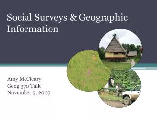
Social Surveys & Geographic Information. Amy McCleary Geog 370 Talk November 5, 2007. What is a social survey?. A research instrument that consists of a series of questions for the purpose of gathering information about some aspect of one’s social life. . Purpose of Social Survey.

E N D
Social Surveys & Geographic Information Amy McCleary Geog 370 Talk November 5, 2007
What is a social survey? • A research instrument that consists of a series of questions for the purpose of gathering information about some aspect of one’s social life.
Purpose of Social Survey • Findings are used to help researchers, the government, or special-interest groups to understand people’s habits, beliefs, experiences, behaviors, etc. • For example: integrate population information and data on the environment to define an emergency response plan. • Who will be affected if a river floods? • How will people be evacuated?
Social Survey Examples American Community Survey Similar to the questions on the US Census, but fills in information in the 10 year period between the Census for a sample of the population. Resident Relocation Survey Reports on the relocation experiences of current and former residents of public housing developments. National Longitudinal Survey of Youth Addresses key questions about the economic, social, and academic experiences of respondents and issues about youth entry into the work force.
Social Survey Taking A survey instrument is designed. The survey instrument is pre-tested. How well did people respond? Did they understand the questions? Should anything be added to the survey? The survey instrument is then refined.
Social Survey Taking The survey is administered to the target group. Phone Internet Mail In person (home, office, public) The data are collected/tabulated in some meaningful way for analysis. Database Spreadsheet
Social Survey Analysis The data are analyzed in some way that is appropriate for the purpose of the survey. Statistical analysis (SAS, STATA). Spatial analysis. Modeling. The survey results are distributed. Tables, figures, reports. If longitudinal, the survey may be administered again in the future.
Creating Spatial Data Linking to GPS points or other types of existing spatial data. Existing shapefiles or CAD drawings Geocoding results of survey. Addresses Zipcode Region Using satellite imagery to determine geographic location.
Results Additional research. Questions Hypotheses Surveys Direct application. Decisions on policies, programs, & services Social programs Public action
Issues to Consider Privacy & protection of private information. IRB HIPPA Federal guidelines Compensation (monetary or otherwise). Cultural issues & taboos. Language barriers.
Peruvian Amazon Project • Study of seasonal land use/land cover change. • Pre-tested household survey (2004). • Focus on access to resources and to local communities.
Ecuador Project Study of population and land use/land cover change. Northern Ecuadorian Amazon. Surveys in 1990, 1999, 2000, & 2001.
Survey Locations 65 Communities. 5 Indigenous groups in 26 communities. 767 households on 405 farms.
Lago Agrio Puerto Bolivar
Ikonos Image & Survey Farms Road Farm House
Linking satellite imagery to GPS locations. • Farmers provided sketch maps of farms. • Farm data also derived from satellite data.
Nang Rong, Thailand Project Study of demographic, social, and environmental change. Nang Rong District, Northern Thailand. Data collection over the past 20 years.
Survey Locations • 1984: • 5,860 households in 51 villages. • 1994-95: • 7,331 households in 76 villages, plus 310 communities. • 2000: • 8,638 household in 92 villages.
Cadastral & Household Links Village Center Homes Farms or Parcels