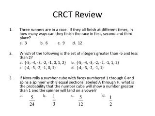
CRCT MAP REVIEW
CRCT MAP REVIEW. St. Lawrence River is #______?. 2. 1. 4. 3. Hudson Bay is #______?. 2. 1. 4. 3. What physical feature is # 2?. A: North Canadian Plains B: Canadian Shield C: The Great American Plains D: Quebec Plains. 1. 2. 4. 3. The circled feature is the_____.

CRCT MAP REVIEW
E N D
Presentation Transcript
St. Lawrence River is #______? 2 1 4 3
Hudson Bay is #______? 2 1 4 3
What physical feature is # 2? A: North Canadian Plains B: Canadian Shield C: The Great American Plains D: Quebec Plains 1 2 4 3
The circled feature is the_____ • Iberian Peninsula • Scandinavian Peninsula • Italian Peninsula • European Peninsula
The arrow is most likely pointing to the ______ • Iberian Peninsula • North European Plain • Italian Plain • North English Plain
The arrow is most likely pointing to the _______ • Iberian Peninsula • Alps Mountains • Ural Mountains • Pyrenees Mountains
The circled feature is the_____ • Iberian Peninsula • Scandinavian Peninsula • Italian Peninsula • European Peninsula
The arrow is most likely pointing to the • Iberian Peninsula • Alps Mountains • Ural Mountains • Pyrenees Mountains
The arrow is most likely pointing to the • Iberian Peninsula • Alps Mountains • Ural Mountains • Pyrenees Mountains
The country marked #4 is • Russia • Ukraine • France • Spain 3 4 2 1
The country marked # 3 is • Russia • Ukraine • Germany • Poland 3 4 2 1
The country marked #2 is • Germany • Ukraine • France • Spain 3 2 4 1
The country marked # 3 is • Russia • Ukraine • Austria • Italy 4 3 1 2
The country marked # 2 is • Russia • Ukraine • Austria • Italy 4 3 1 2
Which physical feature can be found near # 2? • Danube River • Mediterranean Sea • Rhine River • Mediterranean River 4 3 1 2
The arrow is pointing to the country of ______ • Cuba • Haiti • Bolivia • Puerto Rico
The physical feature marked on the map is most likely the_______ • Danube River • Mediterranean Sea • Rhine River • Mediterranean River
The country marked #1 is ____ • France • Belgium • Spain • Austria 1 4 3 2
Ayer’s Rock is #_____ 1 5 3 2 4
The Great Victoria Desert is #_____ 1 5 3 2 4
The Coral Sea is #_____ 1 5 3 2 4
The Great Barrier Reef is #_____ 1 5 3 2 4
The arrow is pointing to the country of ______ • Cuba • Haiti • Bolivia • Puerto Rico
The arrow most likely points to this physical feature • Panama River • Panama • Panama Canal • Caribbean Sea
The arrow is pointing to the country of ______ • Panama • Peru • Bolivia • Brazil
The arrow is pointing to the country of ______ • Panama • Venezuela • Bolivia • Colombia
The arrow is pointing to the country of ______ • Panama • Venezuela • Bolivia • Colombia
The arrow is most likely pointing to this physical feature______ • The Atacama Desert • The Andes Mountains • The Andes Desert • Chile
The shaded area is most likely the _______ • Arid Desert • Atacama Desert • Andes Desert • Chili
The shaded area is most likely the ______ • Hudson Bay • Gulf Bay • Gulf of Mexico • Caribbean Sea