Definitions
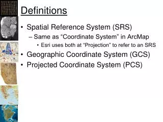
Definitions. Spatial Reference System (SRS) Same as “Coordinate System” in ArcMap Esri uses both at “Projection” to refer to an SRS Geographic Coordinate System (GCS) Projected Coordinate System (PCS). Definitions. Datum – shape of the earth Typically contains a Spheroid

Definitions
E N D
Presentation Transcript
Definitions • Spatial Reference System (SRS) • Same as “Coordinate System” in ArcMap • Esri uses both at “Projection” to refer to an SRS • Geographic Coordinate System (GCS) • Projected Coordinate System (PCS)
Definitions • Datum – shape of the earth • Typically contains a Spheroid • Coordinate System • Cartesian or Rectangular • Spherical (Geographic) • Projection – How to convert 3D to 2D • Geographic or Un-projected • UTM • State Plane
Major Axis Minor Axis Inverse Flattening = Semi-Major Axis/ (Semi-Major Axis – Semi-Minor Axis)
East-West Datum Shift GIS Fundamentals, Paul Bolstad, University of Minnesota
ArcGIS Datum Shifts • Picture of ArcGIS with geographic transform menu
Selecting a Datum Shift • Link ArcGIS’s website • http://blogs.esri.com/esri/arcgis/2009/05/06/about-geographic-transformations-and-how-to-choose-the-right-one/ • Article with tables to select datum shift for each version of ArcGIS: • http://support.esri.com/en/knowledgebase/techarticles/detail/21327 • Jim’s Research Group Website: • http://seer.science.oregonstate.edu/cwis438/Websites/EPSG/EPSG_Home.php
ArcGIS PRJ Files • Contain the SRS’s for defining and projecting data • Program Files • ArcGIS • Desktop 10.0 • Coordinate Systems • Geographic Coordinate Systems • Projected Coordinate Systems • Vertical Coordinate Systems
WGS 1984 PRJ File Contents GEOGCS["GCS_WGS_1984", DATUM["D_WGS_1984", SPHEROID["WGS_1984", 6378137.0, 298.257223563 ] ], PRIMEM["Greenwich",0.0], UNIT["Degree",0.0174532925199433], AUTHORITY["EPSG",4326] ]
Natural Earth: PRJ File • GEOGCS["GCS_WGS_1984", • DATUM["D_WGS_1984", • SPHEROID["WGS_1984", • 6378137.0,298.257223563]], • PRIMEM["Greenwich",0.0], • UNIT["Degree",0.0174532925199433]] http://docs.geotools.org/stable/javadocs/org/opengis/referencing/doc-files/WKT.html
Projected Coordinate Systems • Continental • North America • North America Albers Equal Area Conic • North America Lambert Conformal Conic • State Plane • NAD 1927 (US Feet) • NAD 1983 (Meters) • UTM • World • World (Sphere-based)
Oregon State Plane North • PROJCS["NAD_1927_StatePlane_Oregon_North_FIPS_3601", • GEOGCS["GCS_North_American_1927", • DATUM["D_North_American_1927", • SPHEROID["Clarke_1866",6378206.4,294.9786982]], • PRIMEM["Greenwich",0.0], • UNIT["Degree",0.0174532925199433]], • (continued on next slide)
Oregon State Plane North • Continued from previous slide: • PROJECTION["Lambert_Conformal_Conic"], • PARAMETER["False_Easting",2000000.0], • PARAMETER["False_Northing",0.0], • PARAMETER["Central_Meridian",-120.5], • PARAMETER["Standard_Parallel_1",44.33333333333334], • PARAMETER["Standard_Parallel_2",46.0], • PARAMETER["Latitude_Of_Origin",43.66666666666666], • UNIT["Foot_US",0.3048006096012192]]
Robinson (world) PROJCS["World_Robinson", GEOGCS["GCS_WGS_1984",…], PROJECTION["Robinson"], PARAMETER["False_Easting",0.0], PARAMETER["False_Northing",0.0], PARAMETER["Central_Meridian",0.0], UNIT["Meter",1.0], AUTHORITY["ESRI",54030]]
Projected Coordinate Systems • UTM • WGS 1984 • Northern Hemisphere • WGS 1984 UTM Zone 1N to 60N • Southern Hemisphere • WGS 1984 UTM Zone 1S to 60N • NAD 1983 • NAD 1983 UTM Zone 1N to 60N
UTM, Zone 10 North PROJCS["WGS_1984_UTM_Zone_10N", GEOGCS["GCS_WGS_1984”,…], PROJECTION["Transverse_Mercator"], PARAMETER["False_Easting",500000.0], PARAMETER["False_Northing",0.0], PARAMETER["Central_Meridian",-123.0], PARAMETER["Scale_Factor",0.9996], PARAMETER["Latitude_Of_Origin",0.0], UNIT["Meter",1.0], AUTHORITY["EPSG",32610]]
Reference System Standards • European Petroleum Standards Group • EPSG • Well Known Text Form • WKT • Arc “projection” files • PRJ (contains entire SRS) • Proj 4 • Projects and performs datum shifts
Geographic/Datum Transforms • International Association of Oil and Gas Producers: • European Petroleum Survey Group (EPSG) • http://www.epsg.org/ • 53 Ellipsoids • 630 Datums (Ellipsoid plus prime meridian and units)