Automated Road Geometry Extraction Using Active Contours from LiDAR Data
This research explores an innovative method for extracting road geometry using mobile mapping technology and active contours, also known as snakes, based on the work of Kass et al. (1988). By initializing snake contours over point cloud data gained from a mobile mapping system, we employ internal energy terms related to curve properties and external energy derived from LiDAR attributes to identify road features. This automated approach aims to facilitate efficient road geometry calculations, significantly impacting road safety and maintenance.

Automated Road Geometry Extraction Using Active Contours from LiDAR Data
E N D
Presentation Transcript
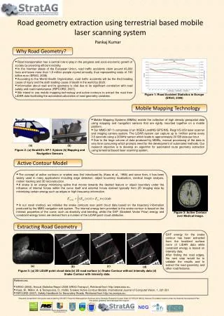
The concept of active contours or snakes was first introduced by (Kass et al., 1988) and since then, it has been widely used in many applications including edge detection, object boundary localisation, medical image analysis, motion tracking and 3D reconstruction. • A snake is an energy minimizing spline that moves towards the desired feature or object boundary under the influence of internal forces within the curve itself and external forces derived typically from 2D imaging data by minimizing certain energy such as edges or high frequency information. • In our novel method, we initialise the snake contours over point cloud data based on the trajectory information produced by the MMS navigation sub-system. The internal energy term provided to the snake contour is based on the intrinsic properties of the curve, such as elasticity and bending, whilst the GVF (Gradient Vector Flow) energy and constraint energy terms are derived from a number of the LiDAR point cloud attributes. Road geometry extraction using terrestrial based mobile laser scanning system Pankaj Kumar Why Road Geometry? • Road transportation has a central role to play in the progress and socio-economic growth of society by providing efficient mobility. • In the member states of the European Union, road traffic accidents claim around 43,000 lives and leave more than 1.8 million people injured annually, thus representing costs of 160 billion euro (ERSO, 2008). • According to the World Health Organization, road traffic accidents will be the third leading cause of injury and the sixth leading cause of death in the world by 2020. • Information about road and its geometry is vital due to its significant correlation with road safety and road maintenance (RIPCORD, 2007). • We intend to use mobile mapping technology and active contours to extract the road from LiDAR data facilitating the automated calculation of road geometry variables. Figure 1: Road Accident Statistics in Europe (ERSO, 2008) Mobile Mapping Technology • Mobile Mapping Systems (MMSs) enable the collection of high density geospatial data using mapping and navigation sensors that are rigidly mounted together on a mobile platform. • Our MMS (XP-1) comprises of an IXSEA LandINS GPS/INS, Riegl VQ-250 laser scanner and imaging camera system. The LiDAR system can capture up to 1million points every 3.5 seconds using a 300kHz sensor which leads to approximately 20 GB data per hour. • Due to the large volume of data produced by MMSs, manual processing of the data is very time consuming which prompts need for the development of automated methods. Our research objective is to develop an algorithm for automated route geometry extraction using terrestrial based laser scanning system. (a) (b) Figure 2: (a) StratAG’s XP-1 System (b) Mapping and Navigation Sensors Active Contour Model Figure 3: Active Contour over Medical Image. Extracting Road Geometry GVF energy for the snake contour has been extracted from the localized surface norm of LiDAR data while constraint energy is based on intensity data. After finding the road edges, the next step would be to validate the results and to extract the road geometry and other road features. (a) (c) (b) (d) Figure 3: (a) 3D LiDAR point cloud data (b) 2D road surface (c) Snake Contour without intensity data (d) Snake Contour with intensity data. References: • ERSO (2008). Annual Statistics Report 2008: ERSO.Transport. Retrieved from http://www.erso.eu. • Kass, M., Witkin. A. & Terzopoulos, D. (1988). Snakes: Active Contour Models. International Journal of Computer Vision, 1, 321-331. • RIPCORD (2007). Safety Handbook for Secondary Roads. Retrieved from http://ec.europa.eu. Research presented in this poster was funded by IRCSET, Pavement Management Services and a Strategic Research Cluster Grant (07/SRC/I1168) by Science Foundation Ireland under the National Development Plan. The author gratefully acknowledges this support.