Modernizing Hydro Survey Charts: A Comprehensive GIS Approach for Enhanced Data Management
150 likes | 273 Views
This document outlines the modernization of hydro survey charts using a modernized GIS approach. It discusses the history of chart development, previous CADD techniques, and the 2009 GIS approach aimed at improving data automation. The new methodology enhances data processing, integrates advanced data management with centralized geodatabases, and includes collaborative efforts from multiple agencies. Improved cartographic techniques ensure accurate presentation of nautical data. This modernization is essential for efficient navigation and environmental management, harnessing technological advancements for superior chart production.

Modernizing Hydro Survey Charts: A Comprehensive GIS Approach for Enhanced Data Management
E N D
Presentation Transcript
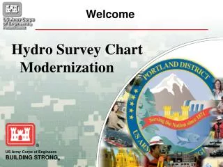
Hydro Survey Chart Modernization Welcome
History • CADD Approach • 2009 GIS Approach • New GIS (Geographic Information Systems) Approach • Introduction • The New Process • Chart Presentation Hydro Survey Chart Modernization
History – CADD Approach • Existing Process • Terramodel for processing and Contours, Labels, Hatching • MicroStation for Review and Plotting • Plotted for Visual Inspection of All Features • Channel Status Sounding Labels “Eyeballed” • Charts were a “stand-alone” Product • Different Units • Different Data
History – 2009 GIS Approach • 2009 Approach tried to Eliminate Operator Input • ESRI’s Model Builder Touted as Robust • Used Automatically Updated Data (IE: Imagery, Buoys) • Used Automated Processes (IE: Labeling) • Advantage - Great in Theory! No Operator Input, Automated Data • Disadvantage - Relied on Others (Network, Data Stewards), Slow • Positive Results - Procedural Improvements, Carto, RD&E
New GIS Approach • Improve 2009 Methodology • Apply New Methodology to All Charts • ARRA Funded NCDB Team Provided Invaluable Support • Accomplished Using Two Parallel Tasks • Data Processing • Simultaneous Evaluation of ModelBuilder & Python • Extensive Data Manipulation & Business Process Improvements Required • Each step of process with OD-NWH Oversight and QA/QC • Cartography • Each Chart being Created in GIS with OD-NWH Oversight and QA/QC • Costliest part of Process – Also Most Visible (Product for Public) • Replicate Existing Chart Features Using New Storage Technique (GDB)
New GIS Approach Geodatabase is a GIS Data Storage Type • Hydrographic Survey Geodatabase Improves Chart Performance by Directing all Data • to One Central Repository • Independent from other Corps GIS Databases • Data Updates can Easily Replace Existing/Old Data Displayed on Charts
New GIS Approach USACE Data Verification Process • Creation of GIS Data Sets Allowed for Analysis of Existing NWP Data • OD-NWH Approved GIS Data Include: • Federal Navigation Channel Framework • River Miles • Horizontal Control Points • Dredged Material Placement Areas
New GIS Approach Multi-Agency Data Usage • Allows for Standardization of Data and Symbols • Allows for Periodic Updating of Features on Charts • Removes Duplication of Efforts to Collect Data • NOAA Electronic Navigation Charts (ENC’s) Data • USDA/FSA 2009 NAIP (National Agriculture Imagery Program) Aerial Imagery • USGS National Hydrography Dataset (NHD)
New GIS Approach Cartography Data Processing GDB Channel Geometry & Data .XYZ Files .DAT Files, CAD Contours, Channel Status Numbers GDB XYZ Points, Contour Lines, Shoaling Polys
GIS Chart Presentation Inset Maps Title, Scale Bar & Notation