Download
1 / 27
290 likes | 457 Views
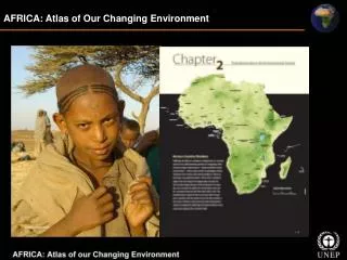
AFRICA: Atlas of Our Changing Environment. Transboundary Environmental Issues. Transboundary Ecosystems and Protected Areas The Congo Basin Forests Maasai Mara – Serengeti Protected Areas in East Africa W-Arly-Pendjari Parks Complex The Great Limpopo Transfrontier Park

E N D
Transboundary Environmental Issues • Transboundary Ecosystems and Protected Areas • The Congo Basin Forests • Maasai Mara – Serengeti Protected Areas in East Africa • W-Arly-Pendjari Parks Complex • The Great Limpopo Transfrontier Park • Mountain Gorilla Conservation in the Virunga Heartland • Southern Sudan: A Survival Surprise • Transboundary Water Resources • Lake Victoria • Lake Chad • Okavango • Transboundary Movement of People • Dadaab Refugee Camp • The Parrot’s Beak Region • Darfur Conflict • Transboundary Movement of Pollutants • Dust storms • Aerosols • Fires • Carbon monoxide pollution
Transboundary Environmental Issues Transboundary Ecosystems and Protected Areas Transboundary Water Resources Transboundary Movement of People Transboundary Movement of Pollutants Between 1990 and 2004 a few African countries expanded their protected area networks, furthering their progress towards the MDG target There are 15 principal lakes, 24 main watersheds and 38 aquifer systems that cross the political boundaries of two or more countries in Africa Africa is one the world’s largest dust-producing regions and the Bodélé Depression is one of its largest sources of airborne dust UNHCR estimates that there were 2.4 million refugees in Africa at the end of 2006
Major migratory bird routes of the world Transboundary Environmental Issues Migratory birds and other migratory animals are a significant component of transboundary environmental resources The map below illustrates global migratory bird routes and shows that Africa has the highest concentration of such routes
The Congo Basin Forests Congo Basin forests form a transboundary ecosystem shared by Cameroon, Central African Republic, Republic of Congo, Equatorial Guinea, Gabon, and Democratic Republic of the Congo • About 60 per cent of the total forest area in the Congo Basin is considered to be industrially exploitable • The transboundary nature of this ecosystem calls for a multinational approach for the conservation and sustainable use of its resources
Maasai Mara – Serengeti Protected Areas in East Africa Kenya’s Maasai Mara Game Reserve and United Republic of Tanzania’s Serengeti National Park are two neighboring transboundary protected areas Every year, herds of wildebeest, zebra, and other herbivores migrate between the Serengeti National Park in Tanzania and the Maasai Mara Game Reserve in Kenya. A pair of images comparing green vegetation in 2005 to the parched, brown landscape in 2006
The W-Arly-Pendjari (WAP) Parks Complex straddles the countries of Benin, Burkina Faso, and Niger, and is one of the largest contiguous protected areas in Africa W-Arly-Pendjari Parks Complex & The Great Limpopo Transfrontier Park The Great Limpopo Transfrontier Park (GLTP) is Africa’s largest transboundary protected area that spreads through Mozambique, South Africa and Zimbabwe
Mountain Gorilla Conservation in the Virunga Heartland Southern Sudan: A Survival Surprise The first aerial survey of southern Sudan in 25 years revealed that vast migrating herds have managed to survive over 20 years of civil war The Virunga Heartland in the central Albertine Rift region of east-central Africa spans the borders of Democratic Republic of the Congo, Rwanda, and Uganda Transboundary Ecosystems and Protected Areas
Transboundary Water Resources • Transboundary Water Resources • Lake Victoria: Africa’s Largest Freshwater Lake • Lake Chad: Africa’s Shrinking Lake • Okavango: The World’s Largest Inland Delta
Lake Victoria: Africa’s Largest Freshwater Lake • Since December 2005, water levels dropped to alarmingly low levels • Current water levels in Lake Victoria are below normal and the lowest level since September 1961 • The lake is a crucial resource to the more than 30 million people • Lake area is the most densely populated rural region in the world
Water Hyacinth in Lake Victoria These images show water hyacinth infestation and control of such invasive species • 1995: Image shows several water-hyacinth-choked bays (yellow arrows) • 2001: A visible reduction of Water Hyacinth on Lake Victoria
Lake Victoria: Population Growth • The population growth around 100 km buffer zone of the Lake Victoria • Population growth around Lake Victoria, East Africa, is the highest in Africa
17 Dec 2005 18 Dec 2006 Lake Victoria’s Winam Gulf Winam Gulf is a large arm of Lake Victoria that extends east into Kenya This images show increased siltation and suspended sediments in the Winam Gulf waters between 8 March 1986 and 5 February 2001 water hyacinth Images showing water hyacinth choked bays
Transboundary Water Resources Lake Victoria: Africa’s Largest Freshwater Lake Lake Victoria is world’s fastest growing rural area Population growth around Lake Victoria vs. Africa Persons/km2
Lake Chad: Africa’s Shrinking Lake Lake Chad drainage basin The Lake Chad drainage basin, a 2 500 000 km² hydrologically closed catchment, extends to eight countries: Algeria, Libyan Arab Jamahiriya, Niger, Chad, Sudan, Central African Republic, Cameroon, and Nigeria Shrinking of Lake Chad
Lake Chad: Africa’s Shrinking Lake Persistent droughts and increased agricultural irrigation have reduced the lake’s extent in the past 35 years to one-tenth of its former size • 1972: Larger lake surface area is visible in this image • 2001: Impact of drought displays a shrunken lake, comparatively much smaller surface area than in 1972 image • The 2007 image shows significant improvement over previous years
Okavango: The World’s Largest Inland Delta Map of the catchment area of the Okavango Delta The map shows the percentage of time between 1985 and 2000 that areas of the delta were inundated Dark blue areas indicate permanently inundated regions while lighter blue to white areas represent less inundation time The Okavango Delta (or Okavango Swamp) is a globally renowned Ramsar Wetland Site and the world’s largest inland delta
Dadaab Refugee Camp Ifo, Dagahaley, and Hagadera refugee camps are located in Dadaab town in the North Eastern Province of Kenya, near the border with Somalia Dagahaley Camp 1987: Shows a fairly intact landscape dominated by shrub vegetation that is characteristic of the semiarid area Ifo Camp 2000: The Ifo, Dagahaley, and Hagadera refugee camps stand out distinctly, revealing the presence and impact of a high concentration of over 100 000 refugees on the environment Hagadera Camp
The Parrot’s Beak Region “Parrot’s Beak” is a small strip of land belonging to Guinea situated between Sierra Leone and Liberia 1974: Prior to the influx of refugees small flecks of light green scattered throughout the deep-green forest of the Parrot’s Beak region represent compounds of villages surrounded by agricultural plots 2002: Contrast this with the light green colour which is the result of deforestation where refugees have settled
2006 2004 Darfur Conflict Bir Kedouas is a two square kilometre settlement within Chad, just west of Sudan’s Darfur region Changes in Bir Kedouas, Chad, between 2004 and 2006 Glimpses of the camp area
Bodele Depression Dust storms in the Bodele Depression Based on satellite data and computer models, scientists estimate that Saharan dust storms generate an average of about 0.7 million metric tonnes of dust during winter days 02 Jan 2007
Aerosol Optical Depth • This image shows the annual mean aerosol optical depth for 2006 • Gray zones on the map represent areas were aerosol data could not be collected
Fires Seasonal Pattern of Wildland Fires This series of images shows the seasonal pattern of wildland fires in Africa during 2005 This image shows the global distribution of fires, represented by red dots. Fire distribution in Africa indicates the highest biomass burning in the world (images based on night-time measurements).
Smoke Spreading From Greece to Africa 26 Aug 2007 Fires burning in southwestern Greece in August 2007 released aerosols that winds carried to Africa This 2007 image shows actively burning fires in red—a line of fires stretches along the western coast of Greece’s Peloponnesus Peninsula
Jul, Aug, Sep (2000 – 2004) Jan, Feb, Mar (2000 – 2004) Apr, May, Jun (2000 – 2004) Oct, Nov, Dec (2000 – 2004) Carbon monoxide pollution This series of images shows a record of global CO production from January 2000 through December 2004
A global map of nitrogen dioxide (NO2) in the troposphere in 2003 • Image shows the locations of high levels of nitrogen dioxide worldwide • High concentrations of NO2 tend to be associated with large urban or industrial Areas • In Africa, NO2 concentrations are particularly high over coal-fired power stations in South Africa • Lower, but widespread, concentrations of the gas—produced by biomass
Thank You! For more information and free download go to: http://www.na.unep.net/AfricaAtlas/ To purchase go to: http://www.earthprint.com/