Download
1 / 72
730 likes | 919 Views
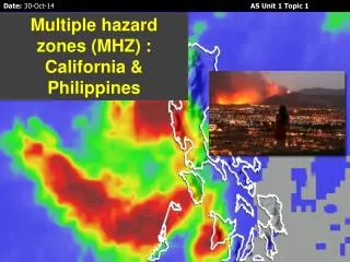
Multiple hazard zones (MHZ) : California & Philippines. Aims To identify and define hazard hotspots. To understand the issues regarding managing MHZs. To look at the hazards in California, their effects and how they are being managed.

E N D
Multiple hazard zones (MHZ) : California & Philippines
Aims To identify and define hazard hotspots. To understand the issues regarding managing MHZs. To look at the hazards in California, their effects and how they are being managed. To consider the hazards affecting the Philippines, their effects and management. To look at the links between the two case studies
Multiple Hazard Zones or ‘Hotspots’ – a greater challenge? What are multiple hazard zones or hotspots? • Traditionally multiple hazard zones (MHZs) are considered to be regions or parts of the world that are exposed to a range of hazards (often a combination of meteorological, climatic and geomorphic impacts). • These are not only at the country level, but also within a country.
In 2001 the World Bank and Columbia University began to try to identify disaster hotspots. • They looked at risk in terms of 6 natural hazards (volcanoes, earthquakes, landslides, floods, drought and storms). • Historical data (from 30 years) was combined with potential vulnerability based on size, density and poverty of the population(as measures of mortality) and GDP per unity area (as a measure of potential economic damage).
Identifying the hotspots has huge implications for the development, investment planning, disaster preparation and loss prevention. • However many countries that are hazard prone have priorities that come before risk management, such as poverty management and fighting HIV/AIDS. They may not be able to afford the technology to cope with multiple hazards. • We will consider in detail: California and the Philippines.
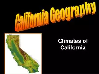
Compulsory Case Study 1 – The Californian Coast • The state of California has approx. 40 million people and has an economy the size of a high income country! • 25 Californian counties have per capita incomes of US$ 65,000 pa – so it is one of the world’s wealthiest places! • But this means that a disaster may comprise high financial losses. • It is home to the megacities of Los Angeles, San Diego and San Francisco.
Only sophisticated management prevents California from becoming a disaster zone (in terms of mortality). • NB prediction of earthquake activity is not possible even with technology. • Parts of the population are vulnerable - around 20% of the residents in Los Angeles live below the official poverty line. These people have the lowest capacity to cope when affected by a hazard.California also has 3.5 million people (many semi-legal migrants) who live in hazardous locations.
Geophysical hazards: Earthquakes • The San Andreas fault (part of a broader fault zone) marks a conservative plate boundary where two coastal plates slide past each other, parallel to the plate margin at differential speeds. • More than 70% of California’s population live within 50km of a fault line. • An earthquake of Richter Scale 7 or above would have massive impacts. • The soft basin sediments in LA lead to rapid shaking with 5 major earthquakes being recorded in the last 100 years. • Earthquakes are shallow and so more destructive. • San Francisco Bay has experience several large earthquakes too.
There is a lot of building on unstable land – this can lead to soil liquefaction during earthquakes (where the ground can become more like a liquid), which damages buildings and increases the risk of landslides. • This was a major problem during the Loma Prieta earthquake in 1989.
Studies of their frequency and magnitude of past earthquakes show that there is a good chance of an earthquake of magnitude 7.0+ hitting the San Francisco Bay area before 2025.
California Earthquakes P 28 photocopy Oxford • The 1989 Loma Prieta earthquake in San Francisco • The 1994 Northridge earthquake in LA • A)What were the causes of these earthquakes? • B)What were the effects of these earthquakes? • C)How are the people of California dealing with the threat of earthquakes?
Volcanoes • There hasn’t been a volcanic eruption in California since 1915 (Lassen Peak) • But there are volcanoes being monitored for potential eruptions, e.g. Lassen Peak, Mount Shasta, and the volcanoes around Mammoth Lakes.
Tsunamis • A tsunami is a series of large waves that can flood coastal areas and they can be caused by earthquakes on the sea bed, or landslides into the sea. • Earthquakes under the Pacific Ocean could cause a tsunami along the California coastline. • An earthquake off the coast of Alaska in 1964 caused a tsunami to strike the coast of northern California, killing 12 people in Crescent City.
Hydro-meteorological hazards in California River flooding • El Niño La Niña oscillation: winter storms, especially during El Nino years lead to floods in the Los Angeles and San Gabriel rivers (with deforested hill sides). • Even though rivers are now heavily channelised floods can still take place (mainly between October and January)
Coastal flooding • Risk of erosion along coast near Malibu and Santa Monica . • Also the area around Long Beach is subsiding and sometimes floods in heavy storms. • The impacts are likely to worsen as sea levels rise in the future.
Drought • Summer drought is a potential problem in a Mediterranean climate, especially in Southern California. • Droughts in California can be caused by anticyclones (long-lasting periods of high air pressure with sinking, dry air. Dry, sinking air means no rain • Drought can also be caused by La Nina events (periods when the surface water in the eastern Pacific Ocean is cooler). This means less evaporation, so there is less precipitation.
Another cause of drought is increased wind blowing westward from the desert areas that are east of California, e.g. Arizona. The dry air has no moisture to cause precipitation. • The problem is exacerbated as the population of LA is increasing so rapidly and there is a lack of water supply.
Wild fires/Bush fires • The most devastating effect of drought in California is wildfires – dry vegetation is extremely flammable, so fires spread quickly over wide areas • In the dry Santa Ana wind period there are more fires. • The wildfires in Southern California in October 2007 killed 22 people and destroyed 1300 homes.
As people move out of LA and San Francisco into the hills fires are likely to be an increasing problem.
Landslides/Mudslides • The risk of landslide disasters in California is high because of building on and around steep slopes, as well as building on coastal land overlooking the ocean, E.g. La Conchita. • Landslides take place in heavy winter storms where hillsides have been burnt by wildfire and eroded. • The risk is high along the coast near Malibu and Santa Monica. • It is a growing problem as the climate becomes more unpredictable in all coastal areas.
Fog/Smog • Advection fog occur when cool air from cold offshore current drifts inland and meets warm air (especially in Summer). • Climate conditions combine with car pollution to generate photochemical smog which collects in the basin. • It is especially bad in cities in late summer and autumn.
Exam Question Explain why California is considered a disaster hotspot. (15 marks).
Compulsory Case Study 2 - Philippines • The Philippines is situated South East of mainland Asia, North of Indonesia. • The country is made up of more than 7000 islands. Many are very small and difficult to reach. • Manila is the capital city and in 2007 there were 91 million people in the Philippines. • And the country was formed in 1946. • The islands are at latitudes 5–20°N of the equator.
It is one of the most disaster-prone countries in the world. • The Philippines is a hazard hotspot for a number of different reasons. • It is situated on a major plate boundary. • Its north and east coast faces the pacific (seismic and world’s greatest tsunami risk.) • A tropical monsoon climate is experienced there, and it is subject to heavy rain. • The country lies in SE Asia’s typhoon belt. • So it gets typhoons, storms, earthquakes, floods, volcanic eruptions and droughts (and more!).
The Philippines is a lower middle income country and it is developing fast. • It has a rapidly increasing young population. • Average population densities across the country are high with 240 people per sq km. • In Manila there are up to 2000 people per sq km. • Many people are very poor and are residents near the coast.
http://www.emdat.be/country-profile • Check out up to date facts for the Philippines
Tectonics of the Philippines • The dense oceanic Philippines plate is being subducted beneath Eurasian plate at a destructive plate boundary. • Creating the Manila Ocean trench. • Both volcanoes and earthquakes are occurring. • Read p 25 Oxford
Geophysical hazards: Volcanic eruptions 1900-2012 • 25 events • 2,996 killed • 1,734,907 affected • Losses of US$ 232 million EM-DAT (2012)
Mount Pinatubo eruption 1991 • P 24-25 Oxford • http://pubs.usgs.gov/fs/1997/fs113-97/
Earthquakes 1900-2012 • Events 24 • Killed 9,693 • Affected 2,543,574 • US$ 528.5 million (EM-DAT) • One earthquake in 2006 killed 15, injured 100 and damaged 800 buildings. It generated a local tsunami 3m high and triggered landslides of material from the Parker volcano into the Maughan Lake making a flood which washed away houses
Tsunamis • 1900-2012 1 event 1976 32 killed (EM – DAT) • Small locally generated waves could be problematic • The Pacific Ocean has the largest potential for tsunamis in the world