Download
1 / 45
510 likes | 798 Views
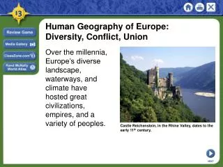
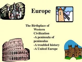
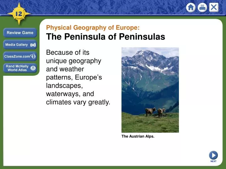
Physical Geography of Europe: The Peninsula of Peninsulas. Because of its unique geography and weather patterns, Europe’s landscapes, waterways, and climates vary greatly. The Austrian Alps. NEXT. Section 1. Landforms and Resources. • Europe is composed of many peninsulas and islands.

E N D
Physical Geography of Europe: The Peninsula of Peninsulas Because of its unique geography and weather patterns, Europe’s landscapes, waterways, and climates vary greatly. The Austrian Alps. NEXT
Section 1 Landforms and Resources • Europe is composed of many peninsulas and islands. • Europe’s landforms also include large plains and mountain ranges. NEXT
SECTION Landforms and Resources 1 Peninsulas and Islands Always Near the Water • Europe is a large peninsula of Asia - also has its own smaller peninsulas: a “peninsula of peninsulas” - most places are within 300 miles of the ocean or a sea Map Continued . . . NEXT
SECTION 1 continuedPeninsulas and Islands Northern Peninsulas • The Scandinavian Peninsula includes Norway and Sweden - bounded by Norwegian, North, and Baltic Seas • Ice Age glaciers remove topsoil; leave thin, rocky soil • Glaciers create fjords in Norway - steep U-shaped valleys connected to sea, filled with seawater - provide harbors for fishing boats • Jutland Peninsula forms large part of Denmark, small part of Germany - gentle, rolling hills and swampy low areas Image Continued . . . NEXT
SECTION 1 continuedPeninsulas and Islands Southern Peninsulas • Iberian Peninsula: home to Spain, Portugal • Italian Peninsula includes Italy, extends into Mediterranean Sea - boot-shaped, with 4,700 miles of coastline • Balkan Peninsula bordered by Adriatic, Mediterranean, Aegean seas Islands • Larger: Great Britain, Ireland, Iceland, Greenland in North Atlantic • Smaller: Corsica, Sardinia, Sicily, Crete in Mediterranean NEXT
SECTION 1 Mountains and Uplands Mountain Chains • The Alps is Europe’s most famous mountain chain - crosses France, Italy, Germany, Switzerland, Austria, Balkans - cuts Italy off from rest of Europe • Pyrenees block movement from France to Spain and Portugal • Apennine Mountains divide Italian Peninsula between east, west • Balkan Mountains block off peninsula, separate ethnic groups Image Continued . . . NEXT
SECTION 1 continuedMountains and Uplands Uplands • Uplands—hills or low mountains; may have mesas, high plateaus - some are eroded remains of mountain ranges • Uplands include Scandinavian Kjolen Mountains, Scottish Highlands - also Brittany in France and the Mesetaplateau in Spain • Some uplands border mountainous areas - Central Uplands of Germany at base of Alps - Massif Central uplands in France • The mountains have caused Europe to develop many different ethnicities and cultures Image NEXT
SECTION 1 Rivers: Europe’s Links Moving People, Goods, Ideas • Network of rivers bring people, goods together - allows goods inland from coastal harbors, aids economic growth • Two major, castle-lined rivers have historically acted as highways - Rhine flows north 820 miles from interior to North Sea - Danube flows east 1,771 miles, through 9 countries, to Black Sea • These and many other rivers connect Europeans - encourage trade and travel Map NEXT
SECTION 1 Fertile Plains: Europe’s Bounty The Northern European Plain • One of the most fertile agricultural regions in world • Curves across France, Belgium, Netherlands, Denmark, Germany, Poland -flat agricultural land produces vast quantities of food • Flatness also has given invaders an open route into Europe • Other, smaller, fertile farming plains: - Sweden, Hungary, northern Italy’s Lombardy Image NEXT
SECTION 1 Resources Shape Europe’s Economy Fueling Industrialization • Coal and iron ore are needed to create steel for industrialization - found in Belgium, Netherlands, France, Germany, Poland • Major industrialized regions: - Ruhr Valley, Germany; parts of United Kingdom Interactive Continued . . . NEXT
SECTION 1 continuedResources Shape Europe’s Economy Energy • Oil, natural gas found in North Sea in 1959; offshore rigs in 1970s - petroleum supplied by Norway, Netherlands, Britain Image Agricultural Land • 33% of Europe is suitable for agriculture; world average only 11% NEXT
SECTION 1 Resources Shape Life Affecting All Parts of Life • Resources affect food, jobs, houses, even culture - for example, folk tales set in deep, dark forests of Old Europe • Distribution of resources creates regional differences - for fuel, Irish burn peat—partially decayed plant matter from bogs - Polish miners have worked coal mines for generations NEXT
Section 2 Climate and Vegetation • Much of Europe has a relatively mild climate because of ocean currents and warm winds. • Eastern Europe has a harsher climate because it is farther from the Atlantic Ocean. NEXT
SECTION Climate and Vegetation 2 Westerly Winds Warm Europe A Mild Climate for a Northern Latitude • Marine west coast climate: warm summers, cool winters - Spain, France, Poland, British Isles, coastal Scandinavia • North Atlantic Drift—warm-water tropical current flows by west coast - prevailing westerlies carry current’s warmth, moisture inland • Alps’ high elevation creates colder climate, deep winter snows • Eastern Europe has a harsher climate because they are further from the Atlantic Ocean and do not receive the warmth of the North Atlantic Drift NEXT
SECTION 2 The Sunny Mediterranean An Appealingly Mild Climate • Mediterranean climate: hot, dry summers; mild, wet winters - Italy, Greece and southern Spain, France - mountains block cold north winds Special Winds • Mediterranean coast of France is not protected by mountains - mistral—a cold, dry winter wind from north •Sirocco—hot North African wind carries sea moisture or desert dust Continued . . . NEXT
SECTION 2 continuedThe Sunny Mediterranean The Climate Attracts Tourists • Vegetation is evergreen shrubs, short trees - major crops: citrus fruits, olives, grapes • Sunny beaches attract tourists NEXT
SECTION 2 Land of the Midnight Sun Cold, Dark Winters • Tundra climate in far northern Scandinavia, along Arctic Circle - permafrost with no trees, only mosses, lichens • South of tundra is subarctic climate: cool with cold, harsh winters - little growth except stunted trees • Region’s sunlight varies sharply: long winter nights, summer days - area north of Arctic Circle the Land of the Midnight Sun - some winter days have no sun, some summer days have no night NEXT
Section 3 Human-Environment Interaction • The Dutch and the Venetians altered lands to fit their needs by constructing polders and canals. • Uncontrolled logging and acid rain destroy forests. NEXT
SECTION Human-Environment Interaction 3 Polders: Land from the Sea Creating Holland • “God created the world, but the Dutch created Holland” - to hold growing population, the Dutch reclaimed land from the sea - 40% of the Netherlands was once under water - dikes—earthen banks that hold back the sea - a polder—land reclaimed by diking and draining Continued . . . NEXT
SECTION 32 continuedPolders: Land from the Sea Seaworks • Seaworks—structures like dikes that control sea’s destructive force - terpen—high earthen platforms that provide safe ground during floods • In 1400s windmills were used to power pumps that drained land - today the pumps are powered by electricity Image Continued . . . NEXT
SECTION 323 continuedPolders: Land from the Sea Transforming the Sea • Zuider Zee—arm of North sea the Dutch turned into a fresh-water lake • Built dikes across entrance in early 1900s - saltwater eventually replaced by fresh water • Project added hundreds of square miles of land to the Netherlands - lake is now called Ijsselmeer NEXT
SECTION 3 Waterways for Commerce: Venice’s Canals An Island City Grows • City of Venice is made up of 120 islands - two of the largest are San Marco and Rialto • People, goods are moved by boat over 150 canals • City forms when people escaping invaders settled on lagoon islands - location at north end of Adriatic makes it a good trading port Map Continued . . . NEXT
SECTION 3 continuedWaterways for Commerce: Venice’s Canals Building on the Islands • Builders sunk wooden pilings into swampy land to support buildings - oak forests in northern Italy and Slovenia were leveled for pilings - weight of buildings is compressing ground, so Venice is slowly sinking • Rising sea levels and removal of groundwater also cause sinking Continued . . . NEXT
SECTION 3 continuedWaterways for Commerce: Venice’s Canals Problems Today • Severe water pollution - industrial waste, sewage, saltwater eat away foundations - erosion lets saltwater in, creates floods such as in 1966 • Agricultural runoff promotes “killer algae” growth - algae grow rapidly, die, decay; this uses up oxygen, so fish die - dead fish attract insects and create stench in warm weather NEXT
SECTION 3 A Centuries-Old Problem: Deforestation The Demand for Wood • Huge areas of Europe fall prey to deforestation • Wood used for fuel, building material for ships, houses - industry needed wood charcoal for blast furnaces - eventually coal replaces wood, but damage to forests is done Continued . . . NEXT
SECTION 3 continuedA Centuries-Old Problem: Deforestation Acid Rain Strips Forests • In 1960s Germans notice Black Forest trees are discolored, dying - cause is acid rain • Factories produce sulfur dioxide, nitrogen oxide emissions - combine with water vapor, create acid rain or snow - winds carry emissions to other areas, affecting one-fourth of forests • Scandinavia suffers heavily due to prevailing winds NEXT