Download
1 / 92
940 likes | 1.29k Views
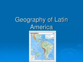
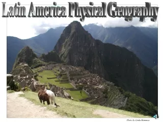
World Geography Latin America Notes. Physical. Latin America. Latin America spans 7,000 miles from U.S.-Mexico border to Tierra del Fuego part of North America, all of Central and South America, & Caribbean . Major Islands of the Caribbean .

E N D
Latin America • Latin America spans 7,000 miles • from U.S.-Mexico border to Tierra del Fuego • part of North America, all of Central and South America, & Caribbean
Major Islands of the Caribbean • Bahamas - Hundreds of islands off southern Florida, north of Cuba • Nassau is largest city and capital • The Greater Antilles - Larger islands in Caribbean: Cuba, Jamaica, Hispaniola, Puerto Rico • Hispaniola divided between Haiti, Dominican Republic • The Lesser Antilles - Smaller islands southeast of Puerto Rico
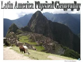
Mountains • Andes Mountains - South American range along western side of continent • World’s longest mountain range • World’s 2nd highest mountain range
Plains for Grain and Livestock • Llanos—grassy, treeless areas used for livestock grazing, farming - Loacted in Colombia and Venezuela
Plains for Grain and Livestock • Cerrado—flat savannas with moderate rainfall, good for farming - Found in interior of Brazilin mostly undeveloped Amazon River Basin
Plains for Grain and Livestock • Pampas—areas of grassland, rich soil, used for cattle and wheat • Located in Argentina and Uruguay • Home to gaucho culture centered on horsemen
Rivers & Waterways • Rio Grande - forms border between U.S. and Mexico
Rivers & Waterways • Amazon River – Longest river in the western hemisphere - flows 4,000 miles, from west to east, to Atlantic - branches start in Andes - fed by over 1,000 tributaries -carries more water than next seven largest rivers combined
Rivers & Waterways • Panama Canal - cuts through land bridge, connects Atlantic, Pacific • canal traffic makes Panama an important crossroads of world-trade
Lakes • Lake Maracaibo – regions largest lake
Lakes • Lake Titicaca – World’s highest larger navigable lake
Lakes • Lake Nicaragua – Largest lake in Central America
Waterfalls • Angel Falls – world’s highest uninterrupted waterfall
Natural Resources of Latin America • Region is rich with minerals, energy resources, agriculture, forests • Minerals- gold, silver, iron, copper, bauxite (aluminum ore), lead, nickel • South America is a world leader in mining, & exporting raw materials
Natural Resources of Latin America • Jamaica began bauxite mining to reduce dependency on agriculture, tourism • Oil, coal, natural gas, uranium & hydroelectric power are plentiful
Natural Resources of Latin America • Brazil rich in hydroelectric power oil, & gas • Venezuela & Mexico have major oil deposits, export oil to world
Climates • Rain forests—dense forests with different species of trees (hot and rainy all year) • unique ecosystem—community of plants, animals living in balance
Climates • Largest is Brazil’s Amazon rain forest with 2 million square miles • 2,500 types of Amazon trees • animals include anaconda, jaguar, piranha • Savannas found in Brazil, Colombia, Argentina (hot with seasonal rain)
Climates • Desert- Atacama Desert located in north Chile • Highlands - Varies from moderate to cold due to elevation, wind, sun, & landscape -found in mountains of Mexico and South America
Agriculture Reshapes the Environment • Slash-and-burn - cut trees, brush, grass; burn debris to clear fields - used by native peoples and today by poor farmers in Amazon basin - they move to new area when soil is exhausted - one reason for shrinking rain forests
Agriculture Reshapes the Environment • Terraced farming - step-like farm fields cut into mountains, hillsides • lets crops grow on steep land, cuts down on soil erosion • used by Incas in Peru, Aztecs in Mexico
Review Questions What is a cerrado? What country moved away from agriculture & began focusing on mining? What natural resources are abundant in Latin America? What mountain range in this region runs along the pacific coast? What is largest river in the western hemisphere? Where does the Amazon River begin & end? What are llanos? What are pampas? What is the world’s highest uninterrupted water falls? What desert is located in Latin America? What is slash- and – burn farming? Why was Panama chosen as the site to build a canal that connects the Atlantic & Pacific Oceans?
Native Americans • Cultural hearth—place from which important ideas spread • Mayan civilization spread throughout Central America -unknown why Maya abandoned many cities in 800s