Download
1 / 23
230 likes | 350 Views
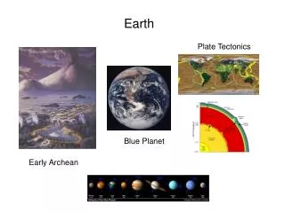
Exploring the Blue Planet … ESRI Press Authors’ Panel on Arc Marine: GIS for a Blue Planet. Dawn Wright, Oregon State University Michael Blongewicz, DHI Water & Environment Pat Halpin, Duke University Joe Breman, Akimeka LLC. Case Studies.

E N D
Exploring the Blue Planet …ESRI Press Authors’ Panel onArc Marine: GIS for a Blue Planet Dawn Wright, Oregon State University Michael Blongewicz, DHI Water & Environment Pat Halpin, Duke University Joe Breman, Akimeka LLC UC 2007
Case Studies • High Resolution Swath Bathymetry, Sidescan Sonar Imagery and Seismic Reflection Profiles – Woods Hole Science Center • CTD and Temperature Time Series – Marine Institute, Galway, Ireland • Sediment Transport for the Municipality of Køge, DK – DHI Water & Environment • Numeric Modeling of Sea Dynamics – Maritime and Hydrographic Agency (BSH) of Germany ESRI User Conference 2007
High Resolution Swath Bathymetry and Seismic Reflection Profiles • Seismic shots along a survey • Multiple reflection type giving multiple depths at a single location ESRI User Conference 2007
High Resolution Swath Bathymetry ESRI User Conference 2007
Seismic Reflection Profiles ESRI User Conference 2007
CTD and Temperature Time Series – Marine Institute, Galway, Ireland • A single value for multiple variables being collected and various depths • Continuous values at varying depths. ESRI User Conference 2007
CTD and Temperature Time Series – Marine Institute, Galway, Ireland ESRI User Conference 2007
CTD and Temperature Time Series – Marine Institute, Galway, Ireland ESRI User Conference 2007
CTD and Temperature Time Series – Marine Institute, Galway, Ireland ESRI User Conference 2007
CTD and Temperature Time Series – Marine Institute, Galway, Ireland ESRI User Conference 2007
CTD and Temperature Time Series – Marine Institute, Galway, Ireland ESRI User Conference 2007
Sediment Transport for the Municipality of Køge, Denmark • Relating transects to surveys and creating profiles • Input data to sediment transport numeric modeling for calculating volumes • Determining shoreline evolution from a baseline ESRI User Conference 2007
Sediment Transport for the Municipality of Køge, Denmark ESRI User Conference 2007
Sediment Transport for the Municipality of Køge, Denmark ESRI User Conference 2007
Sediment Transport for the Municipality of Køge, Denmark ESRI User Conference 2007
Sediment Transport for the Municipality of Køge, Denmark ESRI User Conference 2007
Numeric modeling of sea dynamics – BSH German Maritime and Hydrographic Agency • Daily inputs to numerical simulations for current, temperature, salinity and dispersion of substances • Rendering Vector and Scalar Quantities ESRI User Conference 2007
Numeric modeling of sea dynamics – BSH German Maritime and Hydrographic Agency ESRI User Conference 2007
Numeric modeling of sea dynamics – BSH German Maritime and Hydrographic Agency ESRI User Conference 2007
Numeric modeling of sea dynamics – BSH German Maritime and Hydrographic Agency ESRI User Conference 2007
Numeric modeling of sea dynamics – BSH German Maritime and Hydrographic Agency ESRI User Conference 2007
Numeric modeling of sea dynamics – BSH German Maritime and Hydrographic Agency ESRI User Conference 2007
Numeric modeling of sea dynamics – BSH German Maritime and Hydrographic Agency ESRI User Conference 2007