Download

1 / 24
240 likes | 393 Views
AfriGEOSS : Establishing Africa’s Participation and Contribution to the Global Vision. 3 rd GEOSS AfWCCI Workshop 4-5 February 2013 Lerato Senoko. Millennium Developments Goals (MDGs) – (2000) Goal 7: Ensure Environmental Sustainability

E N D
AfriGEOSS: Establishing Africa’s Participation and Contribution to the Global Vision 3rd GEOSS AfWCCI Workshop 4-5 February 2013 Lerato Senoko
Millennium Developments Goals (MDGs) – (2000) • Goal 7: Ensure Environmental Sustainability • Goal 8: Develop a Global Partnership for Development • The Johannesburg Declaration, WSSD (2002) • “To haul the World’s 2 billion poorest people out of misery and restore/nurture the damaged environmental web that sustains all of its life”. • G8 - .. to create a world where decisions and actions are informed by coordinated, comprehensive and sustained Earth observations.. U.S. Department of State, Washington DC July 31, 2003
The Global Earth Observation System of Systems (GEOSS) • An emerging comprehensive public infrastructure, Globally, Coordinated Sustained System of Observing Systems for monitoring and forecasting changes in the global environment. • This “system of systems” supports policymakers, resource managers, science researchers and many other experts and decision-makers. • 10-Year Implementation Plan (2005 -2015) • “Societal Benefit Areas” of disasters, health, energy, climate, water, weather, ecosystems, agriculture and biodiversity. U.S. Department of State, Washington DC July 31, 2003
GEOSS Provides Coordinated Access to Information from Various Sources U.S. Department of State, Washington DC July 31, 2003
GEO - the Group on Earth Observations Established in 2005, GEO coordinates international efforts to build a Global Earth Observation System of Systems (GEOSS) U.S. Department of State, Washington DC July 31, 2003 • Earth Observation Summit
GEO Worldwide 89 Members 67 Participating Organizations African Participation in GEO Member Nations (22): • Algeria • Burkina Faso • Cameroon • Central African Republic • Congo, Republic of the • Egypt • Ethiopia • Gabon • Ghana • Guinea-Bissau • Guinea, Republic of • Mali • Mauritius • • Morocco • • Niger • • Nigeria • • South Africa • • Sudan • • Tunisia • • Uganda • Cote d’Ivoire • Participating Organizations: • AARSE • ACMAD • EIS-Africa • RCMRD • UNECA U.S. Department of State, Washington DC July 31, 2003
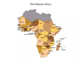
AFRICA IN CONTEXT • Africa: • 2ndLargest Continent - 30.3m Km2 • 15% of the total world population (1.1 billion) • 2billion (2050) • Key Challenges: • Poverty, Food Insecurity, • Water Scarcity, Disasters, • Environmental Degradation, • Climate change, peace, security • Average life expectancy 45.8yrs • (Sept 2004) • Africa second driest continent • Energy U.S. Department of State, Washington DC July 31, 2003
Food for Thoughts • Cooperation in space knowledge generation and sharing as well as in skill development is now the norm rather than the exception for countries in a region that share mutual borders and face common challenges, as is the case in Africa. • The high cost and high risk associated with space activities provide a considerable barrier for nations with other pressing nation-building demands to aim at developing independent space systems. Such costs can be absorbed through cooperation & collaboration. • Africa is now a battle ground for open-source acquisition of space assets – What about the costs of duplicating these assets & the benefits of sharing a limited number of such assets? - Earth Observation, Communications and Human security • (Abiodun, 2009) U.S. Department of State, Washington DC July 31, 2003
Food for Thoughts • Africa is now being left out in this global endeavour; • We need to engage in Knowledge development & Competence building to be relevant internationally & benefit from the global infrastructure; • Each Country will bring its own perspectives & Skills, & in return, will gain access to the common Knowledge & Experience; • Africa must contribute to solving global challenges e.g. Climate Change, through global partnership, collective efforts, & personal endeavours; U.S. Department of State, Washington DC July 31, 2003
Three of the GEOSS Strategic Targets are particularly relevant to the AfriGEOSS initiative: Capacity building: Enhance coordination to strengthen individual,institutional and infrastructure capacities, particularly in developingcountries, to produce and use Earth observations and derivedinformation products. Architecture: Achieve sustained operation, continuity and interoperabilityof existing and new systems that provide essential environmentalobservations andinformation, including the GEOSS CommonInfrastructure (GCI) that facilitates access to, and use of, theseobservations and information. Data Management: Provide a shared, easily accessible, timely, sustainedstream of comprehensive data of documented quality, as well asmetadata and information products, for informed decision-making. U.S. Department of State, Washington DC July 31, 2003
AfriGEOSS Objectives (1) • Coordinate and bring together relevantstakeholders, institutions and agencies acrossAfrica that are involved in GEO and other Earthobservation activities; • Provide a platform for countries to participate inGEO and to contribute to GEOSS; • Assist in knowledge sharing and globalcollaborations U.S. Department of State, Washington DC July 31, 2003
AfriGEOSS Objectives (2) • Identify challenges, gaps and opportunitiesfor African contributions to GEO and GEOSS; • Leverage existing capacities and plannedassets and resources; and • Develop an appropriate strategy andparticipatory model for achieving the abovegoals; U.S. Department of State, Washington DC July 31, 2003
AfriGEOSS Priority Actions (1) • Establishment of GEOSS networks in the continent with its footing in as many African countries as possible; • Active Africa participations in the building of the global infrastructure (GEOSS); • Build relationships with other similar regional entities, e.g. GEOSS in the Americas, AsiaPacific GEOSS etc.; • Liaise with African Leadership Conference on space science & technology (ALC); African Union Commission (AUC); UNECA for efficient coordination of Member States activities U.S. Department of State, Washington DC July 31, 2003
AfriGEOSS Priority Actions (2) • Engage with regional Space Agencies and Remote Sensing/Geoinformation training centres; • Coordinate Earth Observation (EO) satellite infrastructure projects: • Data acquisition strategy for Africa; • African Resources and environmental Management satellite constellation (ARMC) • African Monitoring of the Environment for SustainableDevelopment (AMESD) and Monitoring of Environmentand Security in Africa (MESA); Servir Africa, Africa Water Circle; U.S. Department of State, Washington DC July 31, 2003
AfriGEOSS Priority Actions (3) • • Promote data democracy and data sharing • • focusing on four pillars of data democracy; • Work with CEOS WGCapD on the development of Digital Elevation Model initiative • • advancing data sharing principles and action plan (ID-01); • • Organise sessions on AfriGEOSS at premierAfricanconferences, e.g., AARSE, AfricaGIS; • • Organise regional workshops • • East, Central, North, West, South regions U.S. Department of State, Washington DC July 31, 2003
AfriGEOSS Priority Actions (4) • Open Data Access • Full and Open Exchange of Data • Data and Products at Minimum Time delay and Minimum Cost • Free of Charge or minimal Cost • • Organise regional workshops • • East, Central, North, West, South regions U.S. Department of State, Washington DC July 31, 2003
AfriGEOSS Collaborations • Support/Collaboration with similar GEO Community to fast track capacity building especially on the lost ground by Africans in the building of GEOSS; • Support on the best practice in setting up AfriGEOSS; • Establishment of Secretariat and involvement of bright minds on secondment to support the establishment of AfriGEOSS. U.S. Department of State, Washington DC July 31, 2003
Progress- Recent Engagements & Next Steps (1) Strategy A coordinated AfriGEOSS “virtual network” of Ground Stations GEO will promote the establishment of the continent-wide collaborative mechanism Engage African Space Agencies & ALC Support from Regional GEOSS, Member Organisations, & Member States Recent Engagements RCMRD through GEO Secretariat to serve a springboard for the launching of initiative; Development of BioEnergy Atlas for Africa - included in the GEO 2012- 2015 Work Plan) GEO Secretariat sponsored 2nd & 3rd GEOSS African Water Cycle Symposium in 2011 & 2012.
Progress- Recent Engagements & Next Steps (2) On-going Engagements/Discussions Contd. International Renewable Energy Agency (IRENA) German Space Agency (DLR) Brazilian National Institute for Space Research (INPE) Z_GIS (Austria) through the FP7 Project EnerGEO; AUC - HRST UNECA Other Specific African initiatives MAFA AFREF ARSDI (UNECA)
Progress- Recent Engagements & Next Steps (3) AARSE -El-Jadida Declaration no. 9 – November 2012: ‘To engage actively at all levels of GEO and GEOSS and the implementation of AfriGEOSS to bridge the digital divide and to build an Africa-wide knowledge-based economy using the Group on Earth Observations (GEO) networks and emerging GEOSS infrastructure’ The 46th Meeting of the Governing Council and the 8th Ministerial Conference of the RCMRD, Silverstone Declaration – November 2012: Resolves that all its Member States join GEO and AfriGEOSS
Acknowledgements of Projects/Initiatives AfriGEOSS will Latch On – (1) South Africa for the seed funding and continuous support for GEO initiatives in Africa; The European Commission for funding various Earth observation projects in Africa, such as AMESD (MESA), EnerGEO, DevCoCast, BRAGMA and GEONETCAB etc. Brazil and China for CBERS data dissemination and ground stations support in Africa; Universal Access – Charter; Regional GLAM (G20) The European Space Agency’s (ESA) TIGER initiative, and the TIGER-NET initiative - developing and implementing Water Observation Information Systems - Sentinel missions preparation;
Acknowledgements of Projects/Initiatives AfriGEOSS will Latch On – (2) Japan and UNESCO for supporting the African Water Cycle Initiative; Norway, Australia, and the United States for supporting GFOI and National Demonstrators in Africa; and All Member States and Participating Organizations that have contributed to GEO and would be supporting AfriGEOSS.
NEXT STEP Formation of AfriGEOSS Working Group with Secretariat in UNECA/AUC based on on-going Discussions Ready to Pledge support for AfriGEOSS in order to fast track its implementation?