Download
1 / 28
370 likes | 1.13k Views
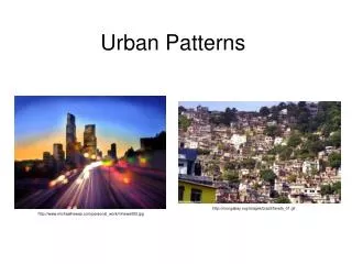
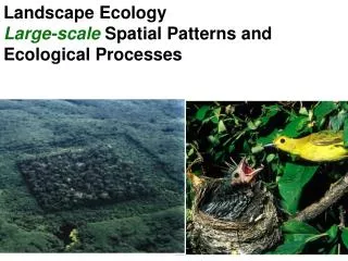
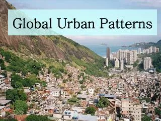
Ch7. Spatial patterns in urban landscape . Definition of Urban Morphology

E N D
Ch7. Spatial patterns in urban landscape • Definition of Urban Morphology - Urban morphology refers to the physical arrangement or structure of towns and cities. It involves the mapping and description of patterns of internal land use,and includes street patterns, individual buildings ,building blocks, densities and the different functions of the town or city
Factors Influencing Urban Morphology • Site factors • Historical and cultural factors • Functional factors • Government influence • Social values • Economic forces ~ economic circulation ~economic accessibility / urban land rents
The Urban Land Rent Concept and Distance Decay Mechanism • 1. Areas of high accessibility ~ centre of the city ~ Major traffic routes ~ major traffic intersections
Land values and uses in a city ~ The central Business district ~ Industrial land use ~ residential land use
Models of urban structure • Introduction Most western cities exhibit areal specialization in their internal land use patterns. That means “ functional areas” or “ functional zones”
Stages of urban growth ~ Infantile stage ~ Juvenile stage ~ Adolescent stage ~ Early mature stage ~ Fully mature stage
Land Use Models 0. 商業中心區1. 過渡地帶/舊城區/內城區2. 低入息住宅區3. 中等入息住宅區 4. 高入息住宅區 5. 新發展中心 6. 工業區 7. 市郊發展區
Burgess’ Concentric Zone Model • Burgess’ concentric zone model is an inductive model based on the case study of chicago in the 1920s. It is one of the earliest attempts to provide some insight into urban structure • Burgess used ecological factors to explain the spatial variations within the city
Competition • Dominance • Invasion • Succession
2. Implicit assumption ~ The population throughout the city is evenly distributed ~ Movement is equally easy in all direction ~ The whole city is considered an isotropic plain ~ and values decline regularly from a common central point in the city ~ economic rent is highest near city centre and decreases progressively away from the core ~ low income families are forced to live in high density apartments or tenements close to the city core
3. The five functional zones in Burgess model • Central Business District (CBD) or loop • Zones in transition • Working men’s residential zone • Middle class residential zone • High class residential zones/ commuters zone
4. Advantages of the Burgess Model • The model has the advantage that it is simple and comprehensive and significant land uses and their relationship are pinpointed in a generalized form. Moreover, since it is an inductive model,taking real examples from American cities in the 1920s, it represents a way to interpret the process of city growth during that particular period for some existing towns and cities
Criticisms of Burgess model • Zonal Boundaries • Internal heterogeneity of zones • Outdated model • Lack of universality • Distortions • Building heights
Conclusion • The zonal model is based on an empirical study • The model is normative and inductive and is therefore limited historically and culturally. • It emphasizes clear cut boundaries which cannot be justified by gradient study. • Nevertheless, it remains useful as a first approximation of urban land use and has stimulated many other studies
Hoyt’s Sector Model • 1. Introduction • Growth • Similarities between the concentric zone model and the sector model • Application of the sector model ~ the case of Chicago ~ the case of Calgary
Criticisms of Hoyt’s model • Hoyt’s model is generally considered to be better than the burgess model as both the distance and direction from the city centre are considered Weakness: Narrow focus ~ Height of building ~ Mixed land use zones ~ Modern developments
Harris and Ullman- multiple Nuclei Model • 1. Introduction Harris and Ullman suggested that the zones develop around a number of separate nuclei such as railway stations and industrial complexes
2. Zones in the multiple nuclei model • Specialized requirement of certain activities • Grouping of similar activities • Repulsion of some activities by others • Ability of activities to pay rents and rates
3. Advantages of the multiple nuclei model • Improved transportation • Hierarchical order of land use • Functional zones • Agglomeration • Suburbanization and decentralization • Accommodation of irregularities • Time dimension • Flexibility
4. Criticism of the multiple nuclei model • Height of the building • Rigidity
Delimiting the CBD • 1. Central Business Index ~ The Central Business Height Index(CBHI) CBHI= total floor area of all CBD functions/ total ground floor area ~ The Central Business Intensity Index (CBII) CBII= total floor area of all CBD functions *100% / Total floor area
~ The Central Business Index CBI= CBHI of 1+ CBII OF 50%
Urban Population Densities • 1. Distribution of population density within a city • 2. Change over time in a density-decay curves
Residential Mobility • 1. Factors responsible for responsible for residential mobility ~ improved living environment ~ Establishment of a new family ~ Land rent mechanism and land supply ~ job or employment opportunities ~ Improved communications ~ government policy
2. Residential mobility in Hong Kong ~ forced moves ~ voluntary moves
The morphology of Asian Cities • 1. Distinct city types in Asia ~ The indigenous city ~ Centres of western penetration ~ The colonial city
2. Main land use areas of a large South-East Asian city(McGee’s model) • The port zone • Zone of intensive market gardening • Mixed land use zone • Residential areas • Industrial estates