Download
1 / 56
570 likes | 740 Views
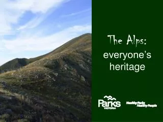
The Alps: everyone’s heritage. Welcome to Country. Before we start, we acknowledge and pay our respects to the traditional owners of this country, in particular the elders and all those traditional owners that may be present today. Jaitmathang Aboriginal Tribe.

E N D
Welcome to Country Before we start, we acknowledge and pay our respects to the traditional owners of this country, in particular the elders and all those traditional owners that may be present today.
Jaitmathang Aboriginal Tribe • “So little is known about them, so few are the relics that they left behind, and so difficult is the country they inhabited that they must remain as the least known of the Aborigines of Victoria”. – Massola 1969: 152 Bogong Moth
1850’s Cattle grazing Blairs Hut And with grazing came infrastructure.
In early times there were no roads in the Alps - original access to the area was on horseback. Later the stock routes became roads which increased the access to the Alps
1890’s – Recreational activities began – small numbers only Mount Feathertop
1920’s Kiewa Hydro Scheme Before the scheme… …Today
Hydro infrastructure Aqueduct being built on the Bogong High Plains45km of aqueducts were constructed to divert water from adjoining catchments
1940’s - Ski resorts were established. Mt Hotham shown here.
Human interactions with the Alps 6000 years ago 1788-Cook landed 1830-Gold rush 1850-Grazing started Confirmed Indigenous Use 1890’s Recreation 1920’s-Hydro Scheme 1940’s-Ski Resorts 1940’s-Logging Today 2010
Alpine National Park1986647,000 hectares Bogong National Park 1981 114,000 ha
1989: the Australian Alps National Parks Program was proclaimed • This includes • * Namadgi National Park • Kosciuszko National Park • Alpine National Park • Baw Baw National Park • Snowy River National Park • Mt Buffalo National Park
Mt Everest 8848m Compared to other mountains around the world Australia’s are small. They are also relatively flat. Mt Aconcagua 6959m Mt Matterhorn 4478m Mt Bogong 1986m
Why is it a National Park? • rare and threatened plants • place of outstanding scenic value • research projects • rare and threatened communities
rare and threatened animals Spotted Tree Frog Mountain pygmy possumBurramys parvus Alpine She-oak skink Alpine Water Skink Alpine Funnel Web
preservation of cultural sites Cope Hut – built in 1929, specifically for recreation Red Robin gold mine – still operational today
So, how do we ‘manage’ this…(and what exactly does management mean anyway?)
Recreation (and other users of the Park)– what types are there? Mt. Bogong Summit Bushwalking / hiking – over 300km’s of walking tracks
Winter Recreation Kangaroo Hoppet Ski touring and camping Snow shoe’s – winter hiking
So what’s the problem? • Lots of different types of uses – why can’t we have them all?
Protection of environmental values Erosion, catchment stability, sedimentation, water quality, water quantity
Frost heave Created when bare ground exists
So now we see the potential problems… How do we fix (manage) this?
Management Plan • Public consultation • Signed off by the Minister for Environment • Includes all activities allowed in the park • Directs management activities • Sets out clearly what can and can’t happen in the park and in what areas • According to what the majority of the public want
Well maintained tracks – direct people Tracks that look like this……. …..should look like this.
Signage – letting people know what you can and can’t do
Toilets – stops people using the bush
Focus recreation in certain areas – protects other areas of significance
Pretty Valley Camping Area – focus for visitors - with toilet, picnic table and fire place.
Maintain vehicle tracks, so people don’t create a bigger road by driving around Harden off surfaces
Seasonal and management gate closures – protects park values
Yellow Hawkweed Recreation (people) can also bring in weeds - weed control protects park values
Supply huts for safety and recreational use….. …..especially in winter
Supply other areas for intensive recreation – such as Falls Creek. These areas still have an impact on the park such as weeds, seed dispersal and runoff.
Remote areas mean we use helicopters a lot – adds to complexity of management