Download
1 / 13
130 likes | 219 Views
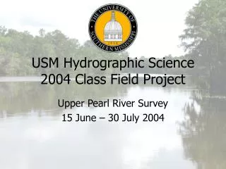
USM Hydrographic Science 2004 Class Field Project. Upper Pearl River Survey 15 June – 20 July 2004. GPS Processing Collection. For BM positioning, Ashtech Z-Xtreme raw data was collected and submitted to OPUS

E N D
USM Hydrographic Science2004 Class Field Project Upper Pearl River Survey 15 June – 20 July 2004
GPS ProcessingCollection • For BM positioning, Ashtech Z-Xtreme raw data was collected and submitted to OPUS • For Skiff, Bertram and infrastructure positioning, two Ashtech Z-Xtremes (base and rover) collected raw data which was processed in GrafNav USM 2004 Upper Pearl Survey
GPS ProcessingOPUS • Two six-hour data collection sessions were conducted at one benchmark for each tide gauge location (I-10, USGS, SBT, Hancock) • Converted from Ashtech U files to RINEX using teqc • Submitted to OPUS in RINEX format (slant measurement corrected to vertical height from BM to ARP) • OPUS error reported as “peak-to-peak,” which is equivalent to 3.3 • I-10 benchmark D unacceptable (under bridge), so benchmark G established USM 2004 Upper Pearl Survey
GPS ProcessingOPUS USM 2004 Upper Pearl Survey
GPS ProcessingOPUS • 11 USM1 base station files submitted to OPUS USM 2004 Upper Pearl Survey
GPS ProcessingGrafNav USM 2004 Upper Pearl Survey
GPS ProcessingGrafNav USM 2004 Upper Pearl Survey
GPS ProcessingGrafNav • Quality numbers are described by GrafNav as follows: USM 2004 Upper Pearl Survey
GPS ProcessingGrafNav • 3 GrafNav export scripts were created • Bertram, Skiff, xyz (infrastructure) • All data were exported as UTM 16 Eastings and Northings • For Bertram and Skiff navigation, all solutions with standard deviations greater than 2 meters and/or with quality numbers 4, 5 or 6 were excluded from import into CARIS • For infrastructure positioning, all solutions were used in conjunction with aerial photography and redrawn USM 2004 Upper Pearl Survey
GPS ProcessingGrafNav USM 2004 Upper Pearl Survey
GPS ProcessingGrafNav USM 2004 Upper Pearl Survey
GPS ProcessingGrafNav USM 2004 Upper Pearl Survey
Processing:Multibeam Katie Reser