Download
1 / 1
40 likes | 242 Views
Vertical fault mapping within the Gutingkeng Formation of southern Taiwan: implications for sub-aerial mud diapir tectonics

E N D
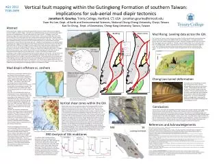
Vertical fault mapping within the Gutingkeng Formation of southern Taiwan: implications for sub-aerial mud diapir tectonics Jonathan R. Gourley, Trinity College, Hartford, CT, USA jonathan.gourley@trincoll.eduYuan-Hsi Lee, Dept. of Earth and Environmental Sciences, National Chung-Cheng University, Chaiyi, Taiwan Kuo-En Ching, Dept. of Geomatics, Cheng-Kung University, Tainan, Taiwan AGU 2012T53B-2699 Looking NE at Gtk exposure along Chishan Fault and vertical shear zone Abstract Mud Rising: Leveling data across the Gtk Bedding Shear zones Vertical faults were mapped around the periphery of the mudstone-rich Plio-Pleistocene Gutingkeng Formation (Gtk) in southern Taiwan. The faults are manifested as black colored, penetrating shear bands that intersect bedding planes of the Gtk (shear band dips range from 60 – 90 degrees; shear band thicknesses range from several centimeters to several meters). Thin (1-2cm), friable calcite veins were found locally within the shear bands and often contain weakly developed slickensides. Where available, the sense of shear of these faults show consistent interior upward motion of the Gtk. The Chishan Fault is the southeastern bounding structure of the Gtk and where exposed, near-vertical shear bands were observed with a normal sense of shear (west-side-up). In addition, three exploratory cores drilled in 2010 along the western edge of the hanging wall of the Chishan Fault did not intersect the fault or the Gtk after nearly 200 meters of drilling. This suggests that the main Chishan Fault may not be a typical top-to-the-west reverse fault as previously mapped and does not fit the typical fold and thrust geometry that is prevalent in the western foothills of Taiwan. Instead, we interpret the collective field evidence to suggest that the Chishan Fault is a near vertical structure that is accommodating uplift of the Gtk, similar to mechanism by which sub-aqueous mud diapirs grow. A chain of mud diapirs is located off the southeastern coast of Taiwan and the Gtk may be the onshore extension of this chain. The sub-aerial mud diapir hypothesis is further supported by recent leveling data collected across the Gtk that shows the largest vertical uplift in the region to be centered within the Gtk. Finally, observations at the western end of the Highway 3 tunnel through the Chishan fault and overlying Wushan Formation indicate that there is recent west side (footwall) uplift along the Chishan Fault. The vertical faults mapped within the Gtk are significant for they may provide evidence for a long-term history of vertical tectonics in this region that has shaped the structural geometries and geologic patterns of southwestern Taiwan. The “interior-up” sense of shear of shear zones within the Gtk is consistent with recent leveling data measured in southern Taiwan from 2002 to 2010 (Hsu and Ching, 2011) . The figure below is an oblique view of the vertical displacements recorded. Black bars indicated uplift and tan bars (below the map imagine represent subsidence. The Gtk is clearly rising at a faster rate (5-15mm/yr) than the surrounding geology. Uplift is maximized in the center of the Formation along the Lungchuan Fault. This movement is assumed to be primarily aseismic due to the lack of seismicity in the region. It is possible that the vertical shear bands throughout the Gtk are accommodating this uplift. Legend Shear Zones » » Bedding # Mud Volcanoes Major Thrust Faults ( ( ( ( ( ( Freeways Pleistocene to Recent- Q3 Terrace deposits 10 mm/yr PPk Pliocene to Pleistocene - Gutingkeng Formation Miocene to Pliocene - MP Kueichulin Formation and equivalents Mud diapirs offshore vs. onshore Several seismic studies have identified active mud diapirs off the southwestern coast of Taiwan, within the accretionary wedge of the northern Luzon volcanic arc (e.g. Lee, 1992; Huang, 1995; Chuang, 2006; Chiu et al., 2006, Ko, 2009;). These diapirs trend NW-SE and are oblong structures that parallel the deformational front and the out of sequence thrusts within the accretionary complex. The mud diapir structures are bathymetric highs and are approximately 3-7 km wide and 15-30 km long. The muds of the Gutingkeng Formation are well exposed on shore, approximately 20 km to the northwest of the off shore diapirs. The map pattern of the exposed Gtk is 5-10 km wide and 25 km long. Limestone reefs are mapped at the southern end of the Gtk and are conformable with the underlying muds (Chen et al. 1994; Lacombe, 1999, personal observations). The presence of these reefs suggests a shallow depth of the Gtk during deposition. However, the connection between the offshore and onshore muds has been debated (Lacombe et al. 1999) in terms of deformation mechanism. The lack of symmetry of the onshore anticline structures is stated as evidence for a fold-and-thrust style kinematics over a diapiric origin. Fold-and-thrust tectonics is well documented throughout most of western Taiwan, especially north of the Chishan Transfer Zone.The entire Gutingkeng Formation and surrounding region (both on and off-shore) are in a current state of seismic quiescence. The map to the right shows 20 years of seismic activity in this region and is notably aseismic compared to the rest of Taiwan. Seismicity increases in frequency to the north of the Chishan Transfer Zone. This zone clearly delineates the region actively colliding with the Eurasian basement promontory (Byrne et al., 2011) from the pre-collisional transitional zone of lateral extrusion and accretionary wedge tectonics. Chong Liao tunnel deformation The eastern side of the Chong Liao tunnel that intersects the Chishan fault has suffered deformation since its construction in 2000. The photograph was taken from the southbound lane looking towards the northeast. The colored blue and green tiles are clearly offset (west side up) and indicate active aseismic uplift of the Gtk along the Chishan Fault. Currently a detailed total station surveying study is measuring the deformation of the bridge immediately west of the Highway 3 tunnel. Offshore mud diapirs (Chuang, 2006) and onshore Gutingkeng Formation Lower Hemisphere shear zone poles plot indicates shear zones are steep to vertically oriented. Vertical shear zones within the Gtk Photo taken by Saam Aiken Conclusions Vertical shear zones were mapped throughout the Gutingkeng (Gtk) Formation and are not limited to major fault zone regions. These shear zones cross-cut bedding in all observed cases and range in dip from 58° to 90°. Thickness of the shear bands range from several centimeters to 10s of meters. Exposure of the Gtk is very good due to the badlands topography created by the eroding muds. The bands are frequently observed in the proximity of the Chishan Fault but are found in outcrops in the western and northern areas of the Gtk as well. Initial mapping focused on the region near the Chishan Fault to determine the sense of shear of the fault zone. (Sobolewski and Gourley, 2008). Despite the Chishan Fault being mapped as a top to the west reverse fault (Wushan Formation over the Gtk), all sense of shear indicators that we could find over a period of three field seasons indicated a normal displacement along steeply dipping or vertical shear bands. This sense of shear indicates that the Gtk is rising along these bands relative to the surrounding geology. Rock cores taken along the Chishan Fault in the hanging wall (Wushan Formation) never intersected the anticipated Chishan thrust fault, further suggesting that boundary between the Gtk and Wushan Formation is a steep, if not vertical structure. Vertical shear zones within the Gutingkeng Formation contain sense of shear indicators that suggest west side up (along the eastern boundary) and south side up (along the northern boundary and interior) displacements, indicating that the Gtk Formation has been rising relative to surrounding geologic units. These vertical structures are supported by drill core samples, recent leveling data and east side deformation along the Chishan Fault within the Highway 3 (Chong Liao) tunnel. These deformation patterns within the Gtk are interpreted as an onshore mud diapir dominated by vertical tectonics. However the complexity of the arc-continent collision of Taiwan cannot rule out the influence of fold-and-thrust kinematics and southwest lateral extrusion especially as the collision propagates southward through time. References and Acknowledgements Shear band sense of shear in proximity of Chishan Fault trace Byrne T., Chan, Y.C., Rau, R.J., Lu C.Y., Lee Y.H., Wang, Y.J., The Arc-Continent Collision of Taiwan, in Brown, D and Ryan P.D., Arc-Continent Collision, Frontiers in Earth Sciences, Spinger-Verlag Berlin Heidelberg, p. 213-245. Casciello, E., Cosgrove, J.W., Cesarano, M., Romero, E., Queralt, I., Verges, J., 2011, Illite-smectite patterns in the sheared Pleistocence mudstones of the southern Apennines and their implications regarding the process of illitization: amultiscale analysis, Journal of Structural Geology, 33, p. 1699-1711. Chen, H.W., Wu, L.C., Tsien, H.H., The contact relationship between the Early Pleistocene Panpingshan Limestone and the Gutingkeng Formation in the Kaoshiung area, southern Taiwan (in Chinese), Centeral Geologic Survey Special Publication, 8, 101-119, 1994. Chuang Hui-Ju, 2006, Distribution and Structural Relationships of Mud Diapirs offshore Southwestern Taiwan, Thesis, 113 pp., Institute of Oceanography, National Taiwan University. Chia-Chun Ko, 2009, Development of Mud Diapirs Offshore Southwestern Taiwan, thesis , 107 pp. Institute of Oceanography, National Taiwan University. Chiu, J. K., Tseng, W.H., Liu, C.S., 2006, Distribution of gassy sediments and mud volcanoes offshore southwestern Taiwan, Terrestrial, Atmospheric and Oceanic Sciences, v. 17, no. 4, pp. 703-722. Huang, Y.L., 1995, Distribution of mud diapirs offshore southwestern Taiwan, their relationship to the onland anticlinal structures and their effects on the deposition environment in southwest Taiwan (in Chinese), Masters thesis, Institute of Oceanography, National Taiwan University. Hsu, S., and Ching, K., 2011, Crustal deformation of the mud stone area in SW Taiwan using geodetic data from 2002 to 2010, Abstract T43D-2383 presented at 2011 Fall Meeting, AGU, San Francisco, Calif., 5-9 Dec. Lacombe, O., Mouthereau, F., Deffontaines, B., and Angelier J., 1999, Geometry and Quaternary kinematics of fold-and-thrust units of southwestern Taiwan, Tectonics, vol. 18, no.6, pp. 1198-1223. Lee, T.Y., 1992, Cenezonic plate reconstruction of southeast Asia and sequence stratigraphy and tectonics in the Tainan basin, offshore southwestern Taiwan, PhD thesis, 240pp. Univ. of Texas at Austin. Sobolewski, S. and Gourley J., 2008, A field investigation of fault rocks within the footwall of the active Chishan Fault, southern Taiwan, Eos Trans. AGU 89(53), Fall Meet. Suppl., Abstract T51A-1863. NW SE Last 20 years of seismicity in southwestern Taiwan XRD Analysis of Gtk mudstones Looking northeast A smectite to illite transition has been observed in shear zones that penetrate mudstones (Casciello et al., 2011). We wanted to determine whether that transition had occurred in the shear zones of the Gtk. Initial XRD scans at low 2 theta angles indicate the presence of illite and chlorite (or smectite). The addition of ethylene glycol to our samples showed no discernible shift in the chlorite peak indicating that smectite is not present in the Gtk mudstones and therefore we could not observe a smectite to illite transition. Mudstones (Undeformed) Shear zone mud Thanks to NSF Grant NSF-MRI 0959526 for funding the XRD instrument used to analyze mudstone power samples.Special thanks to the students of Kuo-En Ching and Yuan-Hsi Lee for their help in the field while in Taiwan including: Chih-HaoLan, Ching-Hui Yu, and Shu-Chin Hsu. Also a special thanks to Trinity students who accompanied me to Taiwan: Stephe Sobolewski, Daniel Lofrese, Saam Aiken and Kelsey Semrod.