Download
1 / 34
400 likes | 681 Views
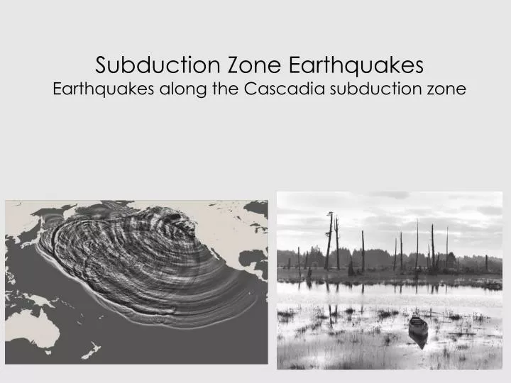
Subduction Zone Earthquakes Earthquakes along the Cascadia subduction zone. NORTH AMERICA 85 MA TO PRESENT PACIFIC PLATE/NORTH AMERICA PLATE. NORTH AMERICA 38MA - PRESENT DEVELOPMENT OF SAN ANDREAS FAULT. 10 largest earthquakes since 1900. Location date Mw

E N D
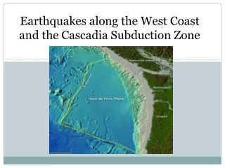
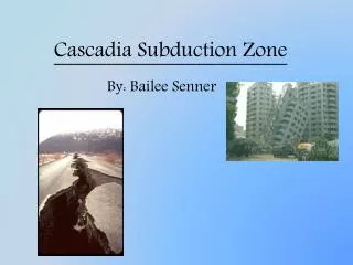
Subduction Zone EarthquakesEarthquakes along the Cascadia subduction zone
NORTH AMERICA 85 MA TO PRESENTPACIFIC PLATE/NORTH AMERICA PLATE
NORTH AMERICA 38MA - PRESENTDEVELOPMENT OF SAN ANDREAS FAULT
10 largest earthquakes since 1900 Location date Mw 1 Chile 22 May 1960 9.5 2 North Sumatra, Indonesia 26 December 2004 9.3 3 Prince William Sound, Alaska 28 March 1964 9.2 4 Andreanof Island, Aleutians 9 March 1957 9.1 5 Kamchatka 4 November 1952 9.0 6 Ecuador 31 January 1906 8.8 7 Rat Island, Aleutians 4 February 1965 8.7 8 Sumatra, Indonesia 28 March 2005 8.7 9 Assam, India-China border 15 August 1950 8.6 10 Kamchatka 3 February 1923 8.5 Pacific-NA along Aleutian trench Middle America - not as large
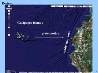
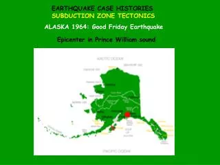
SUBDUCTION ZONE EARTHQUAKESALASKA, MIDDLE AMERICA, CASCADIA Aleutian trench, middle America trench, Cascadian subduction Zone Ocean/Ocean, Ocean/Continent, Ocean/Continent collisions
SUBDUCTION ZONE EARTHQUAKES1964 ALASKA EARTHQUAKEPacific plate subducted beneath North American Plate. 1000 km by 400 km slab moved 19.5 m with 3-4 min shaking. Produced uplift and subsidence Damage mostly due to tsunami Critical earthquake for under standing thrusting in subduction zones
SUBDUCTION ZONE EARTHQUAKES1964 ALASKA EARTHQUAKEPacific plate subducted beneath North American Plate. Ghost forest of trees died from salt water intrusion after the land sank some six feet during the 1964 Alaskan earthquake. Girdwood Flat, Turnagain Arm of Alaska's Cook Inlet.
SUBDUCTION ZONE EARTHQUAKE1985 MEXICO CITY Earthquake in Middle America Trench • Earthquake in middle America trench but damage mostly in Mexico City. • Cocos plate moved 2.3 m at 18o over 200 by 200 km area • Damage because soft lake sediments in Mexico City resonated with 1 - 2 sec frequency of surface waves.
SUBDUCTION ZONE EARTHQUAKES1985 MEXICO CITY East-West Accelerations at stations around Mexico City. UNAM on hard ground - small accelerations. SCT on soft lake sediments - high of acceleration due to amplification effect of resonance of soft lake sediments
SUBDUCTION ZONE EARTHQUAKES1985 MEXICO CITYBuilding response problems during the earthquake. 6 - 16 storey high building worst hit. Buildings of different heights banged into each other. Buildings with different heights tore apart.
SUBDUCTION ZONEEARTHQUAKE GAP Important concept in predicting where next major EQ might occur • West coast of Mexico showing dates of earthquakes and the fault areas. • Note that the Michoacan gap was filled by 1985 earthquake. • Geurrero gap is overdue for a major rupture.
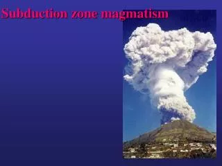
SUBDUCTION ZONE EARTHQUAKESPACIFIC NORTHWEST • Volcanoes • Youthful ocean floor and strong • Coupling with overriding plate • 1872 M6.8, Lake Chelan • 1949, M 7.1 earthquake, Puget Sound • 1965, M6.5 earthquake, Puget Sound • 2001 M 6.8 earthquake, Puget Sound • 1700 M 9.0 earthquake, Cascadia
SUBDUCTION ZONE EARTHQUAKESPACIFIC NORTHWEST2/28/2001 M6.8 Nisqually earthquake
SUBDUCTION ZONE EARTHQUAKEPACIFIC NORTHWEST2001 Nisqually earthquake M6.8 Normal fault Earthquake hypocenter 52.40 km depth under Tacoma Because it was so deep caused remarkably little damage at the surface. Seismicity in the Pacific Northwest
SUBDUCTION ZONE EARTHQUAKESPACIFIC NORTHWEST2001 Nisqually earthquake Normal fault solution at the bend in the Juan de Fuca plate as it descends into the mantle Below the zone where the most devastating thrust earthquakes occur. Normal fault and depth of rupture = damage was small.
SUBDUCTION ZONE EARTHQUAKES Stratigraphic evidence of past earthquakes • Interseismic: Uplift above the locked zone and oceanward submergence CONCEPT OF PIVOT LINE • Coseismic: Rapid submergence above the locked zone and oceanward uplift. • Two features demonstrate the subsidence typical of subduction zone earthquakes • Buried lowlands and sequences of soil horizons.
SUBDUCTION ZONE EARTHQUAKES Stratigraphic evidence of past earthquakes • Rapid coseismic subsidence • Deposition of tsunami sand layers • Interseismic emergence
SUBDUCTION ZONE EARTHQUAKES Stratigraphic evidence of past earthquakes Rapid coastal submergence during great earthquakes, large number of freshwater coastal plants die and leave evidence in the form of "peat". Coastal submergence, some fresh-water lowlands drop below sea-level. Vegetation in these areas is exposed to seawater and dies.
SUBDUCTION ZONE EARTHQUAKES PACIFIC NORTHWEST26 January 1700 9.0 Cascadia earthquake • Annual growth rings in drowned trees along coast from BC to Oregon show • Trees died at the same time 1680-1720. • Rapid subsidence and sea water kills tree roots. • Large earthquakes cause extensive subsidence.
SUBDUCTION ZONE EARTHQUAKESPACIFIC NORTHWESTJapanese records show evidence of a tsunami January 26 1700 that was not from a local earthquake but probably from Pacific Northwest.
SUBDUCTION ZONE EARTHQUAKESPACIFIC NORTHWEST Kenji Sataki found Japanese records to tsunami occurrences along the country's eastern coastline between January 27 and 28, 1700. Careful analysis of these historic tsunami records indicated that several coastal villages were damaged. The following is a chronicle by the head of Miho village, 145 km southwest of Tokyo. This account tells of sea water covering land as if it were high tide. "The water also went into the pine trees of Ego. The receding water went out very fast, like a big river. It came in about seven times before 10 a.m. of that day and gradually lost its power…Because the way the tide came in was so unusual, and was in fact unheard of, I advised the villagers to escape to Miho Shrine…It is said that when an earthquake happens, something like large swells result, but there was no earthquake in either the village or nearby."
SUBDUCTION ZONE EARTHQUAKESPACIFIC NORTHWEST!700 TSUNAMI Tsunami Modeling: Size and source of distant tsunamis.
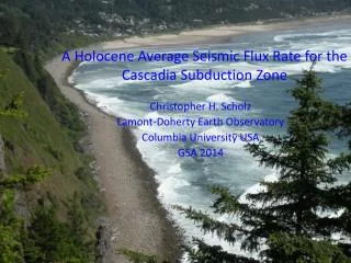
SUBDUCTION ZONE EARTHQUAKESPACIFIC NORTHWESTOFFSHORE TURBIDITE RECORD FOR PAST EARTHQUAKES A number of events can potentially trigger turbidity currents. Tsunamis Storm induced waves Slope failures Earthquakes The turbidite record strongly suggests that Cascadia experienced strong coast-wide shaking typical of a large subduction zone earthquake.
SUBDUCTION ZONE EARTHQUAKESPACIFIC NORTHWESTOFFSHORE TURBIDITE RECORD FOR PAST EARTHQUAKES 54 new cores in Cascadia, document the event record temporally and spatially. Thirteen post-Mazama and 18 Holocene events are found along~ 660 km of plate margin. The most recent event took place in 1700 AD (Satake et al., 1996; Nelson et al., 1995) An additional 12 turbidite events have occurred during the preceeding 7200 years, yielding a mean recurrence time of ~575 years.
SUBDUCTION ZONE EARTHQUAKESPACIFIC NORTHWESTOFFSHORE TURBIDITE RECORD FOR PAST EARTHQUAKES Triggering mechanisms: Are they Earthquakes? Are these events all triggered by earthquakes? Eight mechanisms for turbid flow triggering: 1) storm wave loading 2) great earthquakes 3) Tsunamis 4) sediment loading. 5) crustal earthquakes 6) slab earthquakes 7) hyperpycnal flow 8) gas hydrate destabilization.
SUBDUCTION ZONE EARTHQUAKESPACIFIC NORTHWESTOFFSHORE TURBIDITE RECORD FOR PAST EARTHQUAKES Triggering mechanisms: Are they Earthquakes? 13 turbidites had been deposited off coastal Washington and Oregon since the eruption of Mount Mazama Turbidity currents originating from different locations occurred simultaneously Simultaneous turbidity currents from different side channels merge, the main channel can be expected to show a single large turbidite. If the turbidites orignated at different times in the side channels, the main channel would record each separate turbidite event.
SUBDUCTION ZONE EARTHQUAKESPACIFIC NORTHWESTOFFSHORE TURBIDITE RECORD FOR PAST EARTHQUAKES Triggering mechanisms: Are they Earthquakes? The consistent number of turbidites in core samples from the side and main channels indicate that the turbidity currents were likely caused at the same time and by the same event. Large storms are an unlikely source of a coast- wide event because these storms produce waves not much larger than smaller, more common storms. If common and rare storms produce waves that are approximately the same magnitude, the turbidite record should reflect more than 13 events in the last 5,000 years.
SUBDUCTION ZONE EARTHQUAKESPACIFIC NORTHWESTOFFSHORE TURBIDITE RECORD FOR PAST EARTHQUAKES
SUBDUCTION ZONE EARTHQUAKESPACIFIC NORTHWESTOFFSHORE TURBIDITE RECORD FOR PAST EARTHQUAKES Triggering mechanisms: Are they Earthquakes? The “confluence test” of Adams (1990) requires synchronous triggering within a few hours. 18 Holocene events, all of which pass this test of synchronous triggering.
SUBDUCTION ZONE EARTHQUAKESPACIFIC NORTHWESTTsunami animations
PACIFIC NORTHWESTSUMMARY PALEOSEISMIC RECORD FOR PAST EARTHQUAKES