Archaeology Guidebook
2.01k likes | 2.03k Views
Get the latest travel deals and promo codes toward discounted flights, hotels, cruises, car hires, rail passes and more from 200 travel companies with https://traveldeal.store

Archaeology Guidebook
E N D
Presentation Transcript
Subtopic Topic Ancient History History Archaeology An Introduction to the World’s Greatest Sites Course Guidebook Dr. Eric H. Cline The George Washington University
PUBLISHED BY: THE GREAT COURSES Corporate Headquarters 4840 Westfields Boulevard, Suite 500 Chantilly, Virginia 20151-2299 Phone: 1-800-832-2412 Fax: 703-378-3819 www.thegreatcourses.com Copyright © The Teaching Company, 2016 Printed in the United States of America This book is in copyright. All rights reserved. Without limiting the rights under copyright reserved above, no part of this publication may be reproduced, stored in or introduced into a retrieval system, or transmitted, in any form, or by any means (electronic, mechanical, photocopying, recording, or otherwise), without the prior written permission of The Teaching Company.
i Eric H. Cline, Ph.D. Professor of Classics and Anthropology Director of The George Washington University Capitol Archaeological Institute The George Washington University D Eastern Languages and Civilizations, and the current Director of The George Washington University (GWU) Capitol Archaeological Institute. He is also a National Geographic Explorer, a Fulbright Scholar, a National Endowment for the Humanities (NEH) Public Scholar, and an award-winning teacher and author. He holds a Ph.D. in Ancient History from the University of Pennsylvania, an M.A. in Near Eastern Languages and Literatures from Yale University, and a B.A. in Classical Archaeology modified by Anthropology from Dartmouth College. In 2015, he was awarded an honorary doctoral degree (honoris causa) from Muhlenberg College. r. Eric H. Cline is a Professor of Classics and Anthropology, the former Chair of the Department of Classical and Near An archaeologist and ancient historian by training, Dr. Cline’s primary fields of study are biblical archaeology, the military history of the Mediterranean world from antiquity to the present, and the international connections among Greece, Egypt, and the Near East during the Late Bronze Age (1700– 1100 B.C.E.). He is an experienced and active field archaeologist, with more than 30 seasons of excavation and survey to his credit in Israel, Egypt, Jordan, Cyprus, Greece, Crete, and the United States. Dr. Cline is currently codirector of the renewed series of archaeological excavations at the site of Tel Kabri in Israel, which began in 2005. The project is run by the University of Haifa (with Assaf Yasur-Landau) and GWU. Dr. Cline was also a member of the Megiddo Expedition in Israel, excavating at biblical Armageddon for 10 seasons over a 20-year period, from 1994 to 2014. In 2015, Dr. Cline was named a member of the inaugural class of NEH Public Scholars, receiving the award for his next book project.
Archaeology: An Introduction to the World’s Greatest Sites ii At GWU, Dr. Cline has won the Oscar and Shoshana Trachtenberg Prize for Teaching Excellence and the Oscar and Shoshana Trachtenberg Prize for Faculty Scholarship; he is the first faculty member at GWU to have won both awards. He also won the national Excellence in Undergraduate Teaching Award from the Archaeological Institute of America. Dr. Cline teaches a wide variety of courses at GWU, including Introduction to Archaeology, History of Ancient Greece, History of Egypt and the Ancient Near East, and History of Ancient Israel, as well as various smaller honors and freshmen seminars. He has also served as the advisor to undergraduate archaeology majors at GWU since 2001. Dr. Cline’s most recent book, 1177 B.C.: The Year Civilization Collapsed, received the 2014 Award for the Best Popular Book from the American Schools of Oriental Research and was considered for the 2014 Pulitzer Prize. Three of his previous books have won the Biblical Archaeology Society’s award for Best Popular Book on Archaeology. His books have also been featured as a main selection of the Natural Science Book Club, a main selection of the Discovery Channel Book Club, a USA TODAY “Books for Your Brain” selection, and a selection of the Association of American University Presses for Public and Secondary School Libraries. A prolific researcher and author with 16 books and more than 100 articles and book reviews to his credit, Dr. Cline is perhaps best known for such books as The Battles of Armageddon: Megiddo and the Jezreel Valley from the Bronze Age to the Nuclear Age; Jerusalem Besieged: From Ancient Canaan to Modern Israel; From Eden to Exile: Unraveling Mysteries of the Bible; Biblical Archaeology: A Very Short Introduction; and The Trojan War: A Very Short Introduction. His books have been translated or are being translated into 14 languages. His research has been featured in The Washington Post, The New York Times, U.S. News & World Report, USA TODAY, National Geographic News, CNN, the London Telegraph, the London Mirror, the Associated Press, and elsewhere, His books have been reviewed in The Times Literary Supplement, Times Higher Education, The Jerusalem Post, the Cincinnati Enquirer, the History News Network, Jewish Book World, and many professional journals.
iii iii Dr. Cline has also appeared in more than 20 television programs and documentaries, including those on ABC, the BBC, the National Geographic Channel, HISTORY, and the Discovery Channel. Dr. Cline has been interviewed by syndicated national and international television and radio hosts on such shows as ABC’s Good Morning America, Fox News Channel’s America’s Newsroom, the BBC World Service’s The World Today, NPR’s Public Interest, and The Michael Dresser Show. In addition, he has presented more than 300 scholarly and public lectures on his work to a wide variety of audiences both nationally and internationally, including at the Smithsonian Institution in Washington DC, The Metropolitan Museum of Art in New York, and the Skirball Cultural Center in Los Angeles. ■
Table of Contents INTRODUCTION Professor Biography ............................................................................i Course Scope .....................................................................................1 LECTURE GUIDES LECTURE 1 The Origins of Modern Archaeology ...................................................3 LECTURE 2 Excavating Pompeii and Herculaneum.............................................10 LECTURE 3 Schliemann and His Successors at Troy ..........................................17 LECTURE 4 Early Archaeology in Mesopotamia ..................................................24 LECTURE 5 How Do Archaeologists Know Where to Dig? ..................................32 LECTURE 6 Prehistoric Archaeology ....................................................................39 LECTURE 7 Göbekli Tepe, Çatalhöyük, and Jericho ............................................46 LECTURE 8 Pyramids, Mummies, and Hieroglyphics ..........................................53 LECTURE 9 King Tut’s Tomb ................................................................................60 LECTURE 10 How Do You Excavate at a Site? ......................................................67
Table of Contents v LECTURE 11 Discovering Mycenae and Knossos .................................................74 LECTURE 12 Santorini, Akrotiri, and the Atlantis Myth ...........................................82 LECTURE 13 The Uluburun Shipwreck ..................................................................90 LECTURE 14 The Dead Sea Scrolls.......................................................................97 LECTURE 15 The Myth of Masada? .....................................................................104 LECTURE 16 Megiddo: Excavating Armageddon .................................................111 LECTURE 17 The Canaanite Palace at Tel Kabri .................................................118 LECTURE 18 Petra, Palmyra, and Ebla................................................................124 LECTURE 19 How Are Artifacts Dated and Preserved? .......................................131 LECTURE 20 The Terracotta Army, Sutton Hoo, and Ötzi ....................................138 LECTURE 21 Discovering the Maya .....................................................................146 LECTURE 22 The Nazca Lines, Sipán, and Machu Picchu ..................................154 LECTURE 23 Archaeology in North America ........................................................162 LECTURE 24 From the Aztecs to Future Archaeology .........................................170
Archaeology: An Introduction to the World’s Greatest Sites vi SUPPLEMENTAL MATERIAL Bibliography ....................................................................................177 Image Credits .................................................................................191
Archaeology: An Introduction to the World’s Greatest Sites Scope: What, exactly, is it that archaeologists do? Although tremendous numbers of people are fascinated by the idea of archaeology, many have little idea what is involved. Indeed, many people picture an archaeological excavation as an Indiana Jones movie. This course is meant to set the record straight. It is an introduction to archaeology for the general public that provides answers to the questions archaeologists are asked most frequently: How do archaeologists find ancient sites? What happens during an actual excavation? How do we know how old something is? In answering these questions, this course provides the inside story of what it is that archaeologists actually do and how they do it. We will learn how what began as a haphazard search for famous sites of ancient history evolved into a highly organized, professional, and systematic study of the peoples and cultures of the past—progressing from the first crude excavations at Herculaneum to the high-tech methods being used at Teotihuacan today. We’ll also get firsthand insight into how cutting-edge technology has forever changed the field. In addition, we will discuss some of the most famous archaeological discoveries of all time, including the tomb of King Tut, the Uluburun shipwreck, the Nazca Lines, and the amazing terracotta warriors. These discoveries are arranged thematically, both chronologically and geographically. We’ll travel the world—from Ur in Mesopotamia to China’s Shanxi Province, from Masada in Israel to the ancient town of Akrotiri in Greece, from Sutton Hoo in England, to Machu Picchu in Peru. We’ll
Archaeology: An Introduction to the World’s Greatest Sites 2 also include forays into Spain and France, Italy and North America, Africa, Mexico, and Turkey. Whether you’re new to the subject or you’re an archaeology enthusiast, this course will provide an unparalleled glimpse into a critical source of historical knowledge. ■
Lecture X T In this course, we’ll explore some of the most famous archaeological discoveries of all time, and we’ll look at how cutting-edge technology has changed the field. By the end of the course, you’ll be an expert in excavation, and you’ll possess a deeper appreciation for why saving the past matters. Archaeology not only teaches us about the past, but it also connects us to a broader range of human experience and enriches our understanding of our present and our future. Lecture 1 The Origins of Modern Archaeology he field of archaeology began as a haphazard search for ancient statues and famous sites of history but has evolved into a highly organized, professional, and systematic study of the peoples and cultures of the past. Ancient Archaeologists • The first archaeologist we know of lived more than 2,500 years ago. He was the Neo-Babylonian king Nabonidus, who ruled in ancient Iraq and Syria during the middle of the 6th century B.C. Nabonidus is known to have excavated ancient buildings and even set up a museum so that he could display the objects he found. • Nabonidus wasn’t the only person in antiquity who was interested in what had come before him. The Greek writer Hesiod, who wrote a poem called Works and Days in about 700 B.C., before the time of Nabonidus, referred to the earlier periods in Greece as the Age of Gold, the Age of Silver, and so on. Hesiod lived during a period of regeneration after centuries of the world’s first Dark Age, and he called his own time the Age of Iron. Archaeologists still call that period the Iron Age, thanks in part to Hesiod. Early Modern Archaeologists • In terms of the modern world, one of the first people to try to look back at the stretch of human history was Archbishop James Ussher. In the 1600s, he went through the Bible and added up the various dates for people mentioned there, such as Noah, Joshua, Abraham, and so on, and came up with the idea that the world had been created about 6,000 years ago—specifically, on October 23, 4004 B.C.
Archaeology: An Introduction to the World’s Greatest Sites 4 • The origins of modern archaeology probably go back to the early 1700s, when people first started exploring the ancient Italian ruins that had been buried by an explosion of Vesuvius in 79 A.D. ○ Credit here usually goes to a man named Emmanuel Maurice de Lorraine, who was the prince (and, later, duke) of Elbeuf, in Austria. He was living in Italy near Naples at the time and underwrote the first efforts to tunnel into the ground at Herculaneum, a town near Pompeii. ○ His men happened to dig right into the ancient Roman theater at Herculaneum and were able to extract a number of marble statues. Most of these were used to decorate Emmanuel Maurice’s estate; others were distributed elsewhere in Europe, including to some museums. Proper excavations at Herculaneum and Pompeii began a few decades later. • Interestingly, Thomas Jefferson also did a bit of archaeology in the late 1700s. In fact, some think that what he did should count as the first real archaeological excavations conducted in the New World. ○ In about 1784, he excavated a Native American burial mound on his property in Virginia. He was able to tell that there were different layers in the mound and that the bodies in it had been buried at different times. ○ In this, Jefferson was far ahead of his time. Today, the idea of separate layers is known as stratigraphy, but it wouldn’t become an established part of archaeology until the time of Sir William Matthew Flinders Petrie, who excavated in Egypt and Palestine a century later. Archaeology in the 19th Century • By the mid-1800s, serious excavations were underway at a number of ancient sites in the Near East, underwritten by such institutions as the British Museum and the Louvre and conducted by Sir Austen Henry Layard, Paul Émile Botta, and others. They excavated in what is now Iraq at such places as Nineveh and Nimrud and shipped magnificent pieces back to the museums for display. These
Lecture 1—The Origins of Modern Archaeology 5 pieces include the colossal winged bull and lion statues from the palaces of Sargon II and Ashurnasirpal II that are currently on display at the British Museum. • Other 19th-century archaeologists, such as John Lloyd Stephens, went exploring in the New World. Stephens, along with a British artist named Frederick Catherwood, traveled in the Yucatan, in modern-day Mexico. They published beautiful books about their travels in the 1840s, in which they reported the discovery of previously unknown Maya sites. • The fledgling field of archaeology, as it began to grow and solidify, borrowed heavily from other disciplines, especially geology. James Hutton and Charles Lyell, considered to be among the fathers of geology, had suggested theories concerning the stratification of rocks. ○ They believed that the lower down in the earth one went, the earlier the rocks would date; that is, the earlier rocks had been laid down in the strata first, with later levels coming in on top of them. ○ This is similar to what Thomas Jefferson had concluded; it’s also a premise that would form the basis of Petrie’s excavations. • Another advance came from a Danish museum curator named C. J. Thomsen, who began cataloguing the objects in the National Museum of Denmark in the 1830s. His results were published in an English edition just before 1850. Thomsen split the museum’s collections of antiquities into three periods: the Stone Age, the Bronze Age, and the Iron Age. ○ This system—known as the three-age system—was soon adopted throughout Europe and remains in use to this day, though it now has a number of subdivisions. For instance, the Stone Age is divided into the Paleolithic, that is, the Old Stone Age; the Mesolithic, which is the Middle Stone Age; and the Neolithic, the New Stone Age.
Archaeology: An Introduction to the World’s Greatest Sites 6 ○ The Bronze Age is frequently subdivided even further, according to location. The timing of the Bronze Age varies depending on where you are in the world; for example, the Bronze Age in China took place at a different time than either the Bronze Age in Europe or the Bronze Age in the ancient Near East. • By the 1860s and 1870s, Heinrich Schliemann was searching for the legendary city of Troy. Going against the scholars of the day, most of whom didn’t think the Trojan War had taken place, Schliemann began excavating at the site of Hisarlik in northwest Turkey and soon announced to the world that he had found Troy. Later, he also announced that he had uncovered the ruins of Mycenae, home to Agamemnon, who led the Greek army in its assault on Troy. • At around the same time, various people were working to decipher ancient languages. Probably the most famous person in this field is Jean-François Champollion, the brilliant French scholar who is credited with deciphering Egyptian hieroglyphics in 1823. ○ Another language scholar was Sir Henry Rawlinson, who helped to translate the cuneiform script in Mesopotamia in the 1850s. Cuneiform is a wedge-shaped writing system that was used to write Akkadian, Babylonian, Hittite, Old Persian, and other languages in the ancient Near East. ○ Rawlinson cracked the cuneiform system by translating a trilingual inscription written in Old Persian, Elamite, and Babylonian. Darius the Great of Persia, in about 519 B.C., had carved the inscription into a cliff face at the site of Behistun in what is now Iran. Sir William Matthew Flinders Petrie • By the end of the 19th century and into the 20th, some of the great early archaeologists began to appear on the scene. One of the most important of these was Sir William Matthew Flinders Petrie. • Petrie first dug in Egypt, where he trained a group of workmen from a village near modern-day Luxor. To this day, the descendants
Lecture 1—The Origins of Modern Archaeology 7 of those men, known as guftis, still provide much of the skilled labor for archaeological excavations in Egypt. Each gufti does the same task that his family has always done; some are pickmen, some are trowelmen, and so on. • Petrie also dug in what is now modern Israel but was Palestine in his day. Here, he was responsible for the introduction or popularization of a number of concepts that are taken for granted in archaeology today. For example, he applied the concept of stratigraphy, adopted from geology, and argued that earlier things are usually found lower down than more recent things, especially in the man-made mounds known as tells that can be seen throughout the Middle East. ○ Of course, Petrie was right; tells are actually made up of one ancient city on top of another, built up over centuries or millennia, and the earliest city is always at the bottom. The tell (ancient mound) at Megiddo, which is the site of biblical Armageddon, is made up of 20 different cities in layers.
Archaeology: An Introduction to the World’s Greatest Sites 8 ○ For example, at Megiddo, the 70-foot-tall mound has no fewer than 20 different cities hidden within it, with the first one, at the bottom, dating back to at least 3000 B.C. and the most recent one, at the top, dating to about 300 B.C. • Petrie is also one of the people responsible for realizing that broken pieces of pottery removed while digging can be used to help date different levels of a mound. Because styles of pottery go in and out of fashion, certain types can be correlated, especially in conjunction with radiocarbon dating, with fairly specific dates and periods. Petrie also realized that if the same type of pottery is found at two different sites, the levels in which they are found at each site are probably equivalent in time. This has proven to be an extremely useful point. The idea of separate layers representing successively earlier periods on an archaeological site is known as stratigraphy.
Lecture 1—The Origins of Modern Archaeology 9 Sir Mortimer Wheeler and Dame Kathleen Kenyon • Sir Mortimer Wheeler excavated at Maiden Castle in England and Harappa in India. At both sites, he excavated in 5-meter squares, with a 1-meter-wide balk in between the squares, on which excavators could walk, push wheelbarrows, and so on. Wheeler’s student Kathleen Kenyon, who is probably best known for digging at Jericho and Jerusalem, brought this method with her when she began excavating in what was then Palestine in the 1930s. It is now known as the Wheeler-Kenyon or Kenyon-Wheeler method. • This method allows the archaeologist to keep control of the stratigraphy, by looking at the interior sides of each square to see what has already been dug through and to get a visual idea of the history of the area. • At the end of each season, most archaeological teams in the Near East draw and photograph each of these sections so that they can publish a record of it for others to see and discuss. The reason for this step is that archaeologists destroy the very things they are studying as they dig; thus, it’s important to record every detail of the process. Suggested Reading Bahn, 100 Great Archaeological Discoveries. Fagan, ed., The Great Archaeologists. Fagan and Durrani, In the Beginning. Questions to Consider 1. Might there be a better way to divide and subdivide the periods of antiquity rather than the three-age system that Thomsen created? 2. What do you think of the excavation techniques introduced by Petrie, Wheeler, and Kenyon? Can they be improved upon?
Lecture X M people in Pompeii, plus others in nearby towns, such as Herculaneum. At the time, Pompeii was a wealthy Roman town; in fact, it may have been something of a resort city—used as a getaway for wealthy members of society wishing to escape from Rome. Herculaneum, too, was a wealthy city, perhaps even more so than Pompeii. In this lecture, we’ll look at the destruction and later excavation of these sites. Lecture 2 Excavating Pompeii and Herculaneum ount Vesuvius is located near the modern city of Naples, Italy. It is the only active volcano on the mainland of Europe today; as we know, it erupted on August 24, 79 A.D., killing at least 2,000 The Eruption • We actually have an eyewitness description of the eruption of Mount Vesuvius, contained in two letters written by Pliny the Younger and sent to the Roman historian Tacitus. Pliny was 17 years old at the time and had been staying with his uncle, Pliny the Elder. • The elder Pliny was in charge of the Roman fleet, which was stationed across the Bay of Naples from Vesuvius, at Misenum. During the eruption, the older Pliny attempted to sail to the rescue and save some of the fleeing survivors, but he died while doing so. The younger Pliny remained at Misenum, watching the eruption. His letters are full of details, based both on what he observed and what was later told to him by the men who had been with his uncle on the ships. • Pliny’s second letter, in particular, brings the story of the eruption to life: Behind us were frightening dark clouds, rent by lightning twisted and hurled, opening to reveal huge figures of flame. … I look back: a dense cloud looms behind us, following us like a flood poured across the land. … [Then] a darkness came that was not like a moonless or cloudy night, but more like the black of closed and unlighted rooms. You could hear women lamenting, children crying, men shouting. … Many raised their hands to the gods,
Lecture 2—Excavating Pompeii and Herculaneum 11 and even more believed that there were no gods any longer and that this was one last unending night for the world. • As we know, for centuries afterward, Pompeii, Herculaneum, and other towns lay buried beneath several meters of ash and rock. Pompeii was the first of these towns to be discovered (in 1594), but Herculaneum was the first to be excavated. In the early 1700s, the duke of Elbeuf ordered his men to tunnel into the ground at Herculaneum after he bought the site specifically because ancient pieces of marble had been recovered from the area. The workmen happened to dig into the Roman theater and extracted a number of ancient marble statues. • The earliest excavations at Pompeii were unprofessional, to say the least, frequently involving simply digging tunnels until something ancient was unearthed. Rather than archaeology, it was more like looting, but it was the first known excavation done in the modern era. However, proper excavations at Herculaneum and Pompeii began a few decades later and have essentially been ongoing ever since. Herculaneum • In addition to being hit with ash and pumice, Herculaneum seems to have been the victim of a 30-foot mudflow, known as a lahar in geological terms. This filled up the buildings and completely buried the city. Being buried in such a manner essentially preserved Herculaneum, freezing it just as it had been on that August morning in 79 A.D. • Archaeologists working in 1981 discovered that Herculaneum had suffered yet another horror during the eruption of Vesuvius. ○ Until that point, relatively few human remains had been found, and it had long been assumed that most people had successfully fled or been evacuated. However, in excavations that year and again in the 1990s, archaeologists found the bodies of at least 300 people who had taken refuge in what seem to be boat houses on the shore.
Archaeology: An Introduction to the World’s Greatest Sites 12 ○ The people were probably waiting to be picked up by ships from the Roman fleet; however, a blast of heat, estimated at 1000° F, swept through the area. According to forensic anthropologists, the people were probably killed instantaneously. Only their skeletons remained; their skin and internal organs were destroyed by the heat and the hot ash that covered the bodies almost immediately. • The same intense heat and ash also destroyed other organic material in the town, including private libraries and documents written on scrolls. These were turned into what are described as “cylinders of carbonized plant material.” Up to 300 of these scrolls were found intact during the earliest excavations at Herculaneum (in 1752) in a villa that probably belonged to the family of the father-in-law of Julius Caesar. ○ In looking at photographs of these scrolls, it’s difficult to see how they could possibly be unrolled or read in any way. But recent investigators have discovered a technique for making out letters written on the scrolls without unrolling them. ○ The technique involves using X-rays in a “laserlike beam,” which allows researchers to detect “the … contrast between the carbonized papyrus … and the … ink.” It is not yet known whether the technique will work well enough to allow the carbonized scrolls to be read in their entirety, but it is an exciting development in archaeology. Pompeii • Excavations at Pompeii first began around 1750. Here, the ash and pumice that covered the town mixed with rain and eventually hardened into the consistency of cement, encasing hundreds of bodies. Over time, the flesh and inner organs of each body decayed slowly, forming hollow cavities in the ash in the shape of the body that had once been buried there. • In 1863, Giuseppe Fiorelli, the Italian archaeologist in charge of excavating Pompeii, directed his team to pour plaster into these
Lecture 2—Excavating Pompeii and Herculaneum 13 Early excavators in Pompeii found a town frozen in time from 79 A.D.; bread was still on the tables, a dog remained chained up outside, and bodies were in the streets, some still clutching jewelry and other objects. cavities, yielding an exact cast of what had originally formed the cavity. In this way, Fiorelli’s team recovered the remains of hundreds of bodies, as well other organic materials, such as wooden furniture and loaves of bread. They also recovered nonorganic objects, ranging from jewelry to silverware to jugs made of precious metals. • The houses in Pompeii were quite elegant, and just as in Herculaneum, they are extremely well preserved. One called the House of the Faun features a bronze statue of a faun, the satyr-like creature that is usually depicted playing the double-pipe. This same house also has the famous Alexander Mosaic, which uses hundreds of thousands of small stone tesserae to depict Alexander the Great fighting the Persian king Darius III.
Archaeology: An Introduction to the World’s Greatest Sites 14 • The eruption of Vesuvius also buried the gardens that belonged to some of the houses in Pompeii. In 1961, the archaeologist Wilhelmina Jashemski excavated an open area in Pompeii and found the remains of root cavities from the plants that had once been there. In fact, she was able to figure out the planting pattern in what was once a vineyard. • Elsewhere in Pompeii, archaeologists have uncovered the remains of bath houses, tanneries, shops, and other dwellings that one would expect to find in a city from the period. Some of the most recent findings come from the excavations of Steven Ellis, a professor at the University of Cincinnati. In 2014, after digging in an area by the Porta Stabia, one of the main gates into the city, Ellis announced that he had found 10 separate building plots with 20 shopfronts from which food and drink were sold or served. Such an arrangement seems typical in Pompeii, where even the private houses frequently had shops installed on the street. • Even more interesting, perhaps, were the drains, latrines, and cesspits that Ellis and his team excavated. In these, they found the remains of “grains, fruits, nuts, olives, lentils, local fish, and chicken eggs, as well as minimal cuts of more expensive meat and salted fish from Spain.” In another drain, they found the remains of “shellfish, sea urchin, and even delicacies, including the butchered leg joint of a giraffe.” Paintings, Advertisements, and Graffiti at Pompeii • The sudden burial of Pompeii preserved the paintings on the walls of the houses and buildings, including scenes that now give their names to the structures. For instance, the Villa of the Mysteries— referring to the mystery cult of Dionysus—gets its name from a scene of bacchanalian revelry on the walls of a small room. • Outside some of the shops in Pompeii, we can also see written advertisements. One promises a gladiator combat on April 8 through 12, featuring 20 pairs of gladiators and “a full card of wild beast combats.” Another specifies the market days for Pompeii, Nuceria,
Lecture 2—Excavating Pompeii and Herculaneum 15 Atella, and other towns. Outside a pub, yet another advertises the types of drinks and ales served 2,000 years ago. • Hundreds of campaign notices from a recent or upcoming election have also been found. These notices concern people who were running for vacant offices, such as the office of aedile, which was a relatively lowly job in charge of public buildings, baths, water, sewers, and public festivals. Another was the office of duovir, which was a higher judicial office. Some of these endorsements include: “The goldsmiths unanimously urge the election of Gaius Cuspius Pansa as aedile,” and “I ask you to elect Marcus Cerrinius Vatia to the aedileship. All the late-night drinkers support him. Florus and Fructus wrote this.” • Perhaps most interesting are the graffiti that we would usually think of as scrawled on bathroom walls today. ○ For example, one reads: “Take your lewd looks and flirting eyes off another man’s wife, and show some decency on your face!” Another was obviously written by someone whose heart had just been broken: “Anybody in love, come here. I want to break Venus’ ribs with a club and cripple the goddess’ loins. If she can pierce my tender breast, why can’t I break her head with a club?” ○ Finally, signaling that some things never seem to change, we find what is apparently a prostitute’s sign: “I am yours for 2 asses cash.” • Indeed, looking into the past at such sites as Pompeii and Herculaneum—sites that have been frozen at a precise moment in time—we note a great number of similarities between the past and the present. Of course, we now have iPads and cell phones, but our houses today are not all that different from theirs back then; our food is similar; and we have the same dependence on roads, elected officials, and stores that stock items we need. On the whole, the excavations at these two sites teach us that the ancient inhabitants of the Mediterranean were not that different from people in the same area today.
Archaeology: An Introduction to the World’s Greatest Sites 16 Suggested Reading Beard, The Fires of Vesuvius. Berry, The Complete Pompeii. Ellis, The Making of Pompeii. Questions to Consider 1. If we did not have the words of Pliny the Younger, would archaeology alone be enough to reconstruct what happened in Pompeii when Mount Vesuvius erupted in 79 A.D.? 2. What are some of the similarities between life in Pompeii during the 1st century A.D. and life today in terms of diet, housing, elections, and other aspects of city life?
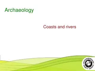
Lecture 3 O Menelaus, had been kidnapped by Paris, a prince of Troy. For their part, the Trojans claimed that Helen went with Paris willingly because she was in love with him. Led by Menelaus and his brother Agamemnon, the Greeks sent a fleet to besiege Troy and get Helen back. After 10 years, the Greeks destroyed Troy and returned with Helen. The question Heinrich Schliemann and others sought to answer was: Was there a historical Trojan War that served as a basis for Homer’s epic? Schliemann and His Successors at Troy ur information about the Trojan War comes to us mainly from the Greek poet Homer. According to Homer, during the Late Bronze Age, the Greeks believed that Helen, the wife of a king named Heinrich Schliemann’s Quest and “Discovery” • The classical scholars of the 19th century in Europe were pretty firmly convinced that the Trojan War had not taken place and was completely invented by Homer. Thus, when Heinrich Schliemann, an amateur in the field of archaeology, decided that he was going to go look for the site of Troy, he was going against the thinking of most scholars of his day. • By all accounts, Schliemann was not a man whose word could be entirely trusted. But by the time he was in his 40s, he had earned enough of a fortune so that he could retire and devote himself to finding evidence for Troy and the Trojan War. • In 1868, Schliemann traveled to Greece and Turkey, searching for a site that would match the description of Troy given by Homer. In his travels, he met the American vice consul to Turkey, Frank Calvert, who had also been looking for Troy and believed that he had found it. In fact, he had already bought the ancient mound, which now had the modern Turkish name Hisarlik, meaning “Place of Fortresses.” • Calvert had already begun excavations at the site but didn’t have enough money to continue the work. Schliemann had plenty of
Archaeology: An Introduction to the World’s Greatest Sites 18 Heinrich Schliemann was intent on finding Troy and proving that the Trojan War had taken place, claiming that the quest had been a childhood dream.
Lecture 3—Schliemann and His Successors at Troy 19 money and was happy to join forces with Calvert. However, once they began excavating and Schliemann decided that the mound was indeed the site of ancient Troy, he deliberately left Calvert’s name out of all subsequent official announcements, lectures, and publications, thereby claiming the fame and glory for himself. Schliemann’s Early Excavations • In 1872, Schliemann began his greatest assault on Hisarlik. Using a large team of local workmen, he dug a huge trench across most of the mound and down to a depth of about 45 feet. Although archaeology was a relatively new field at the time, there were still people who were knowledgeable enough, including Calvert, to warn Schliemann that such reckless digging might result in catastrophe—and they were right. • Schliemann and his men dug deeper into the trench, through buildings and stratigraphic levels. It turned out that there were nine cities buried on top of one another in the mound, although Schliemann thought at first that there were only six. ○ He stopped at what turned out to be the second city from the bottom, which he called the Burnt City. He was convinced that this was the city ruled by the Trojan king Priam, and his discoveries the next year confirmed to him that he was correct. ○ We now know, on the basis of pottery and carbon-14 dating, that Schliemann’s Burnt City dates to 2400 B.C., during the Early Bronze Age, which is more than 1,000 years before the Trojan War would have been fought. ○ If you stand at the bottom of Schliemann’s Great Trench today, at the level where he and his men stopped digging, and look straight up, you can see a level that contains a building made out of huge blocks of stone. This building dates to the period of city VI and was reused in city VII. It is all that’s left of a palace that dates to the Late Bronze Age, that is, the time period for which Schliemann was looking.
Archaeology: An Introduction to the World’s Greatest Sites 20 Priam’s Treasure • What convinced Schliemann that city II was Priam’s Troy? For one thing, he found a huge city gate, which he identified as Homer’s Scaean Gate. He also reported that he had found Priam’s Treasure. • According to Schliemann, he and his wife, Sophia, dug out the treasure themselves. The objects they discovered included gold jewelry, bronze tools, gold and silver cups and bowls, a golden vessel in the shape of a pomegranate, and stone hilts that probably belonged to bronze swords. The Schliemanns brought the objects home from the site and catalogued them. • They subsequently smuggled the treasure back to their residence in Athens. But soon thereafter, Schliemann donated it to the Berlin Museum. The treasure disappeared in the aftermath of World War II and was presumed lost for nearly 50 years. In the early 1990s, the Russians admitted that they had taken it as part of the spoils of war. • Today, Priam’s Treasure is in the Pushkin Museum in Moscow. It remains there despite the fact that four countries now lay claim to it: Turkey, Greece, Germany, and Russia. Interestingly, the question of who owns the treasure is irrelevant because it’s neither Priam’s nor a treasure. • Given that the objects were found in city II, which dates back to about 2400 B.C., they are 1,000 years too early to have belonged to Priam. In addition, some scholars have suggested that Schliemann didn’t even find the treasure in one place. Instead, they think he gathered the best of his finds from the season and announced that he had found them all together. In fact, we may never know what actually transpired. • The objects bear a great deal of resemblance to objects found elsewhere, from the islands of the northeast Aegean to the so- called Death Pits of Ur. The gold earrings, pins, and necklaces that Schliemann found may not have belonged to Priam, but they did belong to a class of jewelry that was in fashion across
Lecture 3—Schliemann and His Successors at Troy 21 much of the Aegean and the ancient Near East at the end of the 3rd millennium B.C. The Excavations of Dörpfeld and Blegen • Schliemann continued to dig at Troy throughout the 1870s and 1880s with the assistance of Wilhelm Dörpfeld, an architect with some previous archaeological experience. Dörpfeld eventually persuaded Schliemann that they should investigate city VI or city VII. Schliemann made plans for an additional attack on the mound, focused on these later levels, but he died in 1890. • Dörpfeld concentrated on excavating the remains at Hisarlik that Schliemann had left untouched, mostly around the edges of the mound. He unearthed tall stone walls, each several meters thick, and large gateways allowing entrance to the interior. • These were the remains of city VI, which seems to have lasted from about 1700 B.C. to 1250 B.C. Dörpfeld found numerous phases to the city, which he categorized A through H. The last phase, Troy VIH, showed signs of almost complete destruction. For Dörpfeld, this was definitive evidence for the Trojan War. He ended his excavations and published his results. • However, Carl Blegen, an archaeologist at the University of Cincinnati, examined Dörpfeld’s results and correctly concluded that an earthquake, not warfare, had caused the destruction of Troy VIH. Blegen believed that city VII had been besieged and destroyed by an army; thus, he reopened the excavations at Hisarlik in the 1930s. • Blegen found enough evidence, including arrowheads, bodies, and other indications of battle, to convince himself that city VII had been destroyed by humans in a protracted siege. ○ He also found that the large buildings and palaces of the previous city had been subdivided to allow several families to live where only one had been previously. Further, he noted that the storage capacity of the city had been increased tremendously, with large jars buried up to their necks in the ground.
Archaeology: An Introduction to the World’s Greatest Sites 22 ○ To Blegen, all this indicated a city that was under siege, just as Homer had said. The fact that the city had been destroyed about 1180 B.C. also put it in the timeframe suggested by the ancient Greeks. ○ Moreover, the material culture of the city showed continuity between Troy VI and VII. In other words, there was no evidence of a new group of people in city VII; rather, it appeared that the people in city VI had rebuilt their city. For these reasons, Blegen was convinced that an earthquake had destroyed city VI, while the Mycenaean Greeks had destroyed city VII during the Trojan War. Recent Excavations • Beginning in 1988, an international team of archaeologists decided to investigate the mound of Hisarlik again. This team was led by two men: Manfred Korfmann from the University of Tübingen, investigating the Bronze Age remains, and Brian Rose from the University of Cincinnati, investigating the post–Bronze Age remains. • Korfmann’s team surveyed the agricultural fields around Hisarlik using a magnetometer, which enabled them to detect walls, ditches, and buildings lying below the surface of the earth. Thanks to this device, the researchers realized that they had found an entire lower city of Troy beneath the agricultural fields. All the earlier archaeologists had simply been excavating the citadel—or upper part—of the city. The remains found by Korfmann’s team increased the size of the city at least tenfold and established it as a site that would indeed have been worthy of a 10-year-long siege. • Although Korfmann’s team misinterpreted some of their initial results—mistaking a large ditch for the great wall of the city—some of their findings seemed to confirm Blegen’s work. For example, in both the citadel and the lower city, they also found evidence for earthquake destruction in city VI and human destruction— warfare—in city VII.
Lecture 3—Schliemann and His Successors at Troy 23 • In addition, Korfmann’s work confirmed Blegen’s findings that after the city was destroyed in about 1180 B.C., the next city was occupied by what seem to be new people. In this phase, called Troy VIIb, we see new types of pottery, new architecture, and other material culture—all indications that the inhabitants of the previous city had been replaced by a new group. • As the Hisarlik digs continued, the post–Bronze Age team, led by Brian Rose, found a great deal of material, too, including a statue of the Roman emperor Hadrian and a marble head of Augustus. The Hellenistic Greeks and then the Romans had built on the citadel and established a nicely gridded city below. These later inhabitants were also convinced that this was the site of ancient Troy; in fact, they gave it the name New Troy in both Greek and Latin. • Korfmann died suddenly in 2005, but the international excavations continued. Interest both in digging and remote sensing in and around the site continues even now, which means that Hisarlik may reveal even more secrets about the ancient town that inspired one of the greatest epics ever written. Suggested Reading Cline, The Trojan War: A Very Short Introduction. Strauss, The Trojan War: A New History. Wood, In Search of the Trojan War. Questions to Consider 1. Do you believe that Schliemann actually found Priam’s Treasure? 2. Do you think that Troy VIh or Troy VIIA is more likely to be Priam’s city?
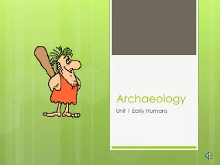
Lecture 4 T “between the rivers”—that is, the Tigris and Euphrates. Ur was a site famous in antiquity, with all the typical features of a Bronze Age Mesopotamian city, including religious structures known as ziggurats. Beginning in 1922, the site was excavated by Sir Leonard Woolley and his right-hand man, Max Mallowan. But it wasn’t until the fifth field season, in 1926–1927, that they began digging the cemetery at the site—the famous Death Pits of Ur that had captured the attention of Europe. Early Archaeology in Mesopotamia he site of ancient Ur is situated on the Euphrates River in modern Iraq, north of where the river empties into the Persian Gulf. This is the region known as ancient Mesopotamia, a name that means Royal Burials at Ur • Between 1927 and 1929, Sir Leonard Woolley and Max Mallowan uncovered 16 royal burials at Ur. The royal burials date to about 2500 B.C. and were quite impressive compared to the many other burials found in the cemetery at Ur. Each tomb usually had a stone chamber, either vaulted or domed, into which the royal body was placed. The chamber was at the bottom of a deep pit, with access possible only via a steep ramp from the surface. Precious grave goods were mostly found in the burial chamber with the body, while wheeled vehicles, oxen, and attendants were found in both the chamber and in the pit outside. • Numerous attendants were found in the Death Pits: One tomb had more than 70 bodies that went with their master or mistress into the afterlife. Most of these were women, but men were present, as well. Woolley assumed that they had drunk poison after climbing down the ramp into the pit, but CT scans of some of the skulls done in 2009 indicate that at least some of these people had been killed by having a sharp instrument driven into their heads just below and behind the ear while they were still alive. Death would have been instantaneous.
Lecture 4—Early Archaeology in Mesopotamia 25 Scenes on the Standard of Ur found in the Death Pits seem to depict a battle, followed by presentation of loot to the king and a victory banquet. • The grave goods that Woolley and Mallowan found with the royal bodies were amazing, despite the fact that many of the graves had been looted in antiquity. Among the finds were gold tiaras, gold and lapis jewelry, gold and electrum daggers, and a gold helmet. There were also delicate sculptures, the remains of a wooden harp with ivory and lapis inlays, and a wooden box with inlays that Woolley dubbed the Standard of Ur. Henry Rawlinson and Paul-Émile Botta • Among the first modern scholars and archaeologists who worked in Mesopotamia was Sir Henry Rawlinson, who helped to decipher and translate cuneiform script in the 1830s. Cuneiform is a wedge- shaped writing system that was used to write Akkadian, Babylonian, Hittite, Old Persian, and other languages in the ancient Near East. ○ Rawlinson, who was a British army officer posted to what is now Iran, cracked the secret of cuneiform by translating a
Archaeology: An Introduction to the World’s Greatest Sites 26 trilingual inscription that was written in Old Persian, Elamite, and Babylonian. Darius the Great of Persia had carved the inscription 400 feet above the desert floor into a cliff face at the site of Behistun in about 519 B.C. ○ By 1837, about 10 years before the copying of the entire inscription was completed, Rawlinson had figured out how to read the first two paragraphs of the part that was written in Old Persian. It reportedly took him another 20 years to decipher the Babylonian and Elamite parts of the inscription and successfully read the whole thing. ○ Along the way, however, Rawlinson was able to use his knowledge of cuneiform to begin translating some of the inscriptions that British archaeologist Sir Austen Henry Layard was finding at his excavations in what is now Iraq. In fact, Rawlinson was able to confirm that Layard had found two ancient sites that, up until that point, had been known only from the Bible. • Paul-Émile Botta was an Italian-born archaeologist who worked for the French. In December 1842, he began the first archaeological excavations ever conducted in what is now Iraq. Botta’s first efforts were concentrated on the mounds known as Kuyunjik, which are across the river from the city of Mosul. However, he didn’t find much there and quickly abandoned his efforts. ○ From one of his workmen, Botta learned that some sculptures had been found at a site called Khorsabad, which was located about 14 miles to the north. In March 1843, he began excavating there and, within a week, began to unearth a great Assyrian palace. ○ At first, Botta thought that he had found the remains of ancient Nineveh, but now we know that Khorsabad is the ancient site of Dur Sharrukin, the capital city of the Neo-Assyrian king Sargon II (r. 721–705 B.C.).
Lecture 4—Early Archaeology in Mesopotamia 27 Austen Henry Layard • Beginning in 1845, Sir Austen Henry Layard undertook his initial archaeological efforts at Nimrud, which he first thought was ancient Nineveh. Amazingly, on the first day of digging, his team of six local men found not one but two Assyrian palaces! Today, they are usually called the Northwest and Southwest Palaces. ○ From the inscriptions Layard found, it eventually became clear that the Northwest Palace was built by Assurnasirpal II (r. 884– 859 B.C.), and the Southwest Palace was built by Esarhaddon (r. 680–669 B.C.). Later, a Central Palace was discovered at the site, built by Tiglath-Pileser III (r. 745–727 B.C.). Shalmaneser III (r. 858–824 B.C.) also had buildings and monuments constructed at the site. ○ Layard published a book about his amazing discoveries at Nimrud. The book was called Nineveh and Its Remains, but when the inscriptions from the site were finally deciphered, they confirmed that it was actually ancient Kalhu (biblical Calah), rather than Nineveh. ○ As it turns out, Kalhu was the second capital city established by the Assyrians, the first being Assur itself. It served as their capital for almost 175 years, from 879 to 706 B.C. After that, Sargon II moved the capital to Dur Sharrukin for a brief period, and then Sennacherib moved it to Nineveh. • In 1849, Layard returned to Mosul for another round of excavations, but this time, his primary focus was Kuyunjik, the mound that Botta had abandoned seven years earlier. Layard’s men immediately began unearthing walls with reliefs and images, and translation of the tablets found there confirmed that this was the actual site of ancient Nineveh. By the time Layard and several other excavators were done, a palace of Sennacherib (r. 704–681 B.C.) had been uncovered, as well as a palace of Assurbanipal, Sennacherib’s grandson (r. 668–627 B.C.). ○ Sennacherib, who had moved the Assyrian capital from Dur Sharrukin after he came to the throne, built what he called the
Archaeology: An Introduction to the World’s Greatest Sites 28 Wall reliefs and tablets found by Austen Henry Layard helped confirm the identity of Kuyunjik as the ancient site of Nineveh. Palace without Rival at Nineveh. Today, the palace is probably most famous for the Lachish Room. Here, Layard found wall reliefs showing Sennacherib’s capture of the city of Lachish in 701 B.C. At that time, Lachish was the second most powerful city in Judah; Sennacherib attacked it before proceeding on to besiege Jerusalem. ○ The capture of Lachish is described in the Hebrew Bible, as is the siege of Jerusalem. Layard’s discovery was one of the first times that an event from the Bible could be confirmed by extrabiblical sources. ○ Twentieth-century excavations at the site of Lachish, in what is now Israel, not only confirmed the destruction of the city in about 701 B.C. but also revealed an Assyrian siege ramp,
Lecture 4—Early Archaeology in Mesopotamia 29 built of tons of earth and rocks and looking similar to ramps depicted in Sennacherib’s reliefs. ○ The Nineveh reliefs are full of gruesome scenes, including captives having their tongues pulled out and being flayed alive, along with decapitated heads displayed on a pole. It is universally accepted that the Assyrians actually committed such atrocities, but the depiction of them in Sennacherib’s palace is most likely meant as propaganda—a means to deter other kingdoms from rebellion. • It’s important to note that Layard was not a trained archaeologist. He frequently left the middle of rooms unexcavated and wasn’t particularly interested in any of the pottery his men uncovered. He was, however, interested in the inscribed slabs that made up the walls of rooms, as well as the colossal statues. Many of these were shipped back to the British Museum, where they can be seen today. Continuing Excavations • In 1853, Hormuzd Rassam, Layard’s protégé and successor at Nineveh, discovered Assurbanipal’s palace, literally under the nose of Botta’s successor, Victor Place, who was digging in the same spot. ○ Rassam and his men dug secretly for three straight nights in disputed territory on the mound; when their trenches first revealed the walls and sculptures of the palace, Place could do nothing but congratulate them on their finds. ○ Within the palace, Rassam found a tremendous library of cuneiform texts, just as Layard had done previously in Sennacherib’s palace. In fact, it is generally considered that the state archives were split between the two palaces, even though they were two generations apart. Apart from state documents, Rassam found religious, scientific, and literary texts, including copies of the Epic of Gilgamesh and the Babylonian flood story.
Archaeology: An Introduction to the World’s Greatest Sites 30 • In 1872, nearly 20 years after Rassam first found the tablets, a man named George Smith was employed at the British Museum, sorting out the tablets that Rassam had sent back from Nineveh. ○ At one point, Smith discovered a large fragment that gave an account of a great flood, similar to the deluge account found in the Hebrew Bible. When Smith announced his discovery at a meeting of the Society of Biblical Archaeology in December 1872, all of London was abuzz with excitement. ○ The problem, though, was that a large piece was missing from the middle of the tablet. A reward was promised to anyone who would go look for the missing fragment, and Smith himself decided to take on the challenge, even though he had never been to Mesopotamia and had no training as an archaeologist. ○ Amazingly, just five days after he arrived at Nineveh, Smith found the missing piece by searching through the back-dirt pile of previous excavators. He also found about 300 other pieces from clay tablets that the workers had discarded. • The 19th-century excavations at Nimrud, Nineveh, Khorsabad, Ur, Babylon, and other sites began an era of excavation in the region that continues to this day. As recently as 1988, spectacular discoveries were made at Nimrud by local Iraqi archaeologists. They uncovered the graves of several Assyrian princesses from the time of Assurnasirpal II in the 9th century B.C. Foreign excavations were suspended in Iraq around 1990 but are now being resumed and may lead to yet more exciting discoveries. Suggested Reading Fagan, Return to Babylon. Lloyd, Foundations in the Dust. Roux, Ancient Iraq.
Lecture 4—Early Archaeology in Mesopotamia 31 Questions to Consider 1. Was it proper for the British Museum and the Louvre to sponsor expeditions to acquire material for their collections? 2. How can we protect antiquities in lands that are ravaged by civil wars and/or invaders bent on destruction?
Lecture 5 I example, when you look at the Athenian acropolis or the mound of Megiddo in Israel, you know that you’re looking at an ancient site. But other sites can be almost indiscernible—as small as a scatter of flakes where someone once made a stone tool. In this lecture, we’ll explore the concept of archaeological surveying, that is, the process of looking for sites. We’ll also learn about the various types of remote sensing now being used by archaeologists. How Do Archaeologists Know Where to Dig? n their textbook In the Beginning: An Introduction to Archaeology, Brian Fagan and Nadia Durrani define a site simply as a place “where traces of past human activity are to be found.” Some sites are fairly obvious. For Ground Reconnaissance • There are two basic ways to find sites: doing reconnaissance on the ground and doing it from the air or from space. Ground surveys first began to be popular in the 1960s and 1970s and gained speed in the 1980s, in part because they are usually a much cheaper alternative to digging and can cover a great deal more ground. They also allow archaeologists to ask and answer different types of questions than they can when digging a single site. • For instance, we might want to investigate how intensively a specific area in Greece was occupied during the Bronze Age. Did that settlement pattern change during the following Dark Ages? What happened when things began to return to normal and we get into the eras of Archaic and Classical Greece? What happened in the region when the Romans arrived? What was it like in the Byzantine period, the Ottoman period, or the modern period? • Ground surveys can help answer these kinds of questions. By doing surveys and identifying various sites from different periods in the area, we can construct a history of the region without ever digging at a single site. Of course, many surveys lead to an excavation afterwards.
Lecture 5—How Do Archaeologists Know Where to Dig? 33 Aerial Surveys • These days, instead of leading with a ground survey, it generally makes more sense to start with aerial surveys. This type of survey can be as simple as buying aerial photographs or satellite images or as complicated and expensive as arranging for overhead flights using light detection and ranging (LiDAR. a remote-sensing technology) to survey an area. Among the images that can be purchased are declassified military satellite images, high-resolution images sold by private companies, and images taken from the space shuttle. ○ Interestingly, buried walls, earthworks, and other large constructions associated with settlements can often be seen more easily from the air than they can be seen on the ground, even if you are walking right over them. Often, aerial images reveal crop marks, which mark the precise locations of buried items, such as ditches, walls, and other structures. ○ Such buried structures affect the soil and, thus, the vegetation that grows directly above them. Very simply, if there is a buried ditch below the modern surface, the vegetation growing directly above it will be higher and more lush than the surrounding vegetation because there are more nutrients in the soil in that spot. If there is a buried wall below the modern surface, the vegetation growing directly above it will be less dense and lush than the surrounding vegetation because there are fewer nutrients in the soil. ○ Although these differences in height and density might be almost imperceptible at ground level, from the air, they are immediately obvious, especially in the spring. • Recently, archaeologists who have enough funding have been using LiDAR, a remote-sensing technology that works like radar but uses light from a laser to produce highly accurate measurements. LiDAR is especially useful in such places as Central America, because it can quite literally see through the trees in a jungle or rain forest and can provide images of lost temples, buildings, and even cities that are completely overgrown and almost inaccessible.
Archaeology: An Introduction to the World’s Greatest Sites 34 • Some archaeologists are now also using small drones to fly above areas of interest. These allow investigators to take either low-level or high-level photos of a region and have the results sent directly to a computer. Other Remote-Sensing Techniques • Ground-penetrating radar works exactly as you might imagine, by having radar signals bounce back from buried objects, such as walls. The newest versions of this technique are extremely powerful and able to “see” down nearly 4 meters (about 12 feet). This has resulted in some incredible discoveries being reported from the area of Stonehenge in England in 2014 and 2015, including the fact that Stonehenge was apparently once a complete circle. ○ Using ground-penetrating radar, as well as magnetometers and other remote-sensing techniques, archaeologists have been involved in the Stonehenge Hidden Landscapes Project. In just a few years, they have detected Bronze Age burial mounds, Iron Age shrines, and enclosures for cows and other livestock that are either Bronze Age or Iron Age, none of which had ever been noticed before. Most exciting is that they have also found another megalithic monument that is less than 2 miles from Stonehenge and probably dates to about the same time, that is, 4,500 years ago. ○ Some are now calling this site Superhenge. It consists of more than 50 giant stones that formed a large C-shaped enclosure. The stones are each about 10 to 15 feet long and about 5 feet wide. All of them are buried horizontally, rather than standing upright, and are about 3 feet below the surface, which is why they hadn’t been spotted before. It is only through remote- sensing techniques that they have now been discovered and recorded. • In addition to ground-penetrating radar, another technique involves electronic resistivity or conductivity, which basically works by running an electric current through the ground between two poles. If a buried wall or similar structure is in the way, it will
Lecture 5—How Do Archaeologists Know Where to Dig? 35 interrupt the current; if there is nothing buried in the location, the current won’t be interrupted. The result is a rather fuzzy picture of what is belowground with little information about its exact location under the surface. • Magnetometers measure the magnetic field in areas that are of interest to archaeologists. Buildings, ditches, or other archaeological features that are buried underground may show up on magnetometer readings because such things affect the magnetic field in the area. In some cases, however, these structures may not appear; the success rate depends on characteristics of the soil and the type of magnetometer in use. ○ At David Schloen’s excavations at Zincirli in Turkey, for example, using a magnetometer worked so well that the results look like a photograph of excavated ruins—except that the ruins are still buried! ○ In contrast, attempts to use a magnetometer at Tel Kabri in Israel have failed rather miserably so far, probably because of the nature of the soil at the site. Sometimes, archaeologists just have to dig to find out what is beneath the surface. Ground Surveys • In cases where satellite imagery and other high-tech solutions don’t work, archaeologists must resort to the tried-and-true methods of finding sites by conducting ground surveys, usually on foot. • There are two types of ground surveys. One is the large-scale reconnaissancesurvey that is intended to cover a large area quickly. The other is the intensivesurvey, which usually involves returning to a single site or a small area that was identified during the reconnaissance survey as being particularly promising. • In areas where the number of sites or the time period is unknown, archaeologists usually start with a general reconnaissance survey. Typically, this involves team members painstakingly walking over every square meter of an area.
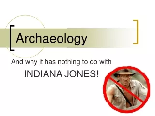
Archaeology: An Introduction to the World’s Greatest Sites 36 ○ The team may divide into groups of about six people each. After identifying the site, the group members spread out, about 30 feet apart, and start walking forward. Usually, they cover about 100 yards at a time in this fashion. This technique is known as walking a transect. ○ As they walk, the group members look at the ground for pottery sherds, stone tools and flakes, ancient walls, or anything else that might mark the remains of an ancient settlement. They keep track of the number of artifacts they find using “clickers,” and by the time they reach the end point of the transect, they have a record of the number of the artifacts seen during each stage of the 100-yard walk. ○ Pottery is not biodegradable, and broken pieces always work their way to the surface of the ground. Thus, if you’re walking across a site that was inhabited in the Bronze Age, the Iron Age, Roman times, and Byzantine times, you will see sherds from all those periods on the ground. And as you record the sherds on your clicker, the numbers will increase as you enter the boundaries of the site on one side, then walk through the middle of what had been the inhabited area. Then, after you exit the boundary of the site on the other side, the numbers on the clicker will drop. ○ The team members give their numbers to the team leader, who records them in a notebook and marks the probable site on the map for later examination by the follow-up team. ○ This process is repeated in 100-yard increments until the team reaches the end of the designated area for the day. Once the team members have reached that end point, they turn around and repeat the process, going back toward where they started. In this way, a team can traverse and record all the sites in a chosen area.
Lecture 5—How Do Archaeologists Know Where to Dig? 37 • Back at camp, the results of each day’s survey are recorded, and from these results, a running list is developed. The list indicates how many sites have been found, the periods they represent, and where they are located. The most promising of these possible sites then receive a visit from a team of experienced surveyors. • There are many variations of this kind of surveying, including those that cover specific portions or randomly chosen portions of an area that is simply too large to survey in its entirety. In such cases, statistics are used to decide the areas to be sampled. • Finally, targeted surveys involve revisiting sites that have been previously discovered; essentially, a targeted survey is similar to the second half of the ground survey just described, except that the sites may have been found by more than one project and over a number Surveyors collect diagnostic pottery sherds, including rims, handles, bases, and anything decorated, to allow pottery experts to identify the periods represented at a site.
Archaeology: An Introduction to the World’s Greatest Sites 38 of years. The goal of such a survey may be to confirm or refine the dating previously assigned to a site or answer similar questions. Suggested Reading Howard, Archaeological Surveying and Mapping. Leach, The Surveying of Archaeological Sites. White and King, The Archaeological Survey Manual. Questions to Consider 1. What do you think of the increasing use of satellite photographs, LiDAR, and other high-tech imaging to find ancient sites? Is it a good use of resources? 2. Is it enough to simply find and locate ancient sites, then end the project? Should excavating always follow surveying?
Lecture 6 I In particular, we’ll look at several discoveries of hominid remains and footprints, and we’ll explore paintings on the walls of caves in France and Spain dating to at least 30,000 years ago. As we’ll see, palaeoanthropology is a fast-moving field of research, with more discoveries made every year. Prehistoric Archaeology n this lecture, we’ll explore prehistoric archaeology, otherwise known as paleontology or palaeoanthropology. This field allows us a unique glimpse into the earliest times of hominid and human history. Hominid Finds • The most famous family in prehistoric archaeology is the Leakey family, with Louis and Mary in the first generation; their son Richard and his wife, Meave, in the second generation; and their daughter Louise in the third generation. ○ Louis was the founder of the dynasty, along with Mary. He was one of the first people to argue that human origins should be sought in Africa rather than in Asia, which had been the generally accepted theory. He turned out to be correct, though it took a while for others to adopt his point of view. His case was helped by the finds that he and Mary made beginning in 1948 and, later, in 1959. At that time, they were working in a canyon or ravine known as Olduvai Gorge in Tanzania. ○ Here, Louis and Mary found skeletal fragments that they identified as coming from a new species of hominid, which they ultimately named Australopithecus boisei. The Leakeys originally thought that it dated to about 600,000 years ago, but another dating technique showed that it was closer to 1.75 million years old. The Leakeys promptly followed this discovery by another one the next year of another new hominid species, Homo habilis (“handy man”). ○ After Louis died in 1972, Mary made what is considered to be her most significant discovery: the hominid footprints at
Archaeology: An Introduction to the World’s Greatest Sites 40 Laetoli, found in 1978 and 1979. The site is located about 45 kilometers southeast of Olduvai Gorge. The famous footprints were made by several individuals who were walking across freshly fallen ash from a nearby volcano about 3.5 million years ago. In all, Mary Leakey and her team found about 70 human footprints that go on for almost 90 feet. It is usually suggested that the footprints were made by hominids called Australopithecus afarensis. • These are not the only footprints that we have now, however. A team led by Dave Braun and Brian Richmond found another series of footprints in 2007 and 2008 at Koobi Fora. These are about 1.5 million years old and were probably made by Homo erectus, a direct ancestor of modern humans. • In 1974, Donald Johanson found Lucy at the site of Hadar in Ethiopia. Lucy died about 3 million years ago at about the age of 20. She has been identified as an Australopithecus afarensis, similar to the individuals who left their footprints at Laetoli 500,000 years earlier. It is believed that she would have stood about 3 feet, 6 inches to 4 feet tall and weighed about 65 pounds. • Today, the discoveries keep coming. The October 2015 issue of National Geographic magazine featured a story about a find made by Lee Berger and his team in a South African cave called Rising Star. They discovered more than 1,500 bones from at least 15 individuals, which Berger thinks belong to previously unknown hominin species, now named Homo naledi. These bones may be up to 2.8 million years old. • Just a few years earlier, Berger had announced another discovery of early hominin fossils from a cave near Johannesburg in South Africa. These were excavated in August 2008 and were officially named Australopithecus sediba in 2010. Berger dates them to about 1.78 to 1.95 million years ago.
Lecture 6—Prehistoric Archaeology 41 Cave Discoveries • Dorothy Garrod is widely recognized as one of the most important early female archaeologists; she specialized in the Paleolithic period, or Old Stone Age (from about 2.6 million years ago to 12,000 B.C.). In the 1920s and 1930s, she investigated a cluster of caves located on the slopes of Mount Carmel, south of the modern city of Haifa. ○ From 1929 to 1934, Garrod excavated the Tabun Cave and another cave, known as el-Wad. She showed that the two caves were occupied almost continuously for about 500,000 years. Tabun Cave was occupied first, from about 500,000 years ago to 40,000 years ago; the occupation of el-Wad began just before Tabun was abandoned, about 45,000 years ago. ○ In Tabun Cave, there is a burial of a Neanderthal woman, dating to about 120,000 years ago. Although the skull indicates that her brain was about the same size as ours today, she had no real chin and a very low forehead, which means she probably looked similar to Hollywood’s depictions of Neanderthals. • There are also burials from nearby Skhul Cave. However, these burials, about 14 in all, are what are called anatomically modern people, that is, Homo sapiens sapiens. These have generated much discussion among scholars, who include this evidence in the debate about whether Neanderthals and modern humans lived side by side for a time. • From 1982 to 1989, Harvard archaeologist Ofer Bar-Yosef excavated in Kebara Cave. There, he and his team found a Neanderthal burial: an adult male who lived about 60,000 years ago. Nicknamed Moshe, he may be the most complete Neanderthal skeleton found to date. The bones in his throat indicate that he was probably capable of speech. Cave Paintings • Even closer to us in time are other caves with evidence for Neanderthals and other hominid inhabitants. In particular, three are rightfully famous for their cave paintings: Chauvet Cave in France,
Archaeology: An Introduction to the World’s Greatest Sites 42 The exquisite paintings in Chauvet, Lascaux, and Altamira caves depict a wide variety of animals, including horses, lions, woolly rhinos, owls, mammoths, bears, and many others. dating to at least 30,000 B.C., if not 6,000 or 7,000 years earlier; Lascaux Cave, also in France, dating to approximately 15,000 B.C.; and Altamira, in Spain, dating to about12,000 B.C. • Lascaux Cave is located near Bordeaux in southern France. It is about 650 feet long, with at least 600 paintings and another 1,500 engravings on the walls. When Willard Libby was first experimenting with the technique of radiocarbon dating in 1949, one