1 / 40

Ellipsoid and Datum, Projection, Coordinate system, and Map Scale

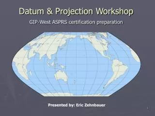
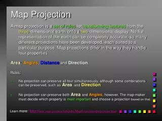
Earth Shape Models. Flat earth models are still used for plane surveying, over distances short enough so that earth curvature is insignificant (less than 10 km). Spherical earth models (Earth centered model) represent the shape of the earth with a sphere of a specified radius. Spherical earth mode

sian
Download Presentation

Ellipsoid and Datum, Projection, Coordinate system, and Map Scale

An Image/Link below is provided (as is) to download presentation Download Policy: Content on the Website is provided to you AS IS for your information and personal use and may not be sold / licensed / shared on other websites without getting consent from its author. Content is provided to you AS IS for your information and personal use only. Download presentation by click this link. While downloading, if for some reason you are not able to download a presentation, the publisher may have deleted the file from their server. During download, if you can't get a presentation, the file might be deleted by the publisher.

E N D

Presentation Transcript


    More Related