Download
1 / 27

E N D
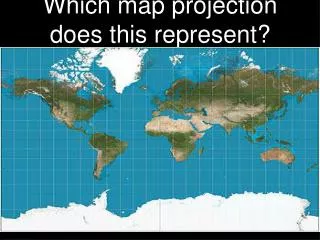
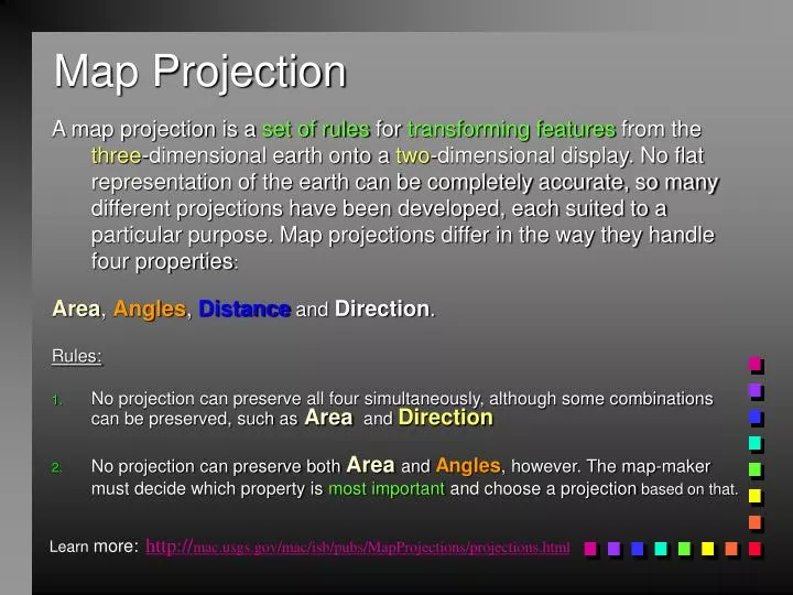
Map Projection A map projection is a set of rules for transforming features from the three-dimensional earth onto a two-dimensional display. No flat representation of the earth can be completely accurate, so many different projections have been developed, each suited to a particular purpose. Map projections differ in the way they handle four properties: Area, Angles, Distance and Direction. Rules: • No projection can preserve all four simultaneously, although some combinations can be preserved, such asArea and Direction • No projection can preserve both Areaand Angles, however. The map-maker must decide which property is most important and choose a projection based on that. http://mac.usgs.gov/mac/isb/pubs/MapProjections/projections.html Learn more:
Concept of Geoprocessing and Projections Presented by Reza Wahadj
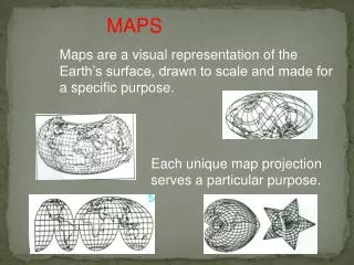
Projections and Coordinates • There are many reasons for wanting to project the Earth’s surface onto a plane, rather than deal with the curved surface • The paper used to output GIS maps is flat • Flat maps are scanned and digitized to create GIS databases • Rasters are flat, it’s impossible to create a raster on a curved surface • The Earth has to be projected to see all of it at once • It’s much easier to measure distance on a plane
Coordinate Systems • Spatial data are referenced to locations on the earth’s surface using coordinate systems • Ensure all map layers share a common coordinate system • Recognized global coordinate systems consist of: • A Spheroid: a mathematical description of the earth’s shape • A Map Projection: a mathematical conversion from spherical to planar coordinates
Different View Normal or Polar Oblique Transverse orEquatorial
Different View Transverse orEquatorial Normal or Polar Oblique
Different family azimuthal cylindrical conic
Projection different family azimuthal conic cylindrical
conformal equal area direction distance Transverse Mercator • Projection properties • Conformal cylindrical • Rhumb lines not projected as straight lines • Transverse -- standard line is a meridian • Projection uses • Topographic maps (USGS) • As a base for the UTM coordinate system • As a base for state plane coordinates
conformal equal area direction distance Universal Transverse Mercator (UTM) • Projection properties • All Transverse properties • Standard line is a meridian • 60 zone divided • Projection uses • World Map
conformal equal area direction distance Azimuthal Equidistant • Projection properties • Distances are correct outward from center • Possible to show the entire sphere • Projection uses • Sea and air navigation planning • Distance from a specified location to all others
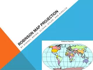
conformal equal area direction distance Robinson Uses tabular coordinates rather than mathematical formulas to make the world "look right." Directions true along all parallels and along central meridian Distances constant along Equator and other parallels • Projection properties • Compromise • Projection uses • World atlas maps
Georeferencing • Is essential in GIS, since all information must be linked to the Earth’s surface • The method of georeferencing must be: • Unique, linking information to exactly one location • Shared, so different users understand the meaning of a georeference • Persistent through time, so today’s georeferences are still meaningful tomorrow
Georeferences as Measurements • Some georeferences are metric • They define location using measures of distance from fixed places • E.g., distance from the Equator or from the Greenwich Meridian • Others are based on ordering • E.g. street addresses in most parts of the world order houses along streets • Others are only nominal • Placenames do not involve ordering or measuring
Placenames • The earliest form of georeferencing • And the most commonly used in everyday activities • Many names of geographic features are universally recognized • Others may be understood only by locals • Names work at many different scales • From continents to small villages and neighborhoods • Names may pass out of use in time
ZIP code boundaries are a convenient way to summarize data in the US. The dots on the left have been summarized as a density per square mile on the right
Linear Referencing • A system for georeferencing positions on a road, street, rail, or river network • Combines the name of the link with an offset distance along the link from a fixed point, most often an intersection
Users of Linear Referencing • Transportation authorities • To keep track of pavement quality, signs, traffic conditions on roads • Police • To record the locations of accidents
Converting Georeferences • GIS applications often require conversion of projections and ellipsoids • These are standard functions in popular GIS packages • Street addresses must be converted to coordinates for mapping and analysis • Using geocoding functions • Placenames can be converted to coordinates using gazetteers
ArcReader is Viewer ArcGIS is Author/Publisher Data ArcGIS Map Doc ArcReader Geographic Information Viewer • Easy • Lightweight New System for Publishing Maps
PMF Publisher Authors PMF Documents ArcReader ArcMap Publisher MXD Data A New Extension