Download
1 / 13
130 likes | 266 Views
Imagery for the Nation and the changing landscape. Remote sensing systems overview Geo-spatial requirements for GIS Technology advancements in sensing systems and platforms Technology advancements in software Technological advancements in visualization Conclusions.

E N D
Imagery for the Nation and the changing landscape • Remote sensing systems overview • Geo-spatial requirements for GIS • Technology advancements in sensing systems and platforms • Technology advancements in software • Technological advancements in visualization • Conclusions
Remote sensing systems overview • Aerial photography • National High Altitude Photography (NHAP) program (1980 – 89). • goal reduce duplicate photography in various Federal Government programs. • cover the lower 48 states over a five year period with infrared aerial photography at 1:58,000 and black and white photography at 1:80,000 based on the USGS 7.5” Quadrangles. • National Aerial Photography Program (NAPP) (1987-2003) • larger scale imagery (i.e. 1: 40,000). • cost-sharing agreement with local government that required higher resolution, photogrammetric quality aerial photography. • in return the local government would provide ortho-images back to the Federal Government.
Remote sensing systems overview • Early Satellite imaging • Landsat I (1972) first comprehensive coverage of the planet. • 90 meter resolution four band (MSS) • (RBV) systems • Six other Landsat systems to follow • “latest” (i.e. 1999) being Landsat 7 ETM • six multispectral 30 meter bands • one 15 meter Panchromatic band • and its one 60 meter thermal band • Landsat Data Continuity Mission (LDCM) • 5 meter TM type sensor???
Remote sensing systems overview • A new era: private sector high resolution spaced-based imaging • IKONOS in 1999 represented two firsts: 082 meters panchromatic • 3.2 meters multispectral • Geo-location accuracy < 5 meters CE90[with GCP& DEM • Quckbird system in 2001 with specifications of: • 0.61 meters panchromatic • 2.4 meters multispectral • Geo-location accuracy < 5 meters CE90 with GCP & DEM • WorldView-1 in 2007 • 0.50 meters panchromatic • Geo-location accuracy 3.0 – 7.6 meters CE90 with GCP & DEM • GEOEYE-1 in August of 2008 with specifications of: • 0.41 meter panchromatic • 1.65 meter multispectral • Geo-location accuracy < 3 meters CE90 with GCP & DE • WorldView-2 expected launch date mid-2009 with specifications of: • 0.46 meters panchromatic • 1.82 meters multispectral (8 bands) • Geo-location accuracy ~2.0 meters with GCP and DEM • GEOEYE-2 expected launch date 2011 with specifications of: • 0.25 meter panchromatic • ??? Multispectral • Geo-location accuracy < 2.0 meters with GCP and DEM.
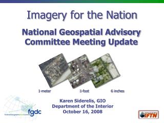
Geo-spatial requirements for GIS • Rural • 50 – 100 cm image resolution • 3 - 5 m absolute accuracy of base-map (CE90) • spot elevations of individual buildings • Suburban • < 66 cm image resolution • 1.0 – 3 m absolute accuracy of base-map (CE90) • spot elevations of individual buildings • Dense urban • < 25 cm image resolution • < 50 cm absolute accuracy of base-map (CE90) • 3-D modeling of individual buildings • “true” orthophotography < 25 cm resolution • Oblique analytic photography (i.e. Pictometry)
Technology advancements in sensing systems and platforms • Advancements in Sensor systems • Greater spatial, spectral, radiometric and temporal resolution • Advancements in positioning systems • Airborne-GPS • Inertial Measurement Unit (IMU) • more stable satellite platforms Above enables new sensor capabilities • Digital camera < 4 cm resolution • LIDAR absolute accuracy < 4cm • Increased RADAR absolute accuracy • Great absolute accuracy of spaced-based images
Technology advancements in software • Automated generation of elevation data Photogrammetrically through image matching • LIDAR as a source for DEM data • RADAR as a source for DEM data • Object-based image analysis (i.e. E-cognition) • 3-D coordinates for geospatial objects supported in GIS
Technological advancements in visualization Seamless access to multi-scale imagery of the earth with integration with other geographic layers • GOOGLE Earth • 2.5-D • 3-D Objects (i.e. buildings) • street level • ESRI ARC-Scene • 2.5-D • 3-D objects (i.e. buildings) • Microsoft’s Virtual Earth • 2.5-D • bird’s eye • 3-D Objects (i.e. buildings) • World Wind
Conclusion • Lines are blurring between satellite-based remote sensing systems and aircraft-based remote sensing systems • Given the new tools for visualization and access of global multi-scale remote sensing data the idea of public domain has been overtaken by the idea of public access • This gives reason to explore licensing options for the IFTN project • High quality elevation models (DEMs) are essential for high accuracy orthophotography such that these data sets can not be discussed separately • The development of a new 5 meter TM like sensor should be deployed by the US government as part of the LSCP