Download
1 / 14
140 likes | 234 Views
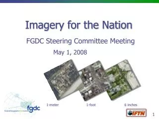
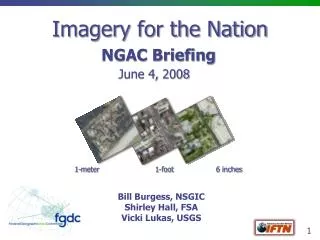
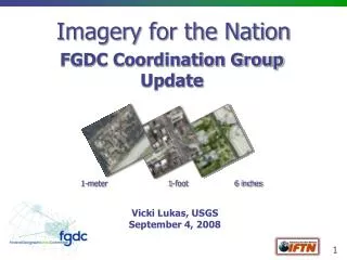
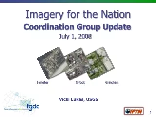
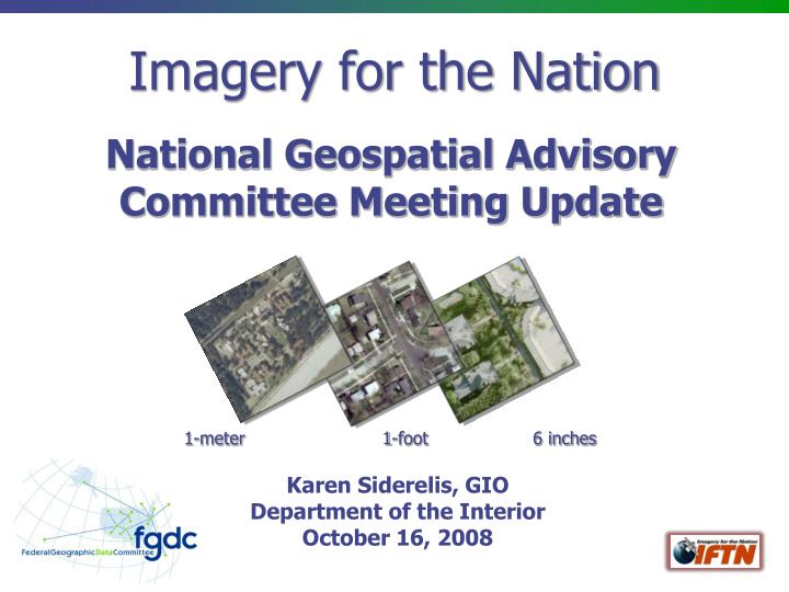
Imagery for the Nation. National Geospatial Advisory Committee Meeting Update. 1-meter 1-foot 6 inches. Karen Siderelis, GIO Department of the Interior October 16, 2008. The Original Vision.

E N D
Imagery for the Nation National Geospatial Advisory Committee Meeting Update 1-meter 1-foot 6 inches Karen Siderelis, GIO Department of the Interior October 16, 2008
The Original Vision The Nation will have a sustainable and flexible program to produce multi-resolution aerial imagery of the country that meets the needs of local, state, regional, tribal and Federal agencies.
What’s New? Project Charter approved, signatures in process Work Groups established and operational Collaboration site established High-level gantt chart in use Project assumptions defined NGAC issues being addressed Handout and website in progress Target to complete Phase 1 by end of year
IFTN Phase 1 Project Goals • Accomplish a few near-term steps to move existing Federal programs towards IFTN goals while developing a more comprehensive plan for IFTN • Document Federal imagery requirements and expenditures • Begin to institutionalize imagery funding – move from the “tin cup” approach of project-based funding to reliable funding at the executive level • Model a process for Federal enterprise geospatial data acquisition efforts • Complete Phase 1 by end of calendar year 2008
Project Assumptions • IFTN is a Federal program conducted in partnership with state and local government • IFTN will address the Federal enterprise, to include all FGDC member agencies • The Project will build upon USDA’s National Agriculture Imagery Program (NAIP) and the USGS-NGA Urban Area Imagery Partnership (UAIP) • Depending on the documented requirements, the 1 meter program will be managed by USDA, and high resolution by USGS • IFTN data will be in the public domain (with flexibility for exceptions) • Considering both aerial and satellite solutions
Project Assumptions • An IFTN governance body that is approved by the FGDC Steering Committee will be defined in the Phase 1 Project • The governance body will serve as a forum for Federal coordination with state agencies/plans, ensure requirements are being met, and adjust the program as needed • The form and specific functions of the governing body will be determined by the Work Groups as part of the IFTN plan
Phase 1 Outcomes • Accomplish a few near-term steps to move existing imagery programs towards IFTN goals • National Agriculture Imagery Program (NAIP) – institutionalize funding for national 1m coverage over a 3-year cycle • Urban Area Imagery – broaden the requirements and planning process to be more inclusive • Draft a more comprehensive plan for implementing IFTN across the Federal enterprise in partnership with state and local government
NGAC Issues – Procurement Strategy • Use of best practices model - IDIQ/QBS for procurement and small business participation - The Contracting Working Group (CWG) has developed recommendations related to this contracting best practice issues; when all CWG members have had a chance to provide comments, recommendations will be provided to the Executive Committee • Analysis of capacity and reduction capabilities - The CWG is working with the American Society for Photogrammetry and Remote Sensing (ASPRS) to survey aerial image acquisition firms to assess their existing capacity to meet IFTN requirements; also meeting with commercial satellite image providers to determine their ability to meet IFTN technical and licensing requirements • Other Contracting Working Group Actions • Developed a list of existing Federal contracts with scope to include acquisition of imagery that meet IFTN specifications • Coordinating with the GeoLOB Common Services working group by providing comments to a pending geospatial “SmartBuy” RFI
Executive Support Secretary Honored for His Leadership in the Federal Government and Support of Geospatial Technology DOI Secretary Kempthorne expressed government commitment to IFTN in his keynote speech at the ESRI Users’ Conference in August: “…we are leading an effort called Imagery for the Nation, in which we will collect in one place, in one standard form, all of the nation's imagery for the benefit of all Americans. Think about it like this… we’ll gather puzzle pieces from every Federal agency creating imagery. We will then create a tremendous and helpful mosaic of our nation.”
Next Steps • Complete a first cut plan by end of 2008 • Seek NGAC review • Develop communications materials to inform and assist the new administration • FGDC Steering and Executive Committees to determine next steps for implementing the plan • Work with NGAC on integrated strategy for NSDI Initiatives
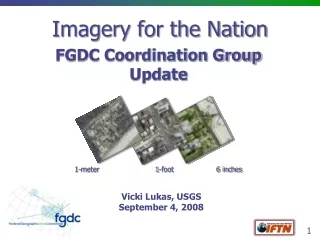
THANK YOU Discussion / Questions? 1-meter 1-foot 6 inches