Download
1 / 48
480 likes | 620 Views
Imagery for the Nation. ASPRS – Tampa May 2007. How Imagery for the Nation Began. September 2004 at NSGIC Annual Conference in Austin Texas Presentation by Ted Koch, NSGIC’s representative to the NDOP Committee

E N D
Imagery for the Nation ASPRS – Tampa May 2007
How Imagery for the Nation Began • September 2004 at NSGIC Annual Conference in Austin Texas • Presentation by Ted Koch, NSGIC’s representative to the NDOP Committee • NSGIC established a committee to research program costs and make a recommendation at its September 2005 Conference in Rochester, New York • Developed a marketing brochure
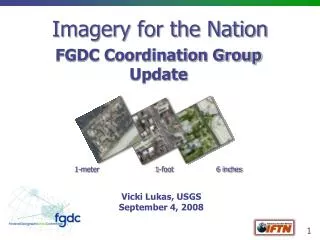
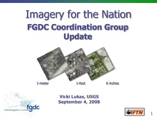
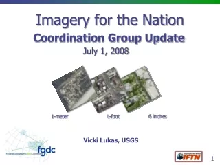
What is Imagery for the Nation? • Organized effort to acquire imagery over the entire US • Multi-Resolution (6”, 1’, 1-meter) • Repeat cycles of 3 to 5 years • Imagery stays in public domain • Consistent national standards (image type/quality & security concerns) • States can manage part of the program through development of business plans • Federal government funds program
Imagery for the Nationmeets the majority of local, state and Federal needs One Meter GSD
Imagery for the Nationmeets the majority of local, state and Federal needs One Foot GSD
Imagery for the Nationmeets the majority of local, state and Federal needs Six Inch GSD 50% cost share in Urbanized Areas with populations >50,000 and more than 1,000 people per square mile
Buy-Up Options • Vary according to product type • Color Infrared • Increased Frequency • Increased Footprint • Increased Horizontal Accuracy • Sampling to Lower Resolutions • Increased Resolution (6” to 3” and 1’ to 6”) • Improved Elevation Data Products • Remove Building Lean (“True Ortho”)
Want More Information? • http://www.nsgic.org/hottopics/imagery_forthe_nation.pdf This document will be updated after any major modifications to the program are agreed to.
NSGIC Conducted a National SurveyImagery for the Nation • Included input on survey questions from other stakeholders • Survey open for approximately 3 months April through July 2006 • Advertised principally through NSGIC, URISA, & ArcNews. • 1887 Respondents • Designed to “get a pulse” on local and state government with regard to IFTN and it was positive • See the full results in the companion PowerPointtm presentation on the survey results that is located on the NSGIC web page
Results of a National SurveyImagery for the Nation Proposal Final Results Compiled by NSGIC (Version 2.0) September 12, 2006 National States Geographic Information Council http://www.nsgic.org
Who were the Respondents? County State City Private Mapping/GIS Federal Regional Academia “Local” Government # Respondents for this question: 1,887 Single Answer Only
Top 20 Functions of Respondents Respondents were allowed to select more than one function. # Respondents for this question: 1,873 Multiple Answers Allowed
Geographic relationship to IFTN East of Mississippi West of Mississippi # Respondents for this question: 1,887 Single Answer Only
Development Intensity for Local Government Urban Rural Suburban Highly Urbanized Agri. Other # Respondents for this question: 870 Single Answer Only
Sources of Imagery – All Respondents Public Domain Contract for New Imagery Licensed Imagery Create Imagery within Organization # Respondents for this question: 1,842 Multiple Answers Allowed
Sources of Imagery - Local Government Public Domain Contract for New Imagery Licensed Imagery Create Imagery within Organization # Respondents for this question: 870 Multiple Answers Allowed
Sources of Imagery - State Government Public Domain Contract for New Imagery Licensed Imagery Create Imagery within Organization # Respondents for this question: 336 Multiple Answers Allowed
Average annual expenditure on imagery – All Respondents This represents an average annual expenditure of $97,387,500.00 for all survey respondents # Respondents for this question: 1,307 Single Answer Only
Average annual expenditure on imagery – Local Government This represents an average annual expenditure of $36,437,500.00 or 37% of the total for all respondents NOTE: There are 3,141 counties and over 18,000 municipal governments in the USA. We reached 888 representatives of local government (~4%) and 76% responded to this question. # Respondents for this question: 678 Single Answer Only
Average annual expenditure on imagery – State Government This represents an average annual expenditure of $25,750,000.00 or 26% of the total for all respondents # Respondents for this question: 205 Single Answer Only
Will the Imagery for the Nation Proposal meet your needs? - All Respondents Yes Standard Products Yes with Buy-ups Not Sure No X There were no consistent trends in the “Other” answers. # Respondents for this question: 1,887 Single Answer Only
Regional Acceptance of Products There are no significant differences between Eastern and Western respondents with regard to acceptance of the program. Respondents in Alaska are less certain that the program will meet their needs. Standard Products Buy-Ups Not Sure No
Urbanized vs. Rural Acceptance Rural areas are less likely to exercise the buy-up options and more likely to use standard products. Standard Products Buy-Ups Not Sure No
Will the Imagery for the Nation Proposal meet your needs? - Local Government Yes with Buy-ups Yes Standard Products Not Sure No X # Respondents for this question: 888 Single Answer Only
Will the Imagery for the Nation Proposal meet your needs? - State Government Yes Standard Products Not Sure Yes with Buy-ups No X # Respondents for this question: 345 Single Answer Only
What “Buy-Up” options will you fund? – All Respondents Increased Pixel Resolution True Ortho CIR Improved Horizontal Accuracy Higher Resolution DEM > Frequency 4-Band > Footprint # Respondents for this question: 1,313 Multiple Answers Allowed
What “Buy-Up” options will you fund? – Local Government Increased Pixel Resolution True Ortho Improved Horizontal Accuracy CIR > Frequency > Footprint Higher Resolution DEM 4-Band # Respondents for this question: 671 Multiple Answers Allowed
What “Buy-Up” options will you fund? – State Government CIR Increased Pixel Resolution 4-Band Higher Resolution DEM > Frequency Improved Horizontal Accuracy True Ortho > Footprint # Respondents for this question: 224 Multiple Answers Allowed
Exercising the Buy-Up Options is dependant on cost of options Want Leaf-Off Products Want Oblique Imagery Want Planimetrics Need Increased Vertical Accuracy 9 5 3 3 2 Most Popular Responses to “Other” for Buy-Up Options Desired Additional Buy-Up Options # of Respondents # Respondents for this question: 1,313 88 Free Text Answers for “Other” National States Geographic Information Council http://www.nsgic.org
What is the age of your current imagery ? - All Respondents 85 respondents commented using the “Other” choice. Most indicated that they used multiple image sources that were acquired over many years. # Respondents for this question: 1,834 Single Answer Only
What is the age of your current imagery ? - Local Government Note the differences in the age of imagery used by Local government and State government (next slide) # Respondents for this question: 871 Single Answer Only
What is the age of your current imagery ? - State Government # Respondents for this question: 337 Single Answer Only
Your current imagery type by Pixel Size - All Respondents # Respondents for this question: 1,561 Multiple Answers Allowed
Your current imagery by Leaf On/Off Status - All Respondents The shift between leaf-on and leaf-off at ~ 1-meter and greater resolutions appears to be related to NAIP Imagery and its availability in the public domain. # Respondents for this question: 1,561 Multiple Answers Allowed
Your current imagery by SourceAll Respondents Commercial satellites do not offer the ground resolutions noted below. These are invalid answers # Respondents for this question: 1,561 Multiple Answers Allowed
Your current imagery by % Cloud Cover - All Respondents It is highly unlikely that aerial imagery at the resolutions noted below would be acquired with any cloud cover. These are highly suspect answers # Respondents for this question: 1,561 Multiple Answers Allowed
Your current imagery by its formatAll Respondents # Respondents for this question: 1,561 Multiple Answers Allowed
Final Thoughts of Respondents • The respondents were asked to make a value judgment about the IFTN Proposal through the final question - “What do you think of the Imagery for the Nation Proposal? (Optional)” • Each answer was determined to be “positive,” “neutral,” or “negative • See the results and sample comments in the following 4 slides # Respondents for this question: 1,025 Responses Evaluated Free Text Answers National States Geographic Information Council http://www.nsgic.org
What do you think of the IFTN Proposal? • 79% Positive Comments • Examples of positive comments: • “As a representative in the Oil and Gas Industry, I think the nation wide Imagery proposal is a great advancement for the country. We have holdings in several different states and to have access to imagery in all of those areas will be an asset to the company.” • “I think it is imperative to have this. I am a Detective and Crime Scene Technician with the Sheriff's Office. I have used this tool to assist my investigative package for trial purposes. I can not stress enough how valuable this can be in a criminal trial. Thank you for the opportunity to share my views.” • “Excellent” • “I think it is a great idea that should have come sooner” National States Geographic Information Council http://www.nsgic.org
What do you think of the IFTN Proposal? • 17% Neutral Comments • Examples of neutral comments: • “A good start” • “It seems like a very interesting proposal.” • “If image quality & accuracy meet our standards, I would be very interested in the product.” • “I think you will find that some areas that are fast developing areas will require photography more often then once every three years. Another factor will be the turn around time from when the photography is flown to when it is available to the customer.” Please Note: Comments were determined to be neutral if they pondered about provisions of the program, did not specifically endorse or reject IFTN, or were esoteric discussions on related or unrelated points. National States Geographic Information Council http://www.nsgic.org
What do you think of the IFTN Proposal? • 4% Negative Comments • Examples of negative comments: • “Great concept. Necessary concept. Very poorly managed in the typical top down fashion we are use to seeing from this group. Also can not answer question 12 because it is based on pixel size and not negative scale or digital equivalent. An example of the misunderstanding common to IFTN” • “Current and readily available imagery would be very beneficial in a business sense. However, I don't believe that it is something that taxpayers should fund.” • “Waste of government money. There are more significant, vital needs than imagery that is not that good. This sounds like and feels like a scam put together by orthoimagery folks and companies who will keep their jobs from such a product. Sounds like a good product but it walks like a duck, sounds like a duck and is a duck!” National States Geographic Information Council http://www.nsgic.org
What do you think of the IFTN Proposal? • For Special Consideration • Examples of Responses • “It is a great proposal except it is very unfair to western states!!!” • “Great idea! This is where data acquisition should be headed: region-wide with many participants. Would be nice to have the 1' image cover more of the western united states (less population density or more control for flying population centers within the areas as a option.)” National States Geographic Information Council http://www.nsgic.org
How Imagery for the Nation is Proceeding • Widespread acceptance • Asked to present program to FGDC Steering Committee in October 2005 • FGDC Steering Committee showed continued interest and appointed an Executive Committee to review funding options (DHS, Commerce, OMB, Interior, Agriculture)
USDA and USGS ConductCost Benefit Analysis Study • Beginning in October 2006, the U.S. Geological Survey and U.S. Department of Agriculture are jointly funding a comprehensive Cost Benefit Analysis • The draft results are due in March of 2007 and final deliverables are due in June 2007 • Goal is to Develop a comprehensive Imagery for the Nation (IFTN) Business Case that accurately communicates program goals, objectives, benefits, and other value propositions.
Cost Benefit AnalysisWhat is being done? • Conduct an analysis of identified program alternatives • Apply USDA, USGS & OMB A-94 Standards for Cost-Benefit Analysis • Define IFTN alternatives and “The Way Ahead” • Articulate IFTN value propositions to internal and external customers, and other stakeholders • Develop a comprehensive report detailing financial metrics and other costs and benefits
What is being done (continued) • Determine the distribution of benefits among stakeholder groups and calculate the accrual rate of expected benefits • Verify the cost assumptions and show whether the costs of acquiring one meter imagery yearly and higher resolution imagery on a three year cycle will increase or decrease over time • Assess the risks associated with moving from existing programs to a consolidated national program and whether all user needs would be met • Conduct the CBA in conformance with Federal Capital Planning and Investment Control (CPIC) Guidance
For more information on the Imagery for the Nation Proposal, please see: http://www.nsgic.org/hottopics/imageryofnation.cfm For specific information on this survey, please contact the following individuals: Bill Burgess, NSGIC Washington Liaison william.burgess@comcast.net or Ted Koch, Wisconsin State Cartographer tkoch@wisc.edu National States Geographic Information Council http://www.nsgic.org
National States Geographic Information Council http://www.nsgic.org