Download
1 / 42
420 likes | 549 Views
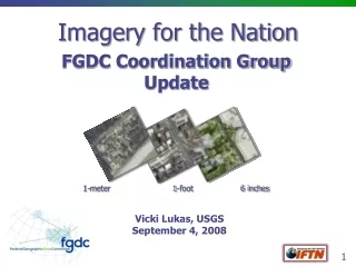
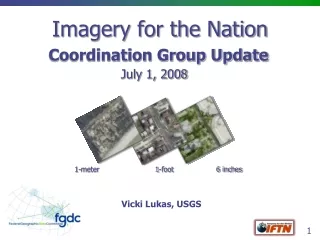
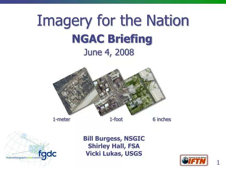
Imagery for the Nation. NGAC Briefing. June 4, 2008. 1-meter 1-foot 6 inches. Bill Burgess, NSGIC Shirley Hall, FSA Vicki Lukas, USGS. Imagery for the Nation (IFTN). IFTN Background and History National Digital Orthophoto Program (NDOP)

E N D
Imagery for the Nation NGAC Briefing June 4, 2008 1-meter 1-foot 6 inches Bill Burgess, NSGIC Shirley Hall, FSA Vicki Lukas, USGS
Imagery for the Nation (IFTN) IFTN Background and History National Digital Orthophoto Program (NDOP) FGDC Executive Leadership IFTN Project Plan Outline Next Steps NGAC Discussion
What is Imagery for the Nation? The Nation will have a sustainable and flexible program to produce multi-resolution aerial imagery of the country that meets the needs of local, state, regional, tribal and Federal agencies. The Vision….
Imagery for the Nation • A national aerial imagery program to collect and disseminate standardized multi-resolution products on “set” schedules • Multi-resolution products (6”, 1’, 1-meter) • Repeat cycles of 1 to 5 years depending on resolution • Imagery in the public domain • Federal Government manages the standards and acquisition processes and funds the basic products • Users cost-share high-resolution products • Users fund buy-up options (e.g. increased accuracy, frequency)
Imagery for the Nation Products (Original Proposal)meet the majority of local, state and Federal needs Six Inch GSD Every 3 Years 50% cost share in Urbanized Areas with populations >50,000 and more than 1,000 people per square mile
Imagery for the Nation Products (Original Proposal)meet the majority of local, state and Federal needs One Foot GSD Every 3 Years
Imagery for the Nation Products (Original Proposal)meet the majority of local, state and Federal needs One Meter GSD Every Year
Why IFTN? Reduced costs (large area contracting and efficiencies) Dependable program with known coverage and schedule Level the “playing field” and turn all the “have nots” into “haves” Meet the business needs of government everywhere in the country Provide a new model for building the NSDI
Origin of Proposal at NSGIC Concept proposed by Ted Koch (WI) at NSGIC Annual Conference in Austin, TX NSGIC established a committee to research needs and “brew” the concept Proposal unveiled at NSGIC Annual Conference in Rochester, NY J F M A M J J A S O N D J F M A M J J A S O N D J F M A M J J A S O N D J F M A M J J A S O N D J F M A M J J A S O N D 2004 2005 2006 2007 2008 2009
Moving to the Broader Community J F M A M J J A S O N D J F M A M J J A S O N D J F M A M J J A S O N D J F M A M J J A S O N D J F M A M J J A S O N D 2004 2005 2006 2007 2008 2009 FGDC requested NDOP to create a taskforce to review IFTN proposal and begin developing a business plan and funding strategy Proposal reworked with NDOP to include federal needs Joint NDOP/NSGIC Committee begins to explore administrative issues related to a national program between federal, state and local agencies Return on Investment Study proposed
Cost Benefit Analysis J F M A M J J A S O N D J F M A M J J A S O N D J F M A M J J A S O N D J F M A M J J A S O N D J F M A M J J A S O N D 2004 2005 2006 2007 2008 2009 • Contract awarded to Perot Systems, Inc. in Dec., 2006 (funded by USGS and USDA) • Western Governor’s Association objected to program design – declared it not equitable • CBA released at end of July, 2007 • 4 alternatives evaluated to include WGA concerns • Alternative 4 selected as lowest risk • NDOP unanimously accepted alternative 4 at its Oct., 2007 meeting
Alternative #4 • 1-meter and 6” programs are the same • 1’ program changes • Alaska, Hawaii, and Insular Areas stay on population density model • All states in CONUS are “guaranteed” 50% coverage every three years • Statewide Councils can: • Buy-up additional coverage • Direct the areas flown each cycle through Business Plan
1’ Program Coverage East half in 2009 then west half in 2012? OR the north half and south half. Based on the Statewide Business Plan, it could be the same area every 3 Years
NDOP Moves Forward J F M A M J J A S O N D J F M A M J J A S O N D J F M A M J J A S O N D J F M A M J J A S O N D J F M A M J J A S O N D 2004 2005 2006 2007 2008 2009 • NDOP assigns three subcommittees to determine how to develop IFTN • Acquisitions Management • Technical Specifications • Program Management • Work plans due in October, 2008 • Subcommittees designed to develop the “next level” of detail
What and Who is NDOP? Chartered in 1993 Focus: Leveraging resources, minimizing redundant acquisition, assuring availability and public access, investigating and evaluating new technologies Membership: BLM, FEMA, FSA, FS, NOAA, NRCS, NSGIC, US Census, USGS; NGA participates but has not finalized membership
Brief Milestones • 1994 – First significant funding for DOQs • 1994 – DOQs named part of NSDI framework • 1995 – NSGIC joins NDOP. MN first state completed • 2000 – 2nd generation coverage started • 2002 – all private lands completed • 2003 – NAIP implemented • 2004 – Development of web-based NDOP-NDEP project tracking system • 2007 – NAIP Cycle 1 Completed
Why NDOP is Successful • Currently operational programs so committee membership is responsible for funding, program and technical leadership • Committee is proactive, meets regularly and still communicates face-to-face • Technical members possess professional remote sensing/GIS expertise • Advancement in technology and industry competition combined to reduce production costs
Current Committee Roles Steering Committee – Provides vision, leadership and program oversight. Project Coordination Subcommittee – Coordinates requirements, develops and monitors production and funding plans, and addresses specific program issues. Technical Subcommittee- Addresses technical issues related to research, production, distribution, and application of orthos, product specifications and standards Acquisition Management Subcommittee – established in support of IFTN
Subcommittee Activities Support IFTN Program Management: propose guidelines for approval of statewide business plans and how to initiate agreements Acquisition Management: propose guidelines on how to execute agreements through contracting agencies Technical Specifications: propose technical guidelines and specifications, research attendant issues
Project Management Propose how to implement IFTN with guidance from subcommittees & others Propose a process for receiving and approving statewide business plans Provide guidance on production schedules Propose a process for making the “hard” decisions when needed (i.e budget cut backs) Propose guidelines for adjudicating issues that arise between partners
Acquisition Management Provide suggested contracting/agreement policies and guidelines Create guidelines for state & local procurement through federal contracts Propose requirements for use in agreements when states assume production and QA Propose standard approaches for documenting changes or exceptions
Important Points Acquisition Management is NOT about contracting for imagery acquisition All about intergovernmental relationships and how federal, state and local partners will work together State and federal participation
Guidelines Document Suggest “ground rules” or guidelines on 1-m, 1’ & 6” programs Propose a Business Plan template for use by Statewide GIS Councils Propose a project tracking tool
Cost Work Sheet (COST FIGURES ARE FOR ILLUSTRATION PURPOSES ONLY) DRAFT
Project Tracking (DATES ARE FOR ILLUSTRATION PURPOSES ONLY) DRAFT
Technical Specifications • Propose new technical specifications for: • IFTN 1-meter • IFTN High Resolution • IFTN Non-CONUS • Research additional issues: • Image Compression • Ground Control Point Database • Other Buy-up Options
Proposed IFTN Programs • 1-meter program • Mostly NAIP specifications and standards • Propose clear guidance on buy-ups and options • 1’ & 6” programs • Identify default deliverables • Propose clear guidance on buy-ups & options • Propose program elements that are within a manageable production framework
FGDC Moves Forward J F M A M J J A S O N D J F M A M J J A S O N D J F M A M J J A S O N D J F M A M J J A S O N D J F M A M J J A S O N D 2004 2005 2006 2007 2008 2009 FGDC Executive Committee formed to provide leadership; first meeting April 11 May 1 – FGDC Steering Committee agrees to pursue IFTN from the executive level May 30 – Executive Committee endorses project management approach to IFTN and Executive Champion roles are finalized June 23 – First meeting of Executive Champion Oversight Group
Executive Roles • Provide leadership and oversight for Federal participation • Ensure coordination at the Federal enterprise level and alignment with GeoLOB • Policy guidance and direction • Inform agency leadership of IFTN • Identify agency contributions and plans • Act as champions and advocates for IFTN activities
Coordinate IFTN at the Federal Enterprise Level Partnership Network and Agreements Aligned Funding Hosting and Archival Infrastructure Technical Plan Communication Contracting Center(s) of Excellence Guidance and Direction
IFTN Plan Outline An initial approach to: • Implement and refine Federal roles in IFTN in partnership with state and local entities • Build on existing funding and capabilities as a first step to demonstrate the viability and benefits of IFTN • Guide Phase 1 development to include: • A few achievable implementation steps towards IFTN goals based on existing programs • The documentation of a more detailed, integrated Federal plan to lead to a validation/decision point for further development of IFTN • Be refined as Phase 1 planning provides further detail
Assumptions • Phased approach that begins with existing funding and programs to demonstrate viability and benefits of IFTN • Build upon and work through existing mechanisms: NDOP and GeoLOB Working Groups • IFTN as a first potential model for Federal enterprise geospatial coordination
Challenges and Opportunities Structure and culture of Federal government: Appropriations drive agencies to act independently to meet mission needs thereby posing a challenge to cross-agency coordination of resources First demonstration/application of newly formed Executive Committee to lead program/operational staff Issues with differing approaches to contracting must be resolved as part of the process
Phase 1 Deliverables #1 “Rebranding” and enhancement of NAIP and Urban Area Imagery as components of Phase 1 IFTN implementation • Documented, systematic approach to 1-meter national coverage through USDA NAIP FY09 and out-year strategy • Documented, systematic and inclusive approach for requirements coordination for high-resolution imagery acquisition
Advancements towards IFTN • 1 meter • Move from 5 to 3 year cycle for nationwide coverage • Move from variable partnering to consistent, documented federal contribution (percentage) across agencies • Move from variable partnering to consistent, documented contribution for state/local partnering • High resolution imagery • Broaden from NGA/USGS requirements to include coordination with other Federal agencies and state plans
Phase 1 Deliverables #2 Integrated Federal Plan for IFTN in partnership with state and local government • Imagery Requirements Documentation (NDOP in progress) • Technical plan including requirements, cost estimates, roles, partnerships, schedules, and acquisition/contracting (NDOP in progress) • Documented funding strategy • Imagery data call • Analysis of possible funding scenarios • Documented guidance and direction for Federal agencies • Documented hosting and archiving strategy • Documented communication strategy • Documented process and roles for integration and management of implementation across elements and work groups
Comprehensive Roles and Responsibilities • FGDC Steering Committee • Executive Champions and Executive Oversight Group • National Digital Orthophoto Program (NDOP) Steering Committee • Acquisitions Management Subcommittee • Technical Management Subcommittee • Program Management Subcommittee • Geospatial Line of Business • Federal Agency Roles • IFTN Work Groups • National Geospatial Advisory Committee
Next Steps • Executive Champions Oversight Group to convene June 23 • Activities coordination between FGDC, NDOP and GeoLOB to begin in early June; expand existing groups or form new IFTN Work Groups • Flesh out project plan outline to incorporate detail of work in progress • Define timeframes for major milestones • NGAC Consideration