Download
1 / 9
90 likes | 109 Views
This study focuses on defining and optimizing monitoring sites for submarine landslides, investigating various gravity-driven processes, and analyzing the influence of coastal aquifers on offshore slope stability. It also examines instabilities, erosion, and retrogressive failures on decollement surfaces. The research aims to develop a long-term monitoring strategy using seafloor and in-situ instruments.

E N D
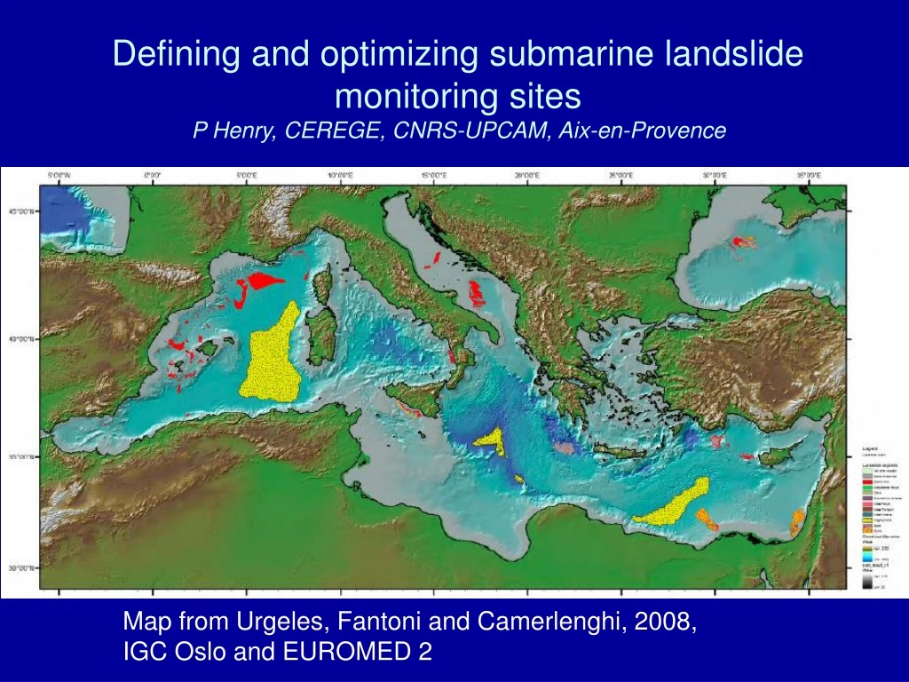
Defining and optimizing submarine landslide monitoring sitesP Henry, CEREGE, CNRS-UPCAM, Aix-en-Provence Map from Urgeles, Fantoni and Camerlenghi, 2008, IGC Oslo and EUROMED 2
LIMOIODP project • Installation of (Cabled) Borehole Observatories on the Ligurian Margin • Pierre Henry, Roland Person, Charles K. Paull, Nicole Béthoux, Anne Deschamps, Achim Kopf, Sébastien Migeon, Barbara Romanowicz, Etienne Ruellan, Françoise Sage, Bruno Savoye, Ralph Stephen, Nabil Sultan.
LIMO - Science added value Geodynamics • Approach gravity driven processes at different scales • Alpine collapse, margin failure and subduction initiation • Failure of sedimented slope • Coupling between stress, pore-pressure and strain • external forcing (sea level, fluid migration, sedimentation and compaction, jetty) vs. internal processes (dilatancy, compaction) • Influence of coastal aquifers on offshore slope stability (1979 Landslide) Local geohazards
Submarine slope monitoring - Cap Ferrat Slope • Nested instabilites • Large instabilities at base of slope • Retrogressive failures on decollement surfaces • Seafloor erosion • Testable hypothesis • Creep occurs on decollement surfaces and may lead to catastrophic failure limo-3B
Piezometer Salinity 20 g/l (Guglielmi and Prieur, 1997)
Nice slope: hydraulic regime (N. Sultan) Precipitations – Nice area
Who and what • Ifremer Brest (N Sultan, A Cattaneo) • 1979 Site surveys: geophysics and geotechnics • Prisme 2007 Atalante cruise with Penfeld penetrometer. • Long term instrumentation: • Piezometer acoustically connected through ASSEM node • Instrumental developments • Sediment transfer in Var canyon… • Geosciences Azur (S Migeon, F Sage, E Ruellan, P Charvis, A Deschamps) • Slope surveys: AUV, HR seismics, side scan sonar, coring • Malisar Suroît cruises, Thetis cruises. • Building infrastructure • CPER PRIMA, DeepSeaNet • RCOM Bremen (A Kopf) • 1979 site survey and fluid geochemistry • Meteor 2007 cruise • CEREGE (P Henry) • IODP liaison • SOACSY (P Plantevin) • THR (>400 Hz) rough seafloor, shallow water chirp (Pôles Mer et Risques) • Geosciences Montpellier (P Pezard) • Instrumental developments with Ifremer (ANR-OFMOGH) • Université de Provence Aix-Marseille I (Y Guglielmi) • Hydrogeology
Demonstration • Objectives • Long term: definition of monitoring strategy on unstable (creeping) slopes combining seafloor and in situ instruments • Short term: • Piezometer refit • Complementary site surveys • Seismic data processing and interpretation • Synthesis of site survey data (3D modeling) -> IODP alternate platform proposal • Operations • Poseidon cruise June 20- July 6, 2009. Lead by C. Waldmann (ESONET WP2) • Antares • Ligurian margin work (assumes ESONET WP4 support) • Diver intervention (25-30 m) • Piezometer / ASSEM refit • Fluid sampling and analysis (Thomas Pichler, Roy Price, RCOM), Ra isotope analysis (O Radakovitch, C Claude, CEREGE) • Haliotis microbathymetry in 1979 scar (October 21 deadline) • SOAC-CHIRP trial at 1979 Site • Scientist exchange: RCOM/Ifremer/Geosciences Azur/CEREGE • Prospective • Hydrophone array for detecting landslides and gas emissions • Extension of geophysical investigations West of Antares • Instrument testing • Connection method
3.5 kH profilesoffshore Nice airport,1979 landslide site Fault Gas flare Strata outcroping in headwall