Download
1 / 9
90 likes | 231 Views
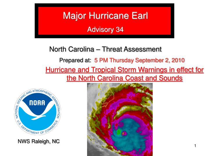
Major Hurricane Earl Advisory 34 North Carolina – Threat Assessment. Prepared at: 5 PM Thursday September 2, 2010. Hurricane and Tropical Storm Warnings in effect for the North Carolina Coast and Sounds. NWS Raleigh, NC. 500 PM Earl Information.

E N D
Major Hurricane Earl Advisory 34 North Carolina – Threat Assessment Prepared at: 5 PM Thursday September 2, 2010 Hurricane and Tropical Storm Warnings in effect for the North Carolina Coast and Sounds NWS Raleigh, NC
500 PM Earl Information Position:32.5N75.2W, 185 nm south of Cape Hatteras, NC. Intensity:Winds near 115 mph (cat. 3). Earl has weakened slightly and will continue to slowly weaken as it approaches NC overnight passing offshore as a cat. 2 hurricane. Movement:Initially north (360 degrees) at 18 mph. Storm continues moving north and will turn a little east of north overnight. Watches/Warnings:Hurricane Warning from Bogue Inlet to VA border Tropical Storm Warning from Cape Fear to Bogue Inlet Impacts: Track: Hurricane Earl forecast unchanged bringing the storm within 60 miles of Cape Hatteras, NC tonight into early Friday morning with winds of 110 mph (cat. 2) Wind & Seas: Storm surge forecasts 3 to 6 feet along the Outer Banks, southern Pamlico Sound and lower Neuse River. A breach of the Outer Banks near Hatteras is possible. Seas up to 25 feet along the Outer Banks will result in significant loss of dune structures and ocean overwash.
Wind Speed Probabilities (sustained wind) ● Tropical Storm Force Winds expected along the Outer Banks starting Tonight evening (98% chance). 60-70% chance (likely) along Highway 17 New Bern north. Tropical Storm Force Wind ● Damaging 58 mph wind probable along the Outer Banks (55% chance) by 12 am Friday. 20% chance as far west as Highway 17. 58 mph Wind ● Hurricane Force winds chances have decreased to near 15% for the Outer Banks. Hurricane Force Wind 3
Forecast Winds Gusts (unchanged) Forecast wind speeds based on the current track… • 60-75 mph gusts along the Outer Banks and eastern Pamlico Sound by 12 AM Fri. • 45-55 mph wind gusts along Highway 17 (higher on the water near New Bern and Washington) • 30 mph gusts inland to near Interstate 95. Forecast wind gusts (kts) Tonight into Early Fri
Coastal Impacts (unchanged)(from Newport/Morehead City NWS) • Seas up to 25 feet (see image) are forecast in the coastal waters. Breakers on the beach of 15 ft will over wash onto the Outer Banks ocean side tonight before midnight, peaking between midnight and 6 AM Friday. High tide will be around 230 AM. • A breach/cut of the Outer Banks with loss of highway structure is possible near Cape Hatteras/Buxton as well as in other areas of weak dune structure. Forecast Wave Height 12 AM Fri
Storm Surge (unchanged) Forecast Storm Surge (3-6 ft) Probability of surge 5 feet or higher Locations/probabilities of storm surge 6 feet or greater (above image) along the Outer Banks, Ocracoke and southern Pamlico Sound (above image) 3-6 feet of storm surge expected along the Outer Banks, lower Pamlico Sound and lower Neuse River (above image)
Forecast Rainfall (slight decrease) • Heaviest rainfall along the Outer Banks (2- 4 inches) • Heaviest rain amounts should remain just offshore. • Rapid decrease in rainfall amounts west of the sounds where less than one inch of rain is forecast. • Any flooding from heavy rain should be limited to the Outer Banks and eastern sound counties. Rainfall Through Friday Morning
Threat Summary The official forecast track and current motion of Hurricane Earl will allow the storm to pass just offshore the Outer Banks barely missing NC. Major Hurricane Earl continues to move towards NC passing within 60 miles of Cape Hatteras shortly after 12 AM Friday. Hurricane force winds possible along the Outer Banks with tropical storm force winds as far west as Highway 17. Storm surge of 3 – 5 feet in combination with waves of 15 feet will destroy dune structures, over wash Highway 12 and result in several possible breaches of the Outer Banks. Sound side surge of 3 – 5 feet will cause flooding from Hatteras to Ocracoke and Cedar Island. Heaviest rainfall, up to 2 to 3 inches, should primarily remain over the Outer Banks and Sound counties. All preparations for Hurricane Earl should be complete. 8
References National Weather Service Raleigh, NC Jeff Orrock Warning Coordination Meteorologist jeff.orrock@noaa.gov (919) 515-8209 ext. 223 For the latest information please see the following websites: National Hurricane Center: http://www.nhc.noaa.gov/ NWS Raleigh Briefings: http://www.erh.noaa.gov/rah/downloads/briefings/ NWS Morehead City Briefings: http://www.erh.noaa.gov/mhx/downloads/briefings/ NWS Wilmington Briefings: http://www.erh.noaa.gov/ilm/downloads/briefings/ NWS Webpages: NWS Raleigh: http://www.erh.noaa.gov/rah/ NWS Wakefield: http://www.erh.noaa.gov/akq/ NWS Morehead City: http://www.erh.noaa.gov/mhx/ NWS Wilmington: http://www.erh.noaa.gov/ilm/