Download
1 / 69
700 likes | 1.01k Views
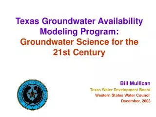
Texas Groundwater Availability Modeling Program: Groundwater Science for the 21st Century. Bill Mullican Texas Water Development Board Western States Water Council December, 2003. groundwater and Texas. 60 percent of the 16.6 million acre-feet of water used in 1999

E N D
Texas Groundwater Availability Modeling Program:Groundwater Science for the 21st Century Bill Mullican Texas Water Development Board Western States Water Council December, 2003
groundwaterandTexas • 60 percent of the 16.6 million acre-feet of water used in 1999 • 81 percent of groundwater is used for irrigation • groundwater provides 39 percent of water to cities
groundwater and surface-water use by county > 55% groundwater 45 to 55% groundwater and surface water > 55% surface water
GAM • Purpose: to develop tools that can be used to help GCDs, RWPGs, and others assess groundwater availability. • Public process: you get to see how the model is put together. • Freely available: standardized, thoroughly documented, and available over the internet. • Living tools: periodically updated.
What is a Numerical Groundwater Flow Model? • ‘The aquifer in a computer!’
geology structure digital elevation models water levels water-level variations soil maps precipitation water quality stream flows spring flows lake levels hydraulic properties pumping cultural references satellite imagery geophysical mapping well information Groundwater models are data hungry:
Do we haveto use GAM? • Water Code & TWDB rules require that GCDs use GAM information. Other information can be used in conjunction with GAM information. • TWDB rules require that RWPGs use GAM information unless there is better site specific information available
GAMs andgroundwateravailability • A GAM is a tool that can be used to assess groundwater availability once GCDs and RWPGs decide how to define groundwater availability.
How do weuse GAM? • The model • predict water levels and flows in response to pumping and drought • effects of well fields • Data in the model • water in storage • recharge estimates • hydraulic properties • GCDs and RWPGs can request runs
N Pumping rate(acre-feet/yr) 5000 1000 500 100 50 10 5 1 0 30 mile 0 Total Pumping Rate 2005 COLORADO KANSAS NEW MEXICO OKLAHOMA TEXAS TEXAS NEW MEXICO TEXAS OKLAHOMA
N Saturated thickness (ft) 700 600 500 400 300 200 100 50 0 30 mile 0 Simulated Saturated Thickness 1950 COLORADO KANSAS NEW MEXICO OKLAHOMA TEXAS TEXAS NEW MEXICO TEXAS OKLAHOMA
N Saturated thickness (ft) 700 600 500 400 300 200 100 50 0 30 mile 0 Simulated Saturated Thickness 1955 COLORADO KANSAS NEW MEXICO OKLAHOMA TEXAS TEXAS NEW MEXICO TEXAS OKLAHOMA
N Saturated thickness (ft) 700 600 500 400 300 200 100 50 0 30 mile 0 Simulated Saturated Thickness 1960 COLORADO KANSAS NEW MEXICO OKLAHOMA TEXAS TEXAS NEW MEXICO TEXAS OKLAHOMA
N Saturated thickness (ft) 700 600 500 400 300 200 100 50 0 30 mile 0 Simulated Saturated Thickness 1965 COLORADO KANSAS NEW MEXICO OKLAHOMA TEXAS TEXAS NEW MEXICO TEXAS OKLAHOMA
N Saturated thickness (ft) 700 600 500 400 300 200 100 50 0 30 mile 0 Simulated Saturated Thickness 1970 COLORADO KANSAS NEW MEXICO OKLAHOMA TEXAS TEXAS NEW MEXICO TEXAS OKLAHOMA
N Saturated thickness (ft) 700 600 500 400 300 200 100 50 0 30 mile 0 Simulated Saturated Thickness 1975 COLORADO KANSAS NEW MEXICO OKLAHOMA TEXAS TEXAS NEW MEXICO TEXAS OKLAHOMA
N Saturated thickness (ft) 700 600 500 400 300 200 100 50 0 30 mile 0 Simulated Saturated Thickness 1980 COLORADO KANSAS NEW MEXICO OKLAHOMA TEXAS TEXAS NEW MEXICO TEXAS OKLAHOMA
N Saturated thickness (ft) 700 600 500 400 300 200 100 50 0 30 mile 0 Simulated Saturated Thickness 1985 COLORADO KANSAS NEW MEXICO OKLAHOMA TEXAS TEXAS NEW MEXICO TEXAS OKLAHOMA
N Saturated thickness (ft) 700 600 500 400 300 200 100 50 0 30 mile 0 Simulated Saturated Thickness 1990 COLORADO KANSAS NEW MEXICO OKLAHOMA TEXAS TEXAS NEW MEXICO TEXAS OKLAHOMA
N Saturated thickness (ft) 700 600 500 400 300 200 100 50 0 30 mile 0 Simulated Saturated Thickness 1995 COLORADO KANSAS NEW MEXICO OKLAHOMA TEXAS TEXAS NEW MEXICO TEXAS OKLAHOMA
N Saturated thickness (ft) 700 600 500 400 300 200 100 50 0 30 mile 0 Simulated Saturated Thickness 2000 COLORADO KANSAS NEW MEXICO OKLAHOMA TEXAS TEXAS NEW MEXICO TEXAS OKLAHOMA
N Saturated thickness (ft) 700 600 500 400 300 200 100 50 0 30 mile 0 Simulated Saturated Thickness 2005 COLORADO KANSAS NEW MEXICO OKLAHOMA TEXAS TEXAS NEW MEXICO TEXAS OKLAHOMA
N Saturated thickness (ft) 700 600 500 400 300 200 100 50 0 30 mile 0 Simulated Saturated Thickness 2010 COLORADO KANSAS NEW MEXICO OKLAHOMA TEXAS TEXAS NEW MEXICO TEXAS OKLAHOMA
N Saturated thickness (ft) 700 600 500 400 300 200 100 50 0 30 mile 0 Simulated Saturated Thickness 2015 COLORADO KANSAS NEW MEXICO OKLAHOMA TEXAS TEXAS NEW MEXICO TEXAS OKLAHOMA
N Saturated thickness (ft) 700 600 500 400 300 200 100 50 0 30 mile 0 Simulated Saturated Thickness 2020 COLORADO KANSAS NEW MEXICO OKLAHOMA TEXAS TEXAS NEW MEXICO TEXAS OKLAHOMA
N Saturated thickness (ft) 700 600 500 400 300 200 100 50 0 30 mile 0 Simulated Saturated Thickness 2025 COLORADO KANSAS NEW MEXICO OKLAHOMA TEXAS TEXAS NEW MEXICO TEXAS OKLAHOMA
N Saturated thickness (ft) 700 600 500 400 300 200 100 50 0 30 mile 0 Simulated Saturated Thickness 2030 COLORADO KANSAS NEW MEXICO OKLAHOMA TEXAS TEXAS NEW MEXICO TEXAS OKLAHOMA
N Saturated thickness (ft) 700 600 500 400 300 200 100 50 0 30 mile 0 Simulated Saturated Thickness 2035 COLORADO KANSAS NEW MEXICO OKLAHOMA TEXAS TEXAS NEW MEXICO TEXAS OKLAHOMA
N Saturated thickness (ft) 700 600 500 400 300 200 100 50 0 30 mile 0 Simulated Saturated Thickness 2040 COLORADO KANSAS NEW MEXICO OKLAHOMA TEXAS TEXAS NEW MEXICO TEXAS OKLAHOMA
N Saturated thickness (ft) 700 600 500 400 300 200 100 50 0 30 mile 0 Simulated Saturated Thickness 2045 COLORADO KANSAS NEW MEXICO OKLAHOMA TEXAS TEXAS NEW MEXICO TEXAS OKLAHOMA
N Saturated thickness (ft) 700 600 500 400 300 200 100 50 0 30 mile 0 Simulated Saturated Thickness 2050 COLORADO KANSAS NEW MEXICO OKLAHOMA TEXAS TEXAS NEW MEXICO TEXAS OKLAHOMA
N Saturated thickness (ft) 700 600 500 400 300 200 100 50 0 30 mile 0 Simulated Saturated Thickness 1950 COLORADO KANSAS NEW MEXICO OKLAHOMA TEXAS TEXAS NEW MEXICO TEXAS OKLAHOMA
N Saturated thickness (ft) 700 600 500 400 300 200 100 50 0 30 mile 0 Simulated Saturated Thickness 1955 COLORADO KANSAS NEW MEXICO OKLAHOMA TEXAS TEXAS NEW MEXICO TEXAS OKLAHOMA
N Saturated thickness (ft) 700 600 500 400 300 200 100 50 0 30 mile 0 Simulated Saturated Thickness 1960 COLORADO KANSAS NEW MEXICO OKLAHOMA TEXAS TEXAS NEW MEXICO TEXAS OKLAHOMA
N Saturated thickness (ft) 700 600 500 400 300 200 100 50 0 30 mile 0 Simulated Saturated Thickness 1965 COLORADO KANSAS NEW MEXICO OKLAHOMA TEXAS TEXAS NEW MEXICO TEXAS OKLAHOMA
N Saturated thickness (ft) 700 600 500 400 300 200 100 50 0 30 mile 0 Simulated Saturated Thickness 1970 COLORADO KANSAS NEW MEXICO OKLAHOMA TEXAS TEXAS NEW MEXICO TEXAS OKLAHOMA