Download
1 / 11
110 likes | 266 Views
Visualization of Texas Groundwater Water Policy for the Layperson . By Carl Edwards. Outline Texas groundwater planning since 2001 Overview of state sanctioned water resource organizations in Texas Mapping Desired Future Conditions (DFC) for GMA’s Desired Future Conditions for GCD’s

E N D
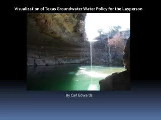
Visualization of Texas Groundwater Water Policy for the Layperson By Carl Edwards
Outline • Texas groundwater planning since 2001 • Overview of state sanctioned water resource organizations in Texas • Mapping Desired Future Conditions (DFC) for GMA’s • Desired Future Conditions for GCD’s • Future Work • Data: http://www.twdb.state.tx.us/home/index.asp
2001: Reorganization of Texas Groundwater Policy • Why? Texas derives 60% of its water wealth from subsurface resources • Purpose from Chapter 36 of the Texas Water Code: to provide for the conservation, preservation, protection, recharging, and prevention of waste of groundwater, and of groundwater reservoirs or their subdivisions, and to control subsidence caused by withdrawal of water from those groundwater reservoirs • Groundwater is subject to the Rule of Capture: landowner may withdraw • groundwater without limitations and without being liable to neighboring landowners for any harmful effects resulting from the withdrawal.
GMA: Groundwater Management Areas • Approved through the Texas Water Development Board (TWDB) • Management areas generally follow major aquifer boundaries • Some major aquifers are split based on water users, or hydrogeologic parameters • GMA’s provide a forum for water planning amongst the GCD’s
GCD: Groundwater Conservation District • Approved by the TWDB • Generally follow county lines • Priority for GCD’s is to determine DFC: Project water needs for 50 years (Developed through groundwater availability models) • Areas in white do not have districts • Incentive for district formation: State Funding for water resource projects
RWPG: Regional Water Planning Groups • Receive and report data for desired future conditions to the State Water Plan • Responsible for Surface & Groundwater Planning • Boundaries based on: • cities • surface water systems • groundwater systems • large water service areas • metropolitan statistical areas • existing regional water supply studies and areas • groundwater management districts
Carl’s Flow Chart for Texas Water Policy TWDB Surface & Groundwater RWPG GCD (Stakeholders) GMA TCEQ Individual Landowners • GMA: Groundwater Management Area • GCD: Groundwater Conservation District • RWPG: Regional Water Planning Group • TCEQ: Texas Commission on Environmental Quality
Water Demand / Total Groundwater Supply 2010 2020 2030 2040 2050 2060
GCD’s affected by Priority Groundwater Management Area Designation • Only the Upper Trinity GCD has set desired future conditions • 90,777 acre ft./yr • Is this sustainable? Not likely. The Trinity Aquifer has low recharge rates. • Annual Recharge = .10 MAF • Pumping = 0.19 MAF
Future Work • If Groundwater Availability Models determine desired future conditions, how are these models developed? • The saturated thickness varies greatly (Ogallala: 30m-100m). Is one desired future condition per GMA acceptable?