Settlement Sites
130 likes | 296 Views
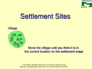
P. PH. Settlement Sites. Village. Move the village until you think it is in the correct location on the settlement maps. Example: Burton upon Trent, Staffordshire and A38. Valley Site. River floodplain. Raised river terrace.

Settlement Sites
E N D
Presentation Transcript
P PH Settlement Sites Village Move the village until you think it is in the correct location on the settlement maps Tom Abbott, Biddulph High School and made available through www.sln.org.uk/geography and only for non commercial use in schools
Example: Burton upon Trent, Staffordshire and A38 Valley Site River floodplain Raised river terrace Some settlements are located in a valley to obtain water from the river. The flat land (deposited silt) also provided fertile farmland. The flat land above the floodplain might provide an excellent transport route way. Tom Abbott, Biddulph High School and made available through www.sln.org.uk/geography and only for non commercial use in schools
Gap Town Example: Corfe, Isle of Purbeck In places which provide an easy route through a ridge or highland villages were set up to take advantage of the trade and travellers. Highland can provide good defensive sites. Tom Abbott, Biddulph High School and made available through www.sln.org.uk/geography and only for non commercial use in schools
Defence Site Example: City of Durham Defences on the neck of meander River meander (incised) Early settlers needed to find places which were easily defended from attack. A good site was one which was surrounded by a river meander. The villagers would only have to build defences on one side at the neck of the meander. Tom Abbott, Biddulph High School and made available through www.sln.org.uk/geography and only for non commercial use in schools
Dry Point Site Example: Isle Ely (Fens), Cambridgeshire In areas of the country where the landscape flooded regularly people sought locations which were normally drier. This might be on the edge of the wetland area or on islands of higher land. Tom Abbott, Biddulph High School and made available through www.sln.org.uk/geography and only for non commercial use in schools
Bridging Point Example: City of Oxford Villages were sometimes built at places where it was easier to cross a valley floodplain. These places acted as nodal points, an attraction for travellers and traders. Tom Abbott, Biddulph High School and made available through www.sln.org.uk/geography and only for non commercial use in schools
P PH Move the settlement site with your mouse and locate it in the most suitable position Tom Abbott, Biddulph High School and made available through www.sln.org.uk/geography and only for non commercial use in schools
P PH Settlement Map 1 Tom Abbott, Biddulph High School and made available through www.sln.org.uk/geography and only for non commercial use in schools
P PH Settlement Map 2 Tom Abbott, Biddulph High School and made available through www.sln.org.uk/geography and only for non commercial use in schools
P P PH PH Settlement Map 3 Tom Abbott, Biddulph High School and made available through www.sln.org.uk/geography and only for non commercial use in schools
P PH Settlement Map 4 Tom Abbott, Biddulph High School and made available through www.sln.org.uk/geography and only for non commercial use in schools
P P PH PH Settlement Map 5 Tom Abbott, Biddulph High School and made available through www.sln.org.uk/geography and only for non commercial use in schools