Download
1 / 24
240 likes | 362 Views
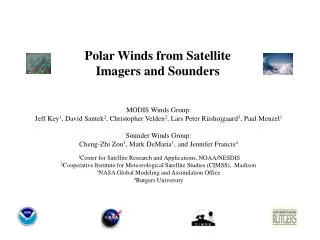
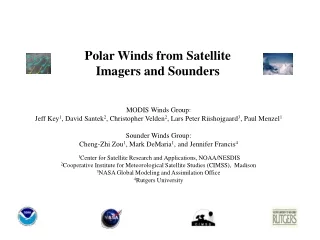
Polar Winds from Satellite Imagers and Sounders. MODIS Winds Group: Paul Menzel 1 , Jeffrey Key 1 , David Santek 2 , Christopher Velden 2 , Lars Peter Riishojgaard 3 Sounder Winds Group: Cheng-Zhi Zou 1 , Mark DeMaria 1 , Jennifer Francis 4 , and Mike Van Woert 1

E N D
Polar Winds from Satellite Imagers and Sounders MODIS Winds Group: Paul Menzel1, Jeffrey Key1, David Santek2, Christopher Velden2, Lars Peter Riishojgaard3 Sounder Winds Group: Cheng-Zhi Zou1, Mark DeMaria1, Jennifer Francis4, and Mike Van Woert1 1Office of Research and Applications, NOAA/NESDIS 2Cooperative Institute for Meteorological Satellite Studies (CIMSS), Madison 3NASA Global Modeling and Assimilation Office 4Rutgers University
An example Meteosat wind set from FGGE helped define atmospheric motions, but not in polar regions
Geostationary Satellite-Derived Winds • Tracking cloud/water vapor features in time provides horizontal advection speed • Brightness temperatures place features in three coarse layers (0-400, 400-700, and 700-1000mb) • 3-hourly product overlaid upon continuous IR loop “Satellite Focus” unites an ever growing compilation of new technology in a common theater, providing users with a one-stop satellite shop. “Where you are, what you need, when you need it.”
Routine production of MODIS WV winds in 2003 Pre ops tests in 2002 500 hPa geo potential North Atlantic Europe
More Polar Obs Improve Mid-latitude Forecasts Propagation of analysis errors from the poles to the midlatitudes in 500 hPa geopotential height for 1 to 5 day forecasts. Solid blueshows geopotential with MODIS winds; dashed black is Control without MODIS winds. Solid red show positive differences (MODIS minus CTL), and thick dashed blue show negative differences. 20 meter positive differences near the Beaufort Sea (north of Alaska) move southward. The 5-day MODIS forecast verifies better. * NWP depends on obs * polar winds fill obs void (offset Siberian raob loss) * during hostility non-US obs may be withheld * improved fcsts of weather affects boating (fishing), shipping routes, aircraft refueling, evacuations
Error Propagation to the Midlatitudes: Snowfall Accumulated snowfall forecasts, in mm water equivalent, over Alaska on 03/20/02 (end of animation period). At right is the snowfall from the 5-day CTL forecast, below left is the snowfall from the 5-day MODIS forecast, below right is the snowfall from a 12-hr forecast for verification. The CTL run produced spurious snowfall in southern Alaska. CTL MODIS “TRUTH”
Fires Around Baghdad NWP Model Overlays
MODIS winds filling observing system void Being used operationally since Jan 2003
Current Users: • European Centre for Medium-Range Weather Forecasts (ECMWF; Lueder von Bremen and Jean-Noel Thepaut) - Using winds in operational system. • NASA Global Modeling and Assimilation Office (GMAO; Lars Peter Riishojgaard and Yanqiu Zhu) - Using winds in operational system. • Japan Meteorological Agency (JMA; Masahiro Kazumori) – Using winds in operational system (Arctic only) • Canadian Meteorological Centre (CMC; Real Sarrazin) – Using winds in operational system. • US Navy, Fleet Numerical Meteorology and Oceanography Center (FNMOC; Pat Pauley and Chuck Skupniewicz) – Using winds in operational system. • UK Met Office (Mary Forsythe and Howard Berger) – Using winds in operational system. • National Centers for Environmental Prediction (NCEP/EMC; John LeMarshall, Jim Jung, Tom Zapotocny) - Engaged in impact studies. Plan to go operational in June 2005. • Deutscher Wetterdienst (DWD; Alexander Cress) – Using winds in experimental system • NCAR Antarctic Mesoscale Model (AMPS; Dale Barker) – Beginning to test the winds over Antarctica. • Other (incomplete information): Chinese meteorological agency, one or more countries involved in HIRLAM. MODIS Winds in NWP
500 hPa Geopotential Northern Hemisphere MODIS WV winds mitigate bust VV= +60h 7th Int. Winds Workshop Jun 2004 Alexander Cress
USA 5 day fcst very sensitive to northern latitudes Figure courtesy of Rolf Langland, NRL Monterey
Busts over North America sometimes (often) have high-latitude origins h500 error in four models on 28 Jun 04 Figure courtesy of Lars Peter Riishojgaard, GSFC
Forecast Busts (GMAO) Southern Hemisphere Extratropics Arctic Blue is forecast with MODIS winds; red is control run
JCSDA showing positive impact especially mitigating busts Operational NCEP utilization planned early 2005 Impact of MODIS AMVs on the operational GFS forecast at 500hPa (60°S - 90°S). (1 Jan – 15 Feb 2004); the pink (dashed) curve shows the ACC with (without) MODIS AMVs
JCSDA showing positive impact especially mitigating busts Operational NCEP utilization planned early 2005
3D display of impact of polar winds on GFS 84 hr forecast of 400 hPa heights
RMS (m/s) Forecast (days) Impact of MODIS Winds on Hurricane Track Forecasts
AVERAGE HURRICANE TRACK ERRORS (NM) FREQUENCY OF SUPERIOR HURRICANE PERFORMANCE (%)* • Percent of cases where the specified run had a more accurate hurricane position than the other run. • Note: These cases are for hurricanes in the subtropics.
MODIS Polar Winds Real-Time Processing Delays - Frequency of Delays in Wind Retrievals MODIS winds do not meet cut-off of EMC and most regional/limited area data assimilation systems. Possible solution: Direct broadcast to high-latitude X-band station(s): • Northern Hemisphere - Fairbanks (NOAA), Kiruna (ESA); Svalbard (EUMETSAT) • Southern Hemisphere - McMurdo. Polar winds system development is in progress!
Sounder Winds This EOS project also seeks to estimate winds in the polar regions from atmospheric sounders. The methodology for deriving winds from sounders involves estimating the temperature and moisture fields from retrievals, and then applying hydrostatic and dynamical balance constraints; i.e., calculate a thermal wind and correct for mass conservation. A surface wind from a model analysis or from satellite data (e.g., scatterometer) is used, and thermal winds are sequentially added upwards. Wind retrieval methods that have been developed for soundings from TOVS and AMSU will be applied to the polar regions. Improved soundings from AIRS will also be considered.
Trends from TOVS Thermal winds have been calculated for 22 years of TOVS data. This unique dataset can be used to examine trends in Arctic circulation, as illustrated below. Trends in total column u and v wind components for the period 1979-2001 show that the polar vortex has strengthened and shifted toward central Siberia.