Download
1 / 37
380 likes | 400 Views
Learn about the Hydrologic Cycle dynamics & Groundwater in Hawaii. Explore Porosity, Permeability, Aquifers, Water Table, Wells, and Groundwater Movement in Hawaiian rocks. Discover basal groundwater, basal lens formation, and high-level groundwater features. Recharge and Discharge processes are also explained.

E N D
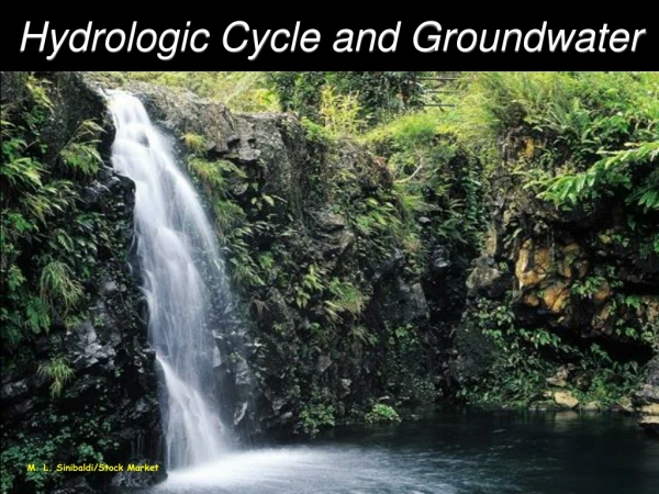
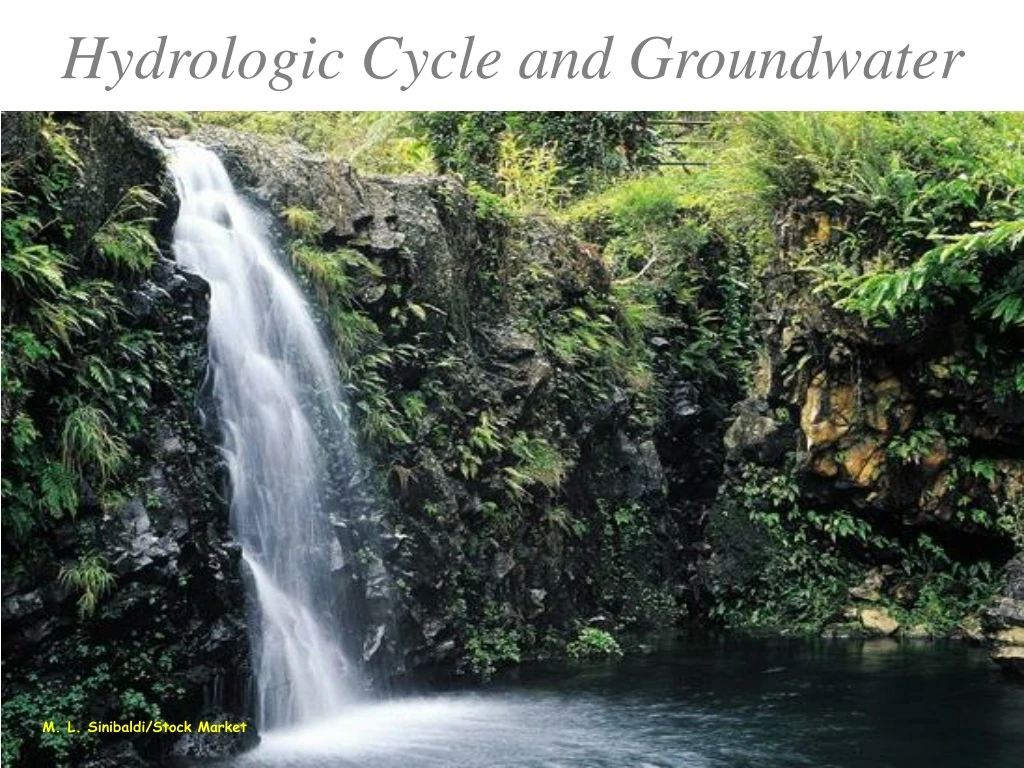
Hydrologic Cycle and Groundwater M. L. Sinibaldi/Stock Market
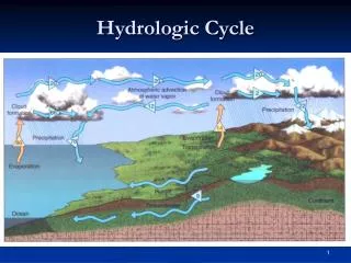
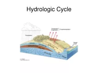
The Hydrologic Cycle • Describes the motion of water through the environment • Driven by solar heat • ocean water evaporates • wind carries moist air over land • topography can force moist air to higher altitudes • as air rises, it cools, water condenses to form clouds and then precipitate as rain or snow • rain that falls on the land can • evaporate back into the atmosphere • be taken up by plants, which also return water to the atmosphere • called transpiration (ET) • flow over the ground, enter streams and rivers, and ultimately be returned to the sea; called surface runoff (RO) • soak into the ground, where it becomes groundwater (I)
P = RO +I+ ET • P = PRECIPITATION • RO = RUN OFF (ALL SURFACE FLOW) • I= INFILTRATION (GROUNDWATER) • ET = EVAPO-TRANSPIRATION • Assignment: L-10, cd- EP/B & D
The Hydrologic Cycle in Hawaii leeward windward
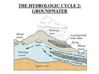
What is Ground Water? • Water occupying the voids (or pores) in the rock below the level of the soil • This is where rock is saturated in water • Water can also move through the rocks if it is permeable
Porosity • The proportion of a body of rock that consists of pore spaces (voids) • can result from spaces between grains • can also result from fractures in the rock • can result from the structure of the rock itself • clinker zones in a‘a lava flows • lava tubes in pahoehoe flows
Well sorted sediments, high porosity Poorly sorted sediments, low porosity Porosity reduced by cementation
Permeability • The capacity for transmitting fluids • in other words, how easily water can move through the rock • is determined by: • size of void spaces • water cannot flow through rocks with pore spaces < 0.005 mm, i.e., clay • whether void spaces are connected or not, examples: • vessicles--i.e., bubbles, not connected • fractures--connected
Hawaiian Rocks • High porosity and permeability: • lava, especially pahoehoe and clinker zones in a‘a • sandstone • Low porosity and permeability: • ash deposits (tuff) • weathered lava • fine-grained sediments • intrusions, especially dikes
A High permeability clinker zones in a‘ā lava flows B Lower permeability cores of a‘ā lava flows C High permeability pahoehoe lava flows
The Water Table • Beneath the surface, the rocks can be divided into saturated and unsaturated (or aerated) zones • saturated--all pore spaces are filled with water • unsaturated--most pore spaces are filled with air • The unsaturated zone lies over the saturated zone, and the top of the saturated zone is called the water table
or aerated (or basalt!)
Aquifers • Rocks with porosities and permeabilities that permit water to flow into wells • Aquifers can be • unconfined--the water table can freely fluctuate in response to the amount of water in the aquifer • confined--the aquifer is bounded by low permeability rocks • low permeability rocks are calledcaprock • ground water is under pressure • water that overflows a well sunk into the aquifer • called an artesian well • the height to which the water will rise is called a piezometric surface
Basal Groundwater • Fresh water is less dense than salt water, therefore it will float on salt water • The contact between the fresh ground water and salt ground water is a brackish-water transition zone • This transition zone is depressed below sea level from the weight of the overlying fresh water and the fresh water forms a lens-shaped body • This fresh ground water is called basal water, and the lens-shaped body is called a basal lens
The Basal Lens • The lens is thickest under the mountains because that is where most of the water comes from (rain), and because rocks are resistant to water flow and so water “piles up” under higher topography producing a sloped water table • Water flows down through the rocks toward the coast • At the coast, basal springs may form when basal water intersects the surface • However, if there is caprock at the coast, then • basal springs cannot form • produces a confined aquifer, a thicker lens, and artesian water
no rainfall rainfall, unconfined aquifer rainfall, confined aquifer
High Level Groundwater • If water descending through the bedrock encounters an impermeable layer, it will move sideways rather than downwards leaving an unsaturated layer between it and the basal water below; this saturated zone above the basal lens is called perched groundwater • impermeable layer can be dense lava, volcanic ash, or sediments • If water cannot move laterally it can also produce a high-level aquifer as it accumulates between vertical impermeable zones • dikes can make vertical impermeable zones • dike-confined water
Recharge and Discharge • Recharge--water (rain) entering the aquifer • Discharge--groundwater leaving the aquifer • Ifrecharge = discharge, water table stays at a constant depth; basal lens stays same size • Ifrecharge > discharge, water table rises and basal will grow • Ifrecharge < discharge, water table falls and basal lens will shrink • Discharge can be increased artificially by pumping • In Hawai‘i, a shrinking basal lens also means a rising transition zone
A well pumping buoyant, fresh water out of a basal lens near the coast As fresh water is withdrawn, the brackish water interface will move up to replace it and the well will eventually pump brackish water
Hydrothermal Phenomena • Groundwater affected by a shallow source of natural heat; i.e., hot rocks underground • Magma chamber: calderas • Dikes: rift zones • Solidifying lava lakes: calderas and pit craters • Produces hot spring springs and fumaroles (steam vents) • Rocks in contact with hot water can be altered; called hydrothermal alteration • results in the water also carrying elements away; e.g., sulfur • produces acid water and steam at the surface • fluid precipitates crystals when it cools • Can be exploited as an energy source by geothermal power plants, but high permeability of Hawaiian rocks are rocks a problem
http://hi.water.usgs.gov/pubs/fs126-00/index.html the end! For Additional Credit: Please read the USGS fact sheet Ground Water in Hawaii, which can be found at: