Download
1 / 22
220 likes | 357 Views
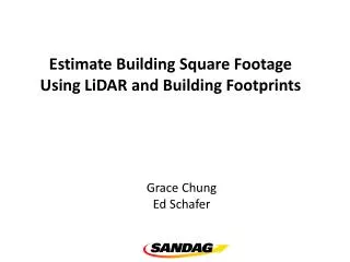
Estimate Building Square Footage Using LiDAR and Building Footprints. Grace Chung Ed Schafer. Why? There is missing data on building square footage. What PECAS needs? Ideally, PECAS needs building square footage for all residential and non-residential buildings in the region by parcel.

E N D
Estimate Building Square Footage Using LiDAR and Building Footprints Grace Chung Ed Schafer
Why? • There is missing data on building square footage. • What PECAS needs? • Ideally, PECAS needs building square footage for all residential and non-residential buildings in the region by parcel. • For non-residential buildings, PECAS needs to match square footage to number of employees.
Building top (from LiDAR DSM) Building Height Ground Elevation (from LiDARDEM)
LIDAR Data Collection City of San Diego, 2005 City of Chula Vista, 2005, partial North County Consortium, 2009 Vista Oceanside Escondido San Marcos Carlsbad Encinitas Poway Solana Beach Del Mar Santee San Diego El Cajon La Mesa Lemon Grove National City Coronado Chula Vista Imperial Beach
Building Footprints Collection Vista Oceanside Escondido San Marcos Carlsbad Encinitas Poway Solana Beach Del Mar Santee San Diego El Cajon La Mesa Lemon Grove National City Coronado Chula Vista Imperial Beach
Building Height Extraction Vista Oceanside Escondido San Marcos Carlsbad Encinitas Poway Solana Beach Del Mar Santee San Diego El Cajon La Mesa Lemon Grove National City Coronado Chula Vista Imperial Beach
DSM/ Surface (.grd) Multipoint .LAS DEM/ Ground Surface (.grd) 2’ contour lines
DSM Max Bldg Top Height Min Bldg Top Height AvgBldg Top Height
DEM Max Ground Elevation Min Ground Elevation Avg Ground Elevation
Max Bldg Height Min Bldg Height AvgBldg Height
Estimating Floor Area • How do we go from footprint and height to floor area? • Most buildings at linear • Rectangular footprint • Regular (or semi-regular) height • Uncertainty lies with the interior layout • Use multiple linear regression Est(FA) = B1*FP + B2*H • Where EST(FA) is estimated floor space • FP is footprint in square feet • H is height in feet • B1 is coefficient relating footprint to floor area • B2 is coefficient relating height to floor space • No need for an intercept
Regression Results • Poway / Industrial • First model • LU = 2101 (industrial park) • N = 51 • AdjR-square = .972 p = .000 • B1 = 1.232 p = .000 • B2 = -62.758 p = .489 • Second model • LU = 2101 (industrial park) • N = 51 • AdjR-square = .972 p = .000 • B1 = 1.208 p = .000
Regression Results • Poway / Retail • First model • LU = 5003, 5004, 5007 • N = 74 • AdjR-square = .845 p = .000 • B1 = 1.022 p = .000 • B2 = 96.142 p = .193 • Second model • LU = 5003, 5004, 5007 • N = 74 • AdjR-square = .843 p = .000 • B1 = 1.062 p = .000