Download
1 / 35
350 likes | 378 Views
This presentation by GIS Analyst Derek McNamara of Coeur d’Alene Tribe focuses on the methodology of extracting building footprints from LiDAR and aerial imagery in the Wildland-Urban Interface (WUI). It covers data availability, examination methods, accuracy assessments, results, limitations, challenges, and future work related to analyzing fire behavior in the WUI. The goal is to advance understanding and modeling of WUI fires through cooperative projects and innovative methodologies.

E N D
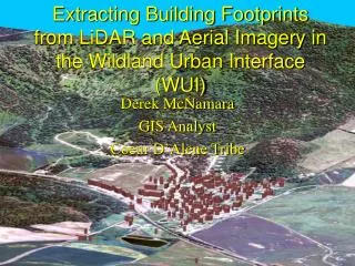
Extracting Building Footprints from LiDAR and Aerial Imagery in the Wildland Urban Interface (WUI) Derek McNamara GIS Analyst Coeur D’Alene Tribe
Presentation Overview • Goals & Objectives • Available Data • Examined Methods • Accuracy Assessments • Methods • Results • Discussion (Limitations & Challenges) • Future Work
Background • Catastrophic Fires in WUI • ~9,000 homes destroyed 1985-1994 (NFPA) • Gain Understanding WUI Fire Behavior • Few Physics-Based Models of WUI Fires • Cooperative Project • CDA Tribe & National Institute for Standards & Technology • Modification of Fire Dynamics Simulator (FDS) for WUI • CDA Tribe Provides Model Inputs • Structure Information • Tree Stem Locations (Crown Width, Height, Height to Live Crown) • Vegetation • Fire Barriers
Goals & Objectives • Extract Building Footprints • Entire CDA Tribe Reservation • Inputs to FDS for testing • Compare Methodologies • Conclusions on Feasibility • Identify/Develop Robust Methodology
Available Data • LiDAR Coverage (Entire Reservation) • Multispectral Imagery (NAIP) • Structure Locations • Surveyed NFPA 1144 Assessment Form
Examined Methods • Building Extraction • Many Methods Conducted in Urban Areas • Fewer studies in Rural Areas. • 4 Methods Examined in WUI
Initial LiDAR Processing All Return LiDAR Point Data Bare Earth LiDAR DEM • Bare Earth DEM • AML: Evans (2005, RMRS) • Create TIN Ground Points • TIN to Raster (1 meter) • Last Return Points • Threshold (2 – 15 meters) • Points Outside Threshold • Set to Zero • Create TIN from Heights • TIN to Raster (1 meter) Extract Values To Points Calculate Surface Height Last Return Threshold Surface Height Threshold Derive nDSM
Texture Measure Extraction • Common Method in Literature • Maas (1999); ICREST (2001); etc.. • Local Variations of Height • Edge Detectors, Texture, Slope, Curvature, Etc… • Similar Results • Present Results Texture Variance • Incorporate Curvature & Slope
Texture Variance ExtractionWorkflow nDSM LiDAR Aggregate Polygons • Vectorization • Binary Image Raster to Polygon • Delete Largest Polygon • Aggregate Polygons • Feature Analyst • Remove Isolated Polygons • Square Polygons • Feature Analyst • Douglas-Peucker • Thickness • Zonal Geometry • Curvature & Slope (Rottensteiner & Briese, 2002) • Apply Threshold (reclassify) • Count Pixels in Polygon • Delete polygons w/ > 50% Texture Variance (3X3) Square Polygons Area Threshold Thickness Threshold Texture Threshold (Binary) Curvature Threshold Slope Threshold Vector- ization Final Building Polygons
Height Threshold Workflow Hewett (2005 ESRI UC) nDSM LiDAR Aggregate Polygons • Integer Conversion • Removes Interpolation Errors Convert To Integer Square Polygons Reclassify To Binary Area Threshold Thickness Threshold Curvature Threshold Slope Threshold Vector- ization Final Building Polygons
Object Oriented Image Classification(Ibrahim, 2005) • Related Pixels part of objects. • Assigns Relationships Related Pixels • Not a Pixel-by-Pixel Approach • Appropriate for Urban Classification • (Wikipedia, 2005) • Implemented in Feature Analyst • Multispectral & LiDAR Height • LiDAR Intensity & Height
PCA 1 NAIP Imagery Curvature nDSM Texture Variance nDSM Slope nDSM Apply Height Mask Training Examples Set-Up Learning Image Classification Aggregate Polygons Square Polygons Thickness Threshold Area Threshold Final Building Polygons Multispectral & LiDAR Workflow • First PCA • Reduce Bands • Set-Up Learning • Input Representation • Spatial Context • Manhattan 7X7 • Height Mask • Improves Classification
LiDAR nDSM Intensity Curvature nDSM Texture Variance nDSM Slope nDSM Apply Height Mask Training Examples Set-Up Learning Image Classification Aggregate Polygons Square Polygons Thickness Threshold Area Threshold Final Building Polygons LiDAR Intensity Workflow • Intensity Not PCA • Measure of Signal Strength • Often contains noise
Accuracy Assessment Methodology(Song & Haithcoat, 2005) • 10 measures Described by Song & Haithcoat (2005) • Use all except Shape Similarity • Most Measures Calculated on Correctly Extracted Building Polygon • Average Across all Correctly Extracted Building Polygon • Reference Data • Manually Digitized • NAIP, LiDAR, Structure Photos.
Accuracy Assessment MethodologyCont. • Detection Rate = Producer’s Accuracy • Correctness = User’s Accuracy • Matched Overlay (Correct Buildings) = • Area Omission Error (Correct Buildings) =
Accuracy Assessment MethodologyCont. • Area Commission Error (Correct Buildings) = • RMSE (Correct Buildings) =
Accuracy Assessment MethodologyCont. • Corner Difference (Correct Buildings) = • Area Difference (Correct Buildings) = • Perimeter Difference (Correct Buildings) =
Accuracy Assessment • Can Not Discern Statistical Differences • Should Look at Methods Building Verse Building • Identify Common Extracted Building Between Methods • Examine statistical differences among methods.
Accuracy Assessment Shape Similarity • Texture Variance Measure • Lowest Corner Difference • Lowest Perimeter Difference • Best Shape Representation (?)
Accuracy Assessment • Slope & Curvature Filters • Show Promise • Remove ~ 40% of Incorrect Polygons • After Area & Thickness Thresholds • Not Removing Buildings Under Trees • Coarse Approach • More Advanced Approach Better (?) • Objected-Oriented Approach (Slope & Curve Filters) • Remove ~ 21% of Incorrect Polygons (Intensity) • Remove ~20% of Incorrect Polygons (Multispectral)
Limitations of All Methods • Lose of Data (Interpolate Point Cloud to Raster) • Only Rectangular Buildings • Smaller Structures Not Discernable • Height Thresholds Vary Over Different Areas • Poor Job of Removing Trees • Last Return DOES NOT Detect Building Edge
First Return Last Return Trees Filtered Trees Present Last Return Necessary(Buildings Surrounded by Trees)
Building Extraction ResultsEntire Reservation • Utilizing All Methods • Database Of Over 11,000 Footprints • Structure Point Locations (NFPA Surveys) • Remove Noise • Required Manual Clean-up • Smaller Structures • Densely Canopied Areas • Modification of Extracted Footprints
Large Area ExtractionChallenges • Software Limitations • Large Dataset • Vectorization Routines • Registration of NAIP to LiDAR • Difficult in Forested Areas • Varying Height Thresholds • Different Techniques (First Return Vs Last Return) • Opened Versus Treed Areas • Trees!!!
Conclusions • LiDAR Feasible • Did Not Quantify Difference Between Methods • Multispectral Removes Most Noise • Does Not Discern Buildings Under Trees • LiDAR Intensity Too Much Noise (?) • Height Easy/Good Results • Texture Best Shape Similarity (?) • Slope & Curvature Filters Show Promise • Object-Oriented Approach • No Filter Thresholds • All Methods Useful in Open Areas • Easy to Apply • Sensor Limitations • Small Structures Not Discernable • Feature Analyst • Easy to Use • Hierarchical Learning Not Examined
Future WorkGeneral • Better Software • Handle Large Point Cloud • Development of LiDAR Standards • WUI Work • Incorporates Many Extraction Scenarios • Good Test Bed
Future WorkCDA Tribe • Segment Man-made Objects From Vegetation!!! • Slope & Curvature (Point Data) • Building Extraction Point Data • Plane Fitting • Other Building Information • Roof Type • Height • Accuracy Assessments • Incorporate Shape Similarity • Statistically Test Differences Between Methods
Acknowledgements • NIST: Ruddy Mell, et al. (Funding) • Jeremy Adams, Noel Sanyal (Building Clean-up) • Berne Jackson (Systems Manager) • Frank Roberts (GIS Manager) • James Twoteeth, Heather Fuller (CDA GIS) • Josh Arnold (NFPA Surveys) • USGS (Feature Analyst)
Light Detection and Ranging (LiDAR)1 1Flown by Horizons Inc., South Dakota
Small Structure Accuracy AssessmentCont. Outliers Height Misses Duplicate Structure
References United States Department of Agriculture. Forest Service. Rocky Mountain Research Station. Fuels Planning: Science Synthesis and Integration. Environmental Consequences Fact Sheet: 3. Structure Fires in the Wildland-Urban Interface. 2004-09. Research Note RMRS-RN-23-3-WWW. Evans, J.S., and A.T. Hudak. A Progressive Curvature Filter for Identifying Ground Returns from Discrete Return LiDAR in Forested Environments. (Submitted IEEE Transactions on Geoscience and Remote Sensing). Haithcoat, T., and W. Song, J. Hipple. Automated Building Extraction and Reconstruction from LIDAR Data. R&D Program for NASA/ICREST Studies Project Report. September, 2001. Hewett, M. Automating Feature Extraction with the ArcGIS Spatial Analyst Extension. 2005 ESRI International User Conference Proceedings. Mass, G-H. The Potential of Height Texture Measures for the Segmentation of Airborne Laserscanner Data. Presented at the 4th Airborne Remote Sensing Conference and Exhibition, Ottawa, Ontario, Canada, 21-24 June 1999. Rottensteiner, F. and C. Briese. A New Method for Building Extraction in Urban Areas from High-Resolution LIDAR Data. IAPRSIS, Vol. XXXIV/3A, Graz, Austria, pp. 310-317 Song, W., and T.L. Haithcoat. Development of Comprehensive Accuracy Assessment Indexes for Building Footprint Extraction. Geoscience and Remote Sensing, IEEE Transactions on. 43:2. February, 2005.