Download
1 / 15
220 likes | 646 Views
Chapter 1 The Ancient Near East: The First Civilizations. The Spread of Homo sapiens sapiens

E N D
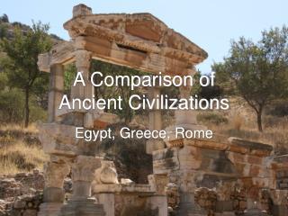
Chapter 1 The Ancient Near East: The First Civilizations
The Spread of Homo sapiens sapiens 1. It is estimated that the earth is as much as six billion years old. Creatures like human beings appeared in the last three to five million years. The earliest of these, called hominids, lived in Africa. Known as Australopithecines, these first hominids lived in East and South Africa. Unlike other animals, the hominids were capable of passing from one generation to the next a culture. 2. About 1.5 million years ago the second stage of human development occurred with the appearance of Homo erectus ("upright human beings"). These hominids used more sophisticated tools than Australopithecines and were the first to leave Africa and move into both Europe and Asia. Being nomadic, they followed animal migrations and vegetation cycles. 3. The use of fire as a source of heat and light in caves and a means to cook began about 500,000 years ago. 4. Homo sapiens ("wise human being") made their appearance about 250,000 years ago. By about 100,000 B.C. there had developed two groups of Homo sapiens -- Neanderthal and Homo sapiens sapiens ("wise, wise human beings"). Remains of the Neanderthal (first found in the Neander Valley in Germany) have been discovered in both Europe and the Middle East. This specie has been dated between 100,000 and 30,000 B.C. They relied on a variety stone tools and in Europe, Neanderthals buried their dead. Neanderthals also made clothes from the skins of animals killed for food. Homo sapiens sapiens, on the other hand, appeared in Africa between 200,000 and 150,000 years ago. About 100,000 B.C., they began migrating out of Africa. By 30,000 B.C. the Homo sapiens sapiens had displaced the Neanderthals who became extinct. Interbreeding between the two races may have occurred. 5. The spread of Homo sapiens sapiens was a very slow process with people in small bands of twenty or thirty people advancing beyond their old hunting grounds at a rate of two or three miles per generation. What drove these people to migrate is unknown but two factors may have been that of seeking a more certain food supply and pressure from competing groups for the same resource area, the loser moving on. Over tens of thousands of years these mobile Homo sapiens sapiens came to populate the world. By 10,000 B.C. the process was completed. 6. The last stage of world occupation by Homo Sapiens Sapiens came about 15,000 years ago when Asians made their way into North America. Driven by a search for a greater food supply or perhaps pursued by other groups, the first occupants crossed by way of Beringia connecting Siberia and America. This bridge may have been either land as a consequence of lower sea levels or ice due to the ice age. Questions: 1. How did the hominids develop and spread to populate the world? 2. What distinguished the various hominids? The Spread of Homo Sapiens Sapiens
The First Humans • Australopithecines, c. 2-4 million years ago • East and South Africa • Homo erectus, c. 100,000-1.5 million years ago • “upright human being” • Europe and Asia • Homo sapiens (“wise human being”) • Neanderthal, c. 100,000-30,000 B.C. • Neander valley of Germany, Europe and Middle East • Homo sapiens sapiens, c. 200,000 B.C. • “wise, wise human being” • Africa
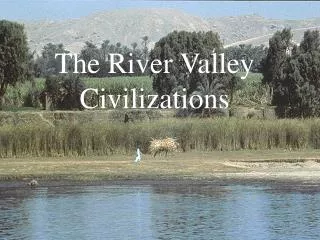
The Development of Agriculture 1. Throughout early hominid development,the people were hunters, fishers, and gatherers, but not producers of food. The division of labor was according to gender. Men were the hunters, fishers, tool and weapon makers, and warriors. Women, less mobile due to childbearing and accompanying responsibilities, smaller in stature, and with less strength, gathered nuts, berries, wove baskets, and made clothing. It was in their capacity as gatherers that women probably discovered how to plant and care for seeds. 2. The Age of Agriculture, during the Neolithic (“New Stone”) Revolution, began following the end of the last ice age around 10,000 B.C.E. and would last to about 4000 B.C.E. The shift to agriculture was slow and probably lasted from about 10,000-7000 B.C.E. Accompanying the domestication of grains was also the gradual domestication of many animals such as dogs, pigs, cows, goats and sheep. 3. Between 8000 and 7000 B.C.E. agriculture appeared independently in five different areas: the Near East about 8000 B.C.E.; in China, Africa, and Mesoamerica about 4000 B.C.E.; and in India by at least 3600 B.C.E. In the Near East the revolution was centered on wheat, barley, and lentils. Wheat was also the standard in India. Millet and rice were cultivated in southern Asia and China. In Mesoamerica, beans, potatoes, and corn were domesticated. Millet and yams were key in western Africa. 4. The growing of crops led to the establishment of permanent settlements. One of the oldest known agricultural villages was Jericho in Palestine dating from about 8000 B.C.E. By 3000 B.C.E. when writing was invented, there were urban civilizations in the valleys of the Tigris and Euphrates Rivers in Mesopotamia, the Nile River in Egypt, the Indus River Valley in India, and the Yellow River basin of China. The Mesoamerican urban civilizations would develop in the first millennium C.E. Questions: 1. Examine the transition from hunting-gathering to agriculture. 2. Why was there a sexual division and labor and what were the consequences of this? The Development of Agriculture
The Hunter-Gatherers of the Old Stone Age • Paleolithic Age, c. 2,500,000-10,000 B.C. • Nomadic people • Division of labor • Fire, 500,000 years ago • Cave Paintings • The Agricultural Revolution (c. 10,000-4000 B.C.E.) • Neolithic (“New Stone”)Revolution • Mesolithic (“Middle Stone”) Age (c. 10,000-7000 B.C.) • Independent development, 8000-7000 B.C. • Near East – wheat, barley , lentils • Southern Asia – rice, millet • Western Africa – millet, yams • Middle America – beans, potatoes, corn
Middle East, 8000 B.C.E. • Jericho • Turkey • Çatul Hüyük, 6700-5700 B.C. • Villages and towns • Division of labor • Writing • Metalworking • Copper • Copper + tin = bronze, 3000-1200 B.C. • Iron
The Ancient Near East 1. Protoneolithic culture developed independently in northern Syria and the Jordan Valley at Jericho near the Dead Sea in Palestine. Existing as early as by 8000 B.C.E., Jericho covered several acres by 7000 B.C.E. Massive fortified walls 6 feet 6 inches at the base and at some places 20 feet high surrounded the city. Enclosed within the wall were the houses of the two thousand inhabitants. In the north on the central plateau of Asia Minor above the Taurus Mountains was the Neolithic town of Çatal Hüyük which covered about thirty-two acres and housed about six thousand inhabitants living in one story mud-brick houses built around inner courtyards. Reaching its zenith between 6700 and 5700 B.C.E., the community apparently grew wealthy due to trade in obsidian that was used in jewelry, mirrors, or knives. With adequate rainfall and both plants and animals to domesticate, agriculture apparently began in these plains rather than the river valleys. 2. The headwaters of the Tigris and Euphrates Rivers are found in the mountains of Armenia (modern Turkey). The land between the two rivers is a rolling plateau broken by limestone suitable for pasturage. Beyond the Tigris are wooded hills and fertile, well-watered valleys. The Euphrates flows over a course of about 1675 miles while the Tigris winds for almost 1150 miles and joins the Euphrates about 120 miles from the Persian Gulf at the Shatt al-Arab. Subject to rains, tributaries, and the melting snow in the Zagros Mountains between April and May, the two rivers irregularly flood leaving deposits of rich alluvial silt in the swamps of the delta. Such conditions fostered the necessity for water management through irrigation and drainage canals. This required both population concentrations (cities) and organizational and bureaucratic controls. One of the earliest cities was Uruk near the Euphrates. It occupied an area of about a thousand acres and was surrounded by a six-mile long wall with defensive towers every thirty to thirty-five feet. The housing consisted of both the flats of peasants and larger dwellings of civil and religious officials. 3. Overland trade routes in Mesopotamia usually followed the Euphrates because the banks of the Tigris are frequently steep and difficult. The excellent location of Babylon allowed it to dominate the trade of Mesopotamia. Merchants followed the Tigris north to the lands of Assyria and Armenia while the Euphrates led northwest to Syria, Palestine, and the Mediterranean. 4. The early residents of Mesopotamia, the Sumerians, arrived at the mouths of the Tigris and Euphrates around 4000 B.C.E. and by 3000 B.C.E. had created a number of independent city-states, most notably Ur, Uruk, and Lagash. Vulnerable due to the ease of invasion from the north and constant warring over land and water rights, Semites from Akkad conquered the area. By 1700 B.C.E., the Sumerian element was completely submerged due to the union of Mesopotamia by the Amorite (Semite) Hammurabi (1792-1750 B.C.E.) of Babylon. 5. The Hittites, Indo-Europeans, arrived in Asia Minor about 2700 B.C.E. By about 1750 B.C.E. the Hittite Empire had extended itself to Babylon where the dynasty of Hammurabi was extinguished. Hittite strength came from being the first in the Near East to master the technology of smelting iron. This gave them both a military and commercial advantage. The empire disappeared about 1200 B.C.E. in part due to the attack of marauders called the "Sea People." Question: 1. What physical and geographical characteristics might affect development of organized society? The Ancient Near East
Emergence of Civilization • Characteristics of Civilization • Urbanization • Religious structure • Governmental bureaucracy • Military structure • Social structure based on economics • Materialism • Writing
Civilization in Mesopotamia • The City States of Ancient Mesopotamia • Eridu, Ur, Uruk, Umma, Lagash • Ziggurat • Theocracy • Sumerian city-states, c. 3000-2350 B.C. • Wheel • Social groups • nobles • commoners • slaves
Empires in Ancient Mesopotamia • Early Dynastic Age, 3000-2340 B.C. • Akkadian Empire, c. 2340-2100 B.C. • Sargon • Third Dynasty of Ur, c. 2112-2000 B.C. • Amorites (Old Babylonians) • Code of Hammurabi • 282 laws • Principle of retribution • Consumer protection • Slavery • Commerce and trade • Women
Culture of Mesopotamia • Religion • Ziggurat • Epic of Gilgamesh • Writing • Cuneiform (“wedged shaped”) • Literature • Epic of Gilgamesh • Uruk • Enkidu • Utnapishtim • Mathematics and Astronomy • Base of 6 and 10 • Geometry • Calendar – 12 months
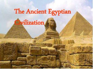
Ancient Egypt 1. The Nile River flows north almost 4200 miles from its southernmost source in modern-day Burundi in central Africa. In ancient times, the arable portion of the Nile Valley extended about 800 miles upriver from the mouth. The river floods every spring from about June to the end of October over a narrow strip of land that is never more than thirteen miles wide. Catch basins built by the Egyptians trapped water over the soil that allowed the salt to settle. Because the color of the soil left by the flooding Nile is black, Egyptians called their country Kemet which means black. 2. At the Nile Delta about one hundred miles from the Mediterranean Sea, the river splits into a number of branches that flow to the sea. This territory, north of Memphis, is called Lower Egypt while the land upstream to the south along a narrow ten to twenty mile wide valley, is referred to as Upper Egypt. Like the delta of the Tigris and Euphrates, engineering works were required to make full use of the waters. Unlike the Tigris and Euphrates that required large population centers to help control the unpredictable rivers, massive intervention was not needed. For this reason, the population remained rural. 3. Granite and sandstone for building were mined near the First Cataract. Minerals came from the hills and deserts to the east. Nevertheless, Egypt lacked copper and timber that were acquired from Sinai and Palestine. The Nile Delta was the source of salt for Egypt 4. The Nile was reflected in the Egyptian creation myth which declared that before creation there was a watery void and then, just as the Nile recedes leaving little hillocks of mud, the primeval watery void subsided leaving an island hillock upon which sat the creator-god Atum who brought into existence all other beings and phenomena of the universe. (John A. Wilson, The Culture of Ancient Egypt, p. 59) 5. For administrative purposes, the Old Kingdom was divided into twenty-two provinces in Upper Egypt and twenty in Lower. After 2000 B.C.E., most pharaohs made Thebes their capital. The temples to Amon and tombs of the pharaohs and their queens were built into cliffs at nearby Luxor. 6. South of the delta is Memphis, the capital of the Old Kingdom (2700-2200 B.C.E.). North of the capital is Djoser's Pyramid, the first pyramid to be built, and Giza where the Great Pyramid and the Sphinx are located. These pyramids served as burial places for the pharaohs of the Old Kingdom. The largest of the pyramids is Khufu (Cheops) dating from about 2540 B.C.E. Standing 481 feet high and 756 feet on each side, it covers thirteen acres and is composed of 2.3 million stone blocks averaging 2.5 tons each. The pyramid was covered with limestone blocks (subsequently removed for building Cairo). The four sides coincided closely to the four points of the compass. 7. During a religious struggle in which the worship of Aton was introduced and the temples of rival gods were closed, Amenhotep IV or Akhnaton (1367-1350 B.C.E.) sought to lessen the power of the priesthood of Amon-Re at the capital of Thebes by moving the center of government two hundred miles north to Akhetaton (near modern Tell-el-Amarna) where an immense temple to Aton was built. Questions: 1. What impact did the Nile have upon Egyptian civilization? 2. Describe how the physical environment of Mesopotamia and Egypt differed and the manner in which this might contribute to the emergence of different civilizations. Ancient Egypt
Egyptian Civilization: “The Gift of the Nile” • Nile River • Old and Middle Kingdom • Upper and Lower Egypt united, 3100 B.C.E. • Old Kingdom, 2700-2200 B.C.E. • Divine kingship • Ma’at • Administration • Middle Kingdom, 2050-1650 B.C.E. • Intermediate Period of Chaos, c. 2200-2050 B.C. • Pharaoes
Culture of Egypt • Spiritual life in Egyptian Society • Religion • Osiris and Seth • Book of the Dead • The pyramids • First pyramid, King Dyoser • King Snefru • Great Pyramid • Art and writing • Hieroglyphs
Chaos and a New Order: New Kingdom, 1567-1085 B.C. • Intermediate Period, c. 1652-1567 B.C. • Hyksos • Bronze Age • New Kingdom • Tutmosis III, c. 1480-c. 1450 • Amenhotep III, c. 1412-1375 B.C. • Amenhotep IV (Akhnaton), c. 1364-1347 B.C. • Tutankamon, 1347-1338 B.C. • Ramesses II, c. 1279-1213 B.C. • Daily Life in Ancient Egypt • Women • Hatshepsut • Children