Download
1 / 16
160 likes | 176 Views
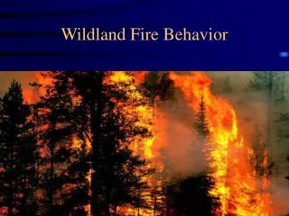
This symposium discusses the state of the art in wildland fire risk mapping, common methods for mapping fire danger, and the design of an Euro-Mediterranean Fire Danger Rating System.

E N D
Achievements in Wildland Fire Risk Mapping Acquis enCartographiedu Risque d’Incendies de Forêt EUFIRELAB, Symposium conclusif, Conclusive symposium, Avignon, 20/10/2006
Wildland Fire Risk Mapping • Deliverables • Wildland fire danger and hazards: a state of the art • Common methods for mapping the wildland fire danger • Towards an Euro-Mediterranean Wildland Fire Danger Rating System • Objectives • Analyse the structure of existing wildland fire danger indexes • Design an Euro-Mediterranean Fire Danger Rating System EUFIRELAB, Symposium conclusif, Conclusive symposium, Avignon, 20/10/2006
Wildland Fire Danger and Hazards: a state of the art (D-08-02, D-08-07) • Wildland fire structure and terminology on fire risk • Fire risk issues • Temporal and spatial issues • Fire management and risk assessment • Risk variables • Vegetation • Climatic and meteorological • Topography • Anthropogenic variables EUFIRELAB, Symposium conclusif, Conclusive symposium, Avignon, 20/10/2006
Common methods for mappingthe wildland fire danger (D-08-05) • Methods for wildland fire risk mapping • Dynamic fire risk indices • Static-structural danger indices • Operationally applied methods for fire danger estimation in Mediterranean countries • Short-term • Long-term • Inventory of existing databases • Cartographic interfaces for the dissemination of fire danger indices EUFIRELAB, Symposium conclusif, Conclusive symposium, Avignon, 20/10/2006
Scheme of the Euro-Mediterranean Wildland Fire Risk Index (EM-WFRI) (D-08-03, D-08-06) Satellite index Fuel moisture Ignition Danger Index Meteo Index Probability of ignition (human factors) Human ignition Fuel properties Wind flows Propagation Danger Index EM - WFRI Topography Population exposition Environmental value Vulnerability Index Economic value Potential soil erosion EUFIRELAB, Symposium conclusif, Conclusive symposium, Avignon, 20/10/2006
Fuel Moisture (Satellite Information) y = 0.9525x - 3.8232 2 Grasslands Ávila-Segovia R = 0.9053 350 300 250 200 Estimated 150 100 50 0 0 50 100 150 200 250 300 350 Observed FMCg = -57.103 + 284.808 x NDVI – 0.089 x ST + 136.75 x FDg FMCc = 70.195 + 53.520 x NDVI – 1.435 x ST + 122.087 x FDc (a) (b) Live fuel moisture content map (August, 10th; 2004) Observed and estimated FMC values for grasslands (a) and C. ladanifer (b). EUFIRELAB, Symposium conclusif, Conclusive symposium, Avignon, 20/10/2006
Fuel moisture(Meteorological Index) • Correlation between meteorological variables and environmental and topographic variables: • elevation ( r -0.72/-0.97), • aspect (r -0.34/-0.53), • slope (r -0.44/-0.70), • sea distance (-0.40/-0.93) • Multiple regression: • r 0.97 for minimum and maximum temperature of January and July • Spatial interpolation of meteorological index value: • Interpolation of the meteorological parameters of the index (temperature, wind…) • Interpolation of the meteorological index EUFIRELAB, Symposium conclusif, Conclusive symposium, Avignon, 20/10/2006
Spatial interpolation of meteorological risk index (c) (a) * Interpolation of meteorological risk index: a) high resolution -50 x 50 m- b) low resolution -1 x 1 km- * Meteorological risk index from interpolated variables: c) high resolution -50 x 50 m- (b) EUFIRELAB, Symposium conclusif, Conclusive symposium, Avignon, 20/10/2006
Probability of Ignition(Human Factors) Landuse types Urban density Road network Structural forest fire ignition risk EUFIRELAB, Symposium conclusif, Conclusive symposium, Avignon, 20/10/2006
Probability of Ignition(Human Factors: occurrence) EUFIRELAB, Symposium conclusif, Conclusive symposium, Avignon, 20/10/2006
Scheme of the Euro-Mediterranean Wildland Fire Risk Index (EM-WFRI) Satellite index Fuel moisture Ignition Danger Index Meteo Index Probability of ignition (human factors) Human ignition Fuel properties Wind flows Propagation Danger Index EM - WFRI Topography Population exposition Environmental value Vulnerability Index Economic value Potential soil erosion EUFIRELAB, Symposium conclusif, Conclusive symposium, Avignon, 20/10/2006
Propagation Danger Index Rate of Spread (RS) Propagation Danger Index (PDI) Flame Length (FL) EU SPREAD Project, 2004 EUFIRELAB, Symposium conclusif, Conclusive symposium, Avignon, 20/10/2006
Vulnerability Index: Environmental value • Landscape Value: • Singularity • Diversity • Connectivity • ...... CORINE LAND COVER Environmental Value • Ecological • Value: • Natural protected areas • Habitat of importance • ..... NATURA 2000 NETWORK EUFIRELAB, Symposium conclusif, Conclusive symposium, Avignon, 20/10/2006
Vulnerability Index: Potential soil erosion Coefficients ascribed to the four soil erosion factors used to estimate erosion risk Erosion Index = Slope * Vegetation density * Fire severity * Soil erodibility Low ≤ 5; Intermediate 6 – 15; High 16-26; Very high ≥ 27 EUFIRELAB, Symposium conclusif, Conclusive symposium, Avignon, 20/10/2006
Vulnerability Index: Potential soil erosion Slope Vegetation density Fire severity Soil erodibility EUFIRELAB, Symposium conclusif, Conclusive symposium, Avignon, 20/10/2006
Conclusions • * The components and structure of a risk index have been identified. • Several examples have been shown to demonstrate their efficiency. • The remaining challenge is to acquire better data necessary for risk estimation at the European scale. • * A GIS can be easily used for the generation and integration of the variables, and a map web server could be used for the distribution of the data and presentation of the risk. • * Two scales must be considered independently: • The European scale provides deciders with a global vision of the risk. • The local scale provides an operational basis upon which local foresters and firemen can make practical decisions. EUFIRELAB, Symposium conclusif, Conclusive symposium, Avignon, 20/10/2006