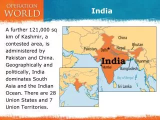
Exploring India's Geographic Features and Historical Sites
This activity provides an engaging way to study India's geography by mapping key physical features and historical sites. Students will delineate significant mountain ranges such as the Himalayas and Hindu Kush, while labeling major landmarks like the Thar Desert, Deccan Plateau, and important rivers: the Indus and Ganges. Additionally, they will identify neighboring countries and ancient cities, including Mohenjo-Daro and Harappa. This hands-on approach enhances understanding of India's diverse landscapes and rich cultural heritage.

Exploring India's Geographic Features and Historical Sites
E N D
Presentation Transcript
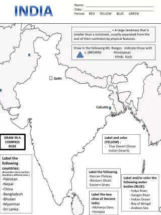
INDIA Name: ______________________________________ Date: _______________________________________ Period: RED YELLOW BLUE GREEN _____________________ = A large landmass that is smaller than a continent, usually separated from the rest of their continent by physical features. Draw in the following Mt. Ranges. Indicate those with s. (BROWN) -Himalyanas - Hindu Kush Delhi Calcutta DRAW IN A COMPASS ROSE • Label and color (YELLOW) : • Thar Desert (Great Indian Desert). Label the following countries: (Remember every countries should be a different color.) -Pakistan -Nepal -China -Bangladesh -Bhutan -Myanmar -Sri Lanka Label the following: -Deccan Plateau -Western Ghats -Eastern Ghats Label and/or color the following water bodies (BLUE): - Indus River - Ganges River - Indian Ocean - Bay of Bengal - Arabian Sea Label the two cities of Ancient India: -MohenjoDaro -Harappa